


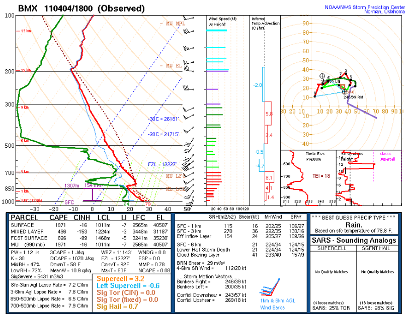
The NWS Birmingham launched a balloon at 1 p.m. today. The results are in.
The instability is moderately high, approaching 2,000 joules. The lifted index is unstable, at -7C.
There is just a small amount of CIN, or convective inhibition. This is the cap you always hear us talking about. The cap is gone now generally south of Corridor X from Hamilton to Birmingham then along US 280 to Columbus GA.
Winds are unidirectional now, out of the southwest. This means the tornado threat is on the low side, at least the closer you get to I-59. The threat is a little higher to the northwest. Isolated tornadoes will be a threat with isolated storms ahead of the main line and with supercell structures in side the line.
The threat of damaging winds will continue to be high. There is good speed shear, so organized storms will not be a problem. And dry air aloft will help produce damaging winds as well.
LATE REPORTS
Trees down in Tupelo…some on houses.
Muscle Shoals Airport just reported a gust to 52 knots (60 mph). Trees were blown down around Cherokee. A severe thunderstorm warning is in effect for Lauderdale, Colbert, Franklin and western Lawrence Counties in Northwest Alabama.
Storms have redeveloped this afternoon over Central Louisiana and eastern Texas. They are becoming severe. One of them just dropped golf ball size hail near Bastrop LA. Bastrop is northeast of Monroe, just north of I-20 in northeastern Louisiana.



