


SUMMARY OF 10 AM CDT…1500 UTC…INFORMATION
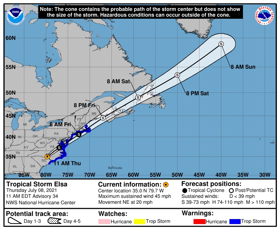
LOCATION…35.0N 79.7W
ABOUT 80 MI…125 KM SW OF RALEIGH NORTH CAROLINA
ABOUT 235 MI…380 KM WSW OF NORFOLK VIRGINIA
MAXIMUM SUSTAINED WINDS…45 MPH…75 KM/H
PRESENT MOVEMENT…NE OR 40 DEGREES AT 20 MPH…31 KM/H
MINIMUM CENTRAL PRESSURE…1006 MB…29.71 INCHES
WATCHES AND WARNINGS
A Tropical Storm Warning is in effect for…
* South Santee River, South Carolina, to Sandy Hook, New Jersey
* Pamlico and Albemarle Sounds
* Chesapeake Bay south of North Beach and the tidal Potomac south of Cobb Island
* Delaware Bay south of Slaughter Beach
* Long Island from East Rockaway Inlet to the eastern tip along the south shore and from Port Jefferson Harbor eastward on the north shore
* New Haven, Connecticut to Merrimack River, Massachusetts including Cape Cod, Block Island, Martha’s Vineyard, and Nantucket
DISCUSSION AND OUTLOOK
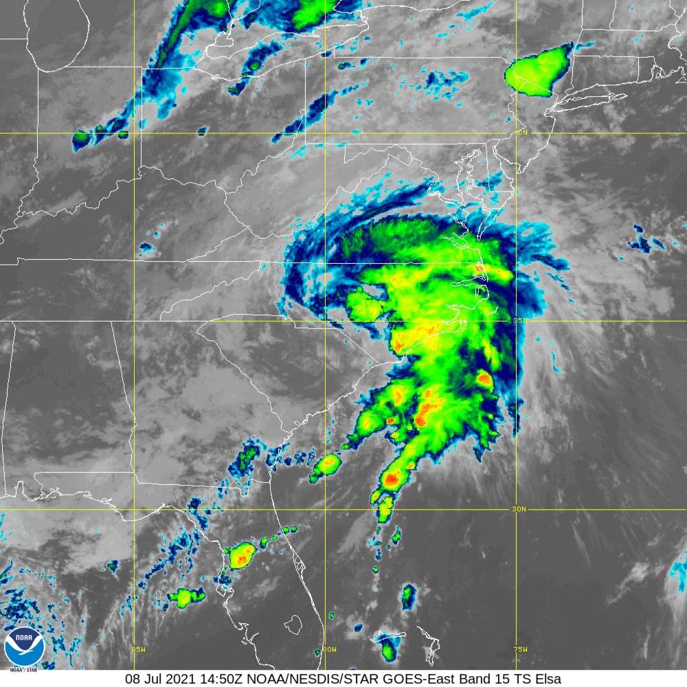
Surface synoptic observations and high-resolution satellite images indicate that the center of the storm has moved into North Carolina. WSR 88-D Doppler radar data and surface reports indicate that the maximum winds are near 40 kt. These highest winds are likely occurring in some of the stronger convective bands near the coast.
Elsa is gradually accelerating toward the northeast, and the initial motion is about 040/17 kt. A faster northeastward motion is expected over the next couple of days as the cyclone becomes entrained into the mid-latitude southwesterly flow ahead of a broad mid-tropospheric trough over the eastern United States and Canada. Elsa should move near or over southeastern New England and Atlantic Canada during the next 24-48 hours. The official track forecast is basically an update of the previous one and continues to follow the multi-model consensus.
Some slight intensification is possible within the next 24-36 hours due to baroclinic forcing from a mid-latitude short wave trough. Around 36 hours, the simulated satellite imagery from the global models depicts a cloud pattern resembling that of a frontal cyclone. Moreover, the FSU phase analyses of the GFS fields shows the system becoming extratropical at that time. This is also reflected in the official forecast.
KEY MESSAGES
1. As Elsa moves across North Carolina and Virginia today, heavy rainfall may result in limited flash and urban flooding. Heavy rainfall from the Mid-Atlantic into New England through Friday could lead to considerable flash and urban flooding.
2. Tropical storm conditions are expected along portions of the North Carolina coast today and the mid-Atlantic coast by this afternoon or tonight. Tropical storm conditions are expected in portions of the southern New England states and New York by Friday. Gusty winds are expected over portions of Atlantic Canada Friday night and Saturday.
All images, forecasts, and documents are courtesy of their respective publishers.



