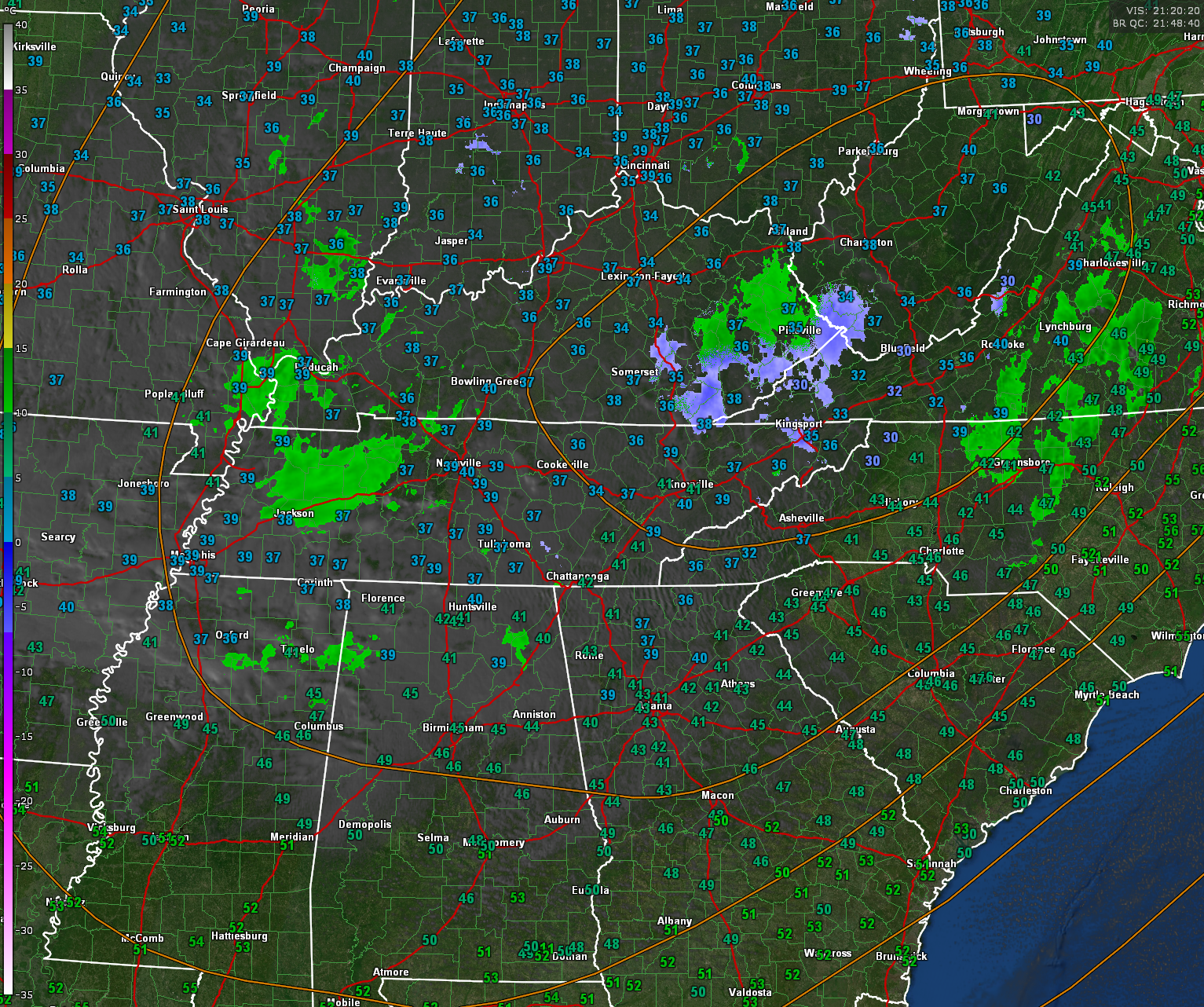
Our elusive upper low is located over southwestern West Virginia this afternoon. It is getting ready to weaken and move out to the northeast. It has become like family during this holiday week.
The upper low is expected to move through the Ohio River Valley with wrap-around moisture stretching down into the northern half of Alabama this evening. Temperatures drop into the lower to middle 30s when the second (better wave) of moisture/precipitation moves in as a rain/snow mix late today toward sunset from the west. Isolated accumulations of snow are possible for portions for the northern third of Central Alabama.
Clouds have become pretty think across the northern half of Alabama this afternoon as expected. They had thinned out a bit as sunshine eroded the inversion and evaporated some of the stratocumulus that formed in the cooler air aloft from the cold core upper low. The sunshine and an approaching upper level disturbance have allowed a few rain showers to form over North Central Alabama and North Central Mississippi.
For this evening, chances for light rain showers and/or light rain sprinkles will be present across the northern third of the area with conditions becoming mixed or switching over to very light snow or flurries as the evening progresses. Only minor accumulations are expected, if any, for areas north of a line from northern Tuscaloosa County to near Pelham to Talladega. North of this line, generally less than 1/4 of an inch of snow may accumulate in isolated locations, and mainly on elevated surfaces like decks, or grassy areas. Note: some sprinkles/flurries may occur a tad further to the south of the shaded area of counties on the map, but no accumulation is expected to the south of the line of demarcation.
A few flurries may be noted before the precipitation ends a row of counties south of there, but no accumulation is expected south of the shaded area. Any precipitation after midnight should be minimal with no additional accumulations in the shaded area.
So no major impacts expected form the wintry mix, just a little fun heading into the long holiday weekend.
I hope you get to see some snow. The AlabamaWX Weather Command will be staffed through midnight, watching and waiting for any reports.