


SUMMARY OF 400 PM CDT…2100 UTC…INFORMATION
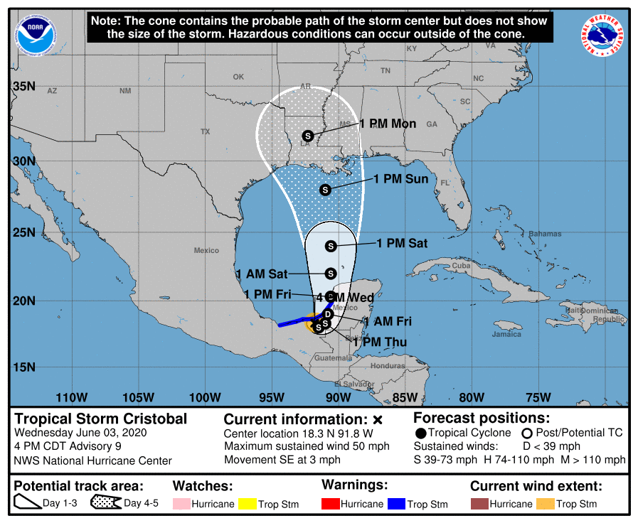
LOCATION…18.3N 91.8W
ABOUT 20 MI…35 KM S OF CIUDAD DEL CARMEN MEXICO
MAXIMUM SUSTAINED WINDS…50 MPH…85 KM/H
PRESENT MOVEMENT…SE OR 135 DEGREES AT 3 MPH…6 KM/H
MINIMUM CENTRAL PRESSURE…995 MB…29.39 INCHES
WATCHES AND WARNINGS
A Tropical Storm Warning is in effect for…
* Campeche to Coatzacoalcos Mexico
DISCUSSION AND OUTLOOK
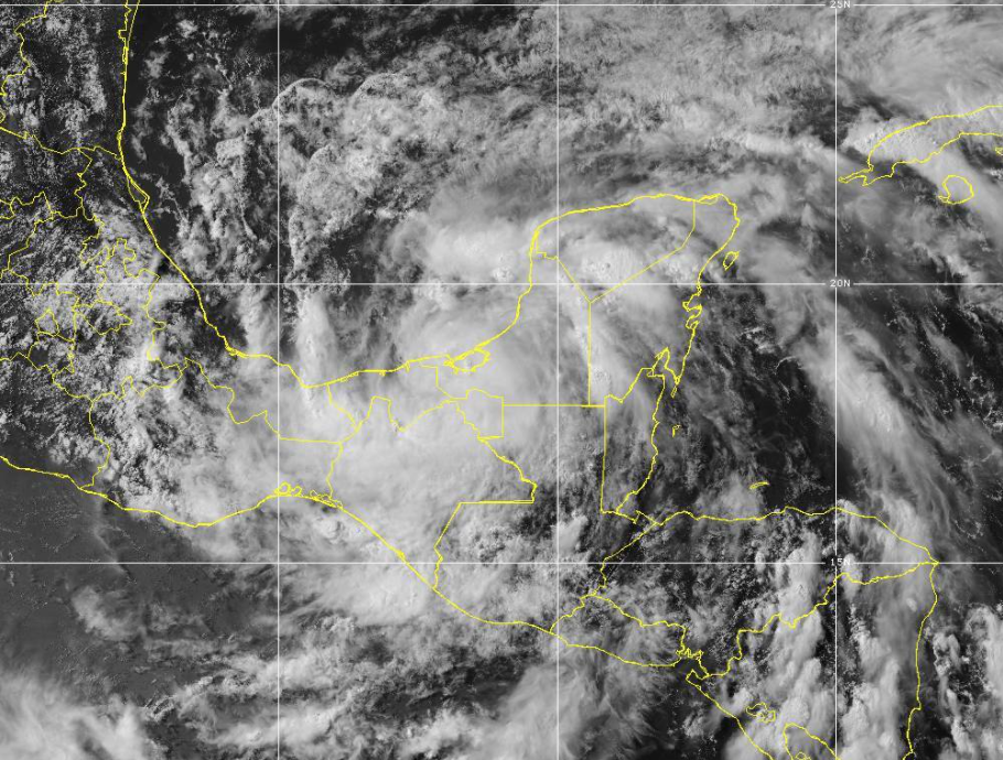
At 400 PM CDT (2100 UTC), the center of Tropical Storm Cristobal was located near latitude 18.3 North, longitude 91.8 West. Cristobal is moving toward the southeast near 3 mph (6 km/h), and a turn toward the east is expected by tonight. A turn toward the north-northeast and north is expected on Thursday and Friday. On the forecast track, the center will move over the landmass of eastern Mexico through Thursday. The center is forecast to move back over the southern Gulf of Mexico by Friday, and over the central Gulf of Mexico on Saturday.
Maximum sustained winds are near 50 mph (85 km/h) with higher gusts. Slow weakening will occur while the cyclone moves over land, and Cristobal will likely become a tropical depression by Thursday evening. Some re-strengthening is expected to begin on Friday.
Tropical-storm-force winds extend outward up to 60 miles (95 km) from the center. The estimated minimum central pressure is 995 MB (29.39 inches).
HAZARDS AFFECTING LAND
RAINFALL: Cristobal is expected to produce the following rain accumulations through Friday night:
Mexican states of Campeche, northern Chiapas, Quintana Roo, Tabasco, and Yucatan…10 to 20 inches, isolated 25 inches.
Mexican state of southern Chiapas…15 to 20 inches, isolated 25 inches.
Mexican states of Veracruz and Oaxaca…5 to 10 inches.
Southern Guatemala…Additional 15 to 20 inches, isolated storm total amounts of 35 inches dating back to Saturday, May 30th.
El Salvador…Additional 10 to 15 inches, isolated storm total amounts of 35 inches dating back to Saturday, May 30th.
Belize and Honduras…3 to 6 inches, isolated 10 inches.
Rainfall in all of these areas may produce life-threatening flash floods and mudslides.
WIND: Tropical storm conditions are affecting the coast within portions of the warning area.



