


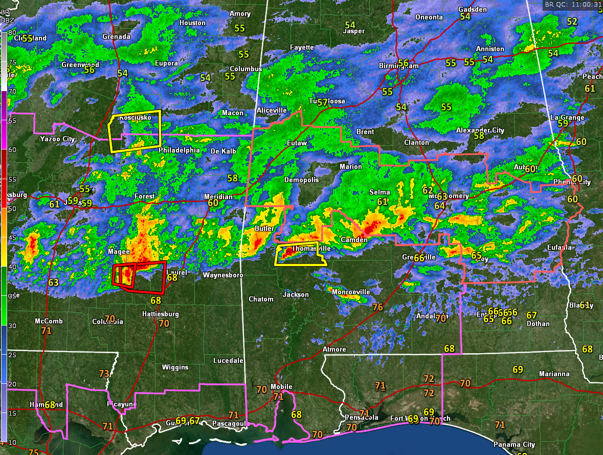
Strong thunderstorms continue across the southern half of Central Alabama this morning, close to a frontal boundary and more unstable air.
They extend now from Sumter and Choctaw Counties in West Alabama eastward through parts of Clarke, Marengo, Wilcox, Dallas, Autauga, Montgomery, Crenshaw, Pike, Bulock and Macon Counties.
Severe thunderstorm warnings are in effect for parts of Clarke County. Large hail is approaching the town of Thomasville. Damaging winds are also possible. The warnings for Choctaw and Sumter counties expired at 5 a.m.
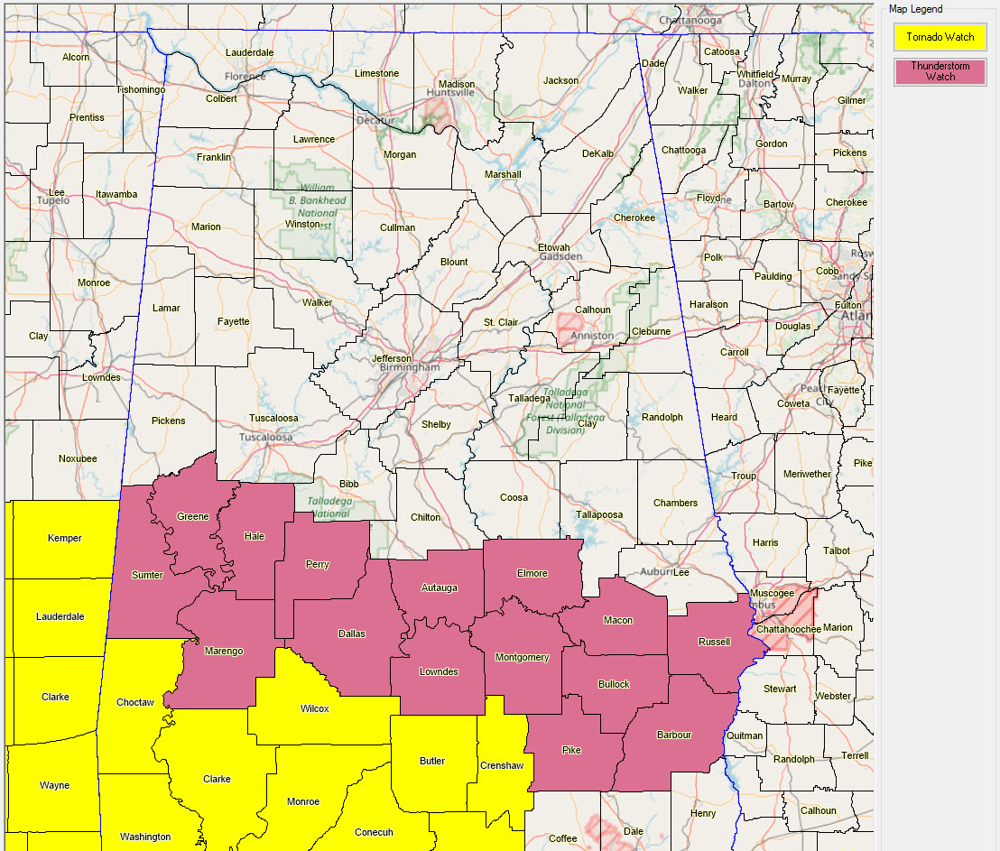
A severe thunderstorm watch continues for parts of South Central Alabama with a tornado watch further south to the coast. Here are the counties in the two watches:
In southern Mississippi, a very dangerous storm is near Collings in Covington County. This storm has a potential tornado in it, and it will be approaching the town of Laurel in Jones County eventually.
To the north, light to moderate rain is falling across the rest of Central Alabama. Lightning is now limited to areas along and south of US-80 over parts of Sumter, Greene, Hale, Perry, Chilton, Autauga, Montgomery and counties east of that.



