


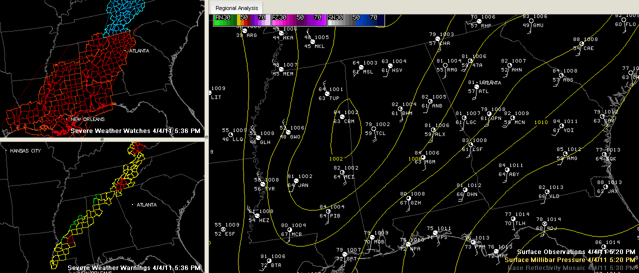
Click to enlarge
Here are the latest developments:
…the eastward progression of the line in western Alabama and eastern Mississippi has slowed to about 15 mph.
…it has slowed in response to the surface low that formed along the line of storms…you can see it in the graphic above…
…the line in Central Mississippi is moving faster to the east, at just over 40 mph.
…a new severe thunderstorm warning was just posted for Fayette and Walker Counties. Dangerous storms from Carbon Hill to south of Fayette. The most dangerous part of this storm will approach Berry.
…there is a new severe thunderstorm warning for Cullman county will 630 p.m…dangerous storms about 12 miles west through 15 miles southwest of Cullman will push across much of the county over the next hour.
…I think we will have to watch the storm moving out of Kemper County MS toward Pickens and Tuscaloosa Counties. It has a bit of an appendage.
…the tornado watch has been extended for Fayette, Lamar, Winston till 11:00 PM CDT
…Marion County has been cleared from the watch.
…the Tornado Watch continues for Autauga, Bibb, Blount, Calhoun, Chambers, Cherokee, Chilton, Clay, Cleburne, Coosa, Dallas, Elmore, Etowah, Greene, Hale, Jefferson, Lee, Lowndes, Macon, Marengo, Montgomery, Perry, Pickens, Randolph, Shelby, St. Clair, Sumter, Talladega, Tallapoosa, Tuscaloosa, Walker Counties til 11:00 PM CDT.



