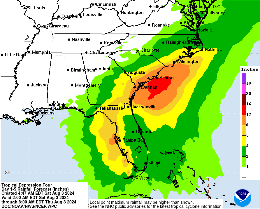
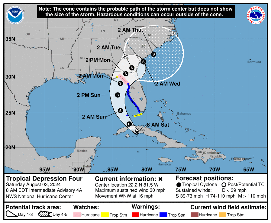
Quick update on the tropical depression. The overall strength of the system has not changed much. The 4am CDT update from the NHC center stated that some of the strongest winds were to the south and east of the center, which is now offshore the southern coast of Cuba. TD #4 should move into the eastern Gulf of Mexico later today and then toward the Florida Big Bend area Sunday and Sunday night. After landfall, the models show slowing steering currents and the system will slow down while moving across north Florida and Georgia. Still no major impacts expected to the state of Alabama. Based on the latest track, the state will stay on the dry, offshore side of the system. Swells will increase rip current risk esp for Florida Panhandle beaches. We will have a fuller update with the 10am CDT NHC advisory.
Published on: August 3, 2024 at 7:02 AM
Related Articles
October 17, 2026 at 7:05 AM
Breezy Saturday, Fall Weekend in Store
A strong, dry cold front pushed through Alabama yesterday, and much cooler drier air been filtering into the state throughout the night. This weekend will feature highs and lows quite seasonable for this time of year with elevated winds today. As we head into next week, an upper-level ridge from the west will cause temperatures to increase each day. Alabama will remain rain-free through the 7 day period. Continue reading →
READ MORE
October 16, 2026 at 9:37 PM
Restoring Service after Hurricane Isaias
Alabama Power restored service to about 90% of customers within 24 hours after Hurricane Isaias, mobilizing thousands of workers and advanced storm-planning tools to recover from widespread damage across south Alabama. Continue reading →
READ MORE