


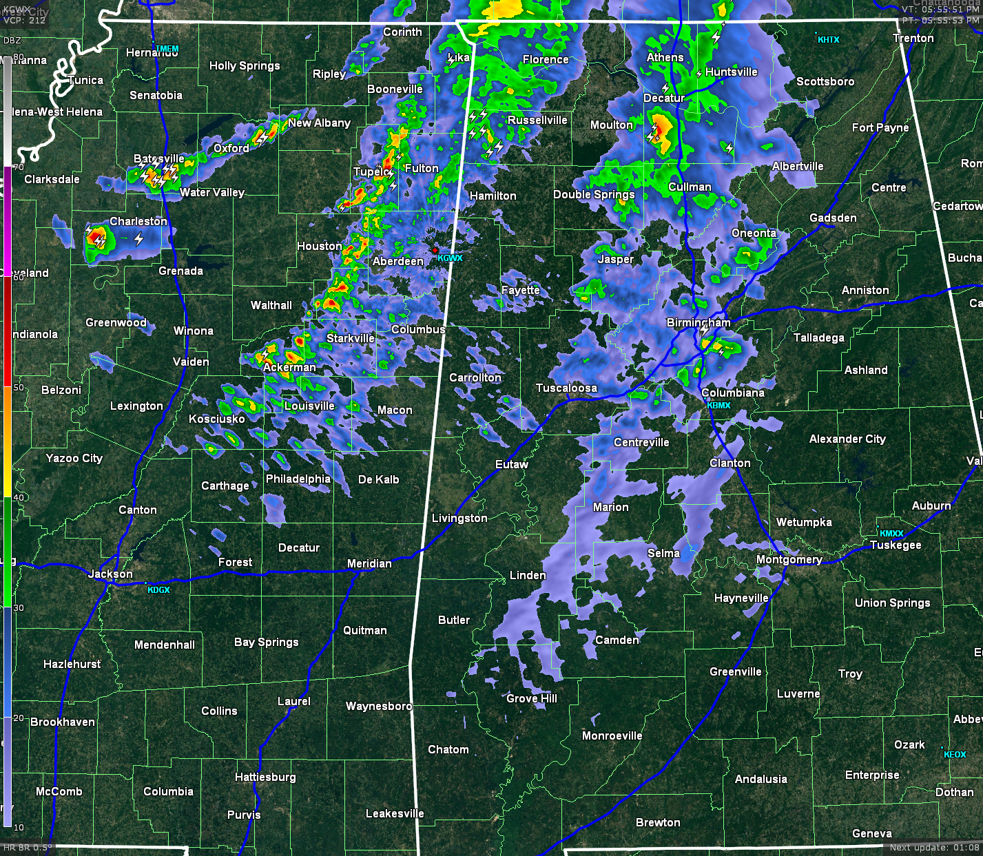
A broken line of showers with a few embedded thunderstorms are pushing their way across the northwestern part of the state at and is approaching the I-65 corridor. Another line of heavier rain and thunderstorms will be pushing across the state line from Mississippi between now and 7PM CDT. There is another broken line of storms still back in the northwestern parts of Mississippi.
These separate lines of storms are expected to all combine into one as they will be making their way across the I-20 & I-59 corridors at around 9-10PM. Once the line moves through, rain should come to an end and skies should clear out after midnight.
There are no severe thunderstorms within the state. A Severe Thunderstorm Warning is in effect until 6:15 PM for Macon, Sumner, Trousdale, and Wilson counties due to a threat for damaging winds. Another Severe Thunderstorm Warning is in effect for four counties until 6:15 PM up in central North Dakota. Those are the only active warnings in the nation as of now.
SEVERE OUTLOOK: The Storm Prediction Center currently does not have any mesoscale discussions up for any part of the country concerning possible watches. The next update for the severe outlook for the rest of tonight will be up by 8PM.
WIND ADVISORY: A wind advisory is in effect for the entire area until 10PM CDT tonight. Pressure gradient winds will be strong tonight as we are currently in between a strong surface high, located to our east, with an approaching cold front to our west. Expect winds averaging in the 15-25 MPH range, with some gusts as high as 35 MPH.
SEVERE WEATHER: Instability numbers on the latest run of the HRRR model are even less impressive than the last update. Number are at or below 900 J/kg. STP numbers are still below 1, and the low-level jet is still holding at the same numbers as earlier.
MAIN THREAT: A few severe thunderstorms are possible, with damaging straight-line winds of 60 MPH or more and damaging hail. The tornado threat is very low, but you simply cannot rule one out. There will be heavy rain at times, but do not believe there will be enough to warrant a warning. Have a reliable source of severe weather information handy.



