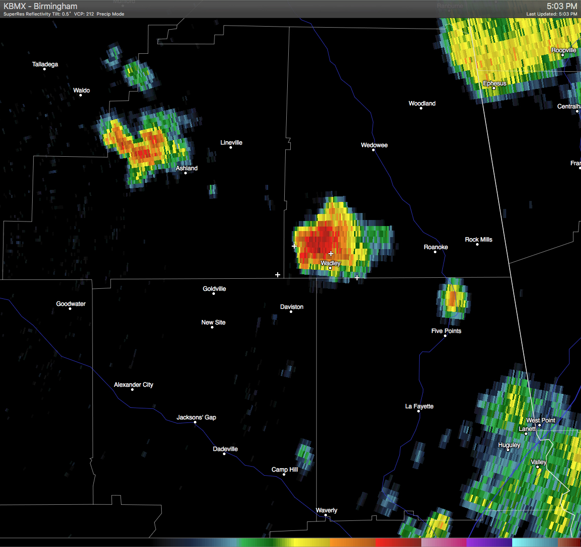
A Significant Weather Advisory has been issued for Southeastern Clay, Southwestern Randolph, Northwestern Chambers, & Northeastern Tallapoosa Counties until 5:45 PM CDT. A strong thunderstorm was located over Corinth and near Lake Wedowee, and was moving north at 10 MPH. Pea size hail and wind gusts in excess of 40 MPH will be possible with this storm. If you are in the path of this storm, seek safe shelter until it has passed. Locations in the path are listed below.
ALZ028-029-037-038-012245-
CHAMBERS AL-TALLAPOOSA AL-RANDOLPH AL-CLAY AL-
500 PM CDT WED JUN 1 2016
…SIGNIFICANT WEATHER ADVISORY FOR SOUTHEASTERN CLAY…SOUTHWESTERN
RANDOLPH…NORTHWESTERN CHAMBERS AND NORTHEASTERN TALLAPOOSA COUNTIES
UNTIL 545 PM CDT…
AT 500 PM CDT…DOPPLER RADAR WAS TRACKING A STRONG THUNDERSTORM OVER
CORINTH…OR 8 MILES SOUTH OF LAKE WEDOWEE…MOVING NORTH AT 10 MPH.
PEA SIZE HAIL AND WINDS IN EXCESS OF 40 MPH WILL BE POSSIBLE WITH
THIS STORM.
LOCATIONS IMPACTED INCLUDE…
ROANOKE…WEDOWEE…LAKE WEDOWEE…WADLEY…RED LEVEL…ABANDA…
MALONE…CRYSTAL LAKE…SPARKLING SPRINGS…DAVISTON…MOTLEY…
TENNANT…R.L.
HARRIS DAM…DICKERT…CRAGFORD…OFELIA AND ROCK STAND.