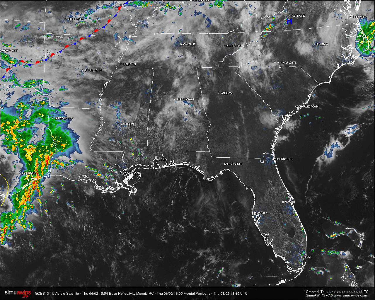
SATELLITE & RADAR CHECK: Radar across Central Alabama is clear, except for one very small shower showing up in Southwestern Clay County, and It is moving to the northeast. Otherwise, a mix of sun and clouds for the rest of the area.
QUICK LOOK AT TEMPERATURES: Temperatures at this time are already are up in the upper 70s to low 80s. The warm spot in the state is Mobile at 84. Here is a list of temperature readings from across the state at this time:
Birmingham 83
Tuscaloosa 80
Muscle Shoals 80
Huntsville 76
Anniston 81
Alexander City 78
Montgomery 83
Dothan 83
Mobile 84
REST OF TODAY: Warm and humid conditions will remain in place across the state, as the ridge that has been in control of our weather for the past week is weakening. There will be a mix of sun and clouds, with scattered showers and thunderstorms developing as we get into the afternoon and early evening hours. Once we lose the heating of the day, those will begin to dissipate. Afternoon highs will be at or near 90 degrees.
AIR QUALITY ALERT FOR BIRMINGHAM AREA: Today’s forecasted air quality index is 56, which is in the CODE YELLOW (moderate) for ozone and particulate matter. Unusually sensitive people should consider limiting prolonged outdoor exertion.
CLIMATOLOGY FOR BIRMINGHAM: The normal high temperature for June 2nd in Birmingham is 85, while the normal low is 62. The record high of 95 was reached in 1998. The record low of 42 was set back in 1972. To learn more about the climatology for the month of June, and the definition of meteorological summer, please visit my earlier post “Welcome To June!”.
FRIDAY: Pretty similar to what to expect for today. A mix of sun and clouds with scattered showers and thunderstorms, which will be more numerous during the afternoon and evening hours. Afternoon highs will be at or near 90 degrees.
HEADED TO THE BEACH: Expect a good supply of sunshine along the Gulf Coast from Panama City Beach over to Gulf Shores today and tomorrow with only isolated showers. Scattered storms will be more likely over the weekend, but we still expect 4 to 6 hours of sunshine both days. Then, next week looks great with generally dry weather on the coast Monday through Friday. Highs will be in the 80s most days. See a very detailed beach forecast here.
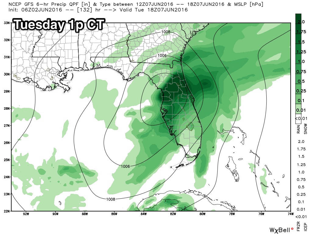
TROPICAL UPDATE: Global models develop a tropical low in the southern Gulf of Mexico Monday; this will move northeast, and should wet down the Florida Peninsula Tuesday. Understand if you have a trip planned to Disney World next week (or places like Tampa or Daytona Beach), understand this will be just a one day issue; after the tropical rain Tuesday the rest of the week looks very nice. And, this tropical system should have no impact on Alabama or the Gulf Coast (places like Gulf Shores, Destin, and Panama City Beach) other than potential rip tides on Tuesday.
SUMMER SEASON: As we get into the summer season, I think it would be a great idea to read James’ post about understanding summer weather forecasts in Alabama. Click here to visit the post.
WEATHERBRAINS: Don’t forget you can listen to our weekly 90 minute netcast anytime on the web, or on iTunes. This is the show all about weather featuring many familiar voices, including our meteorologists at ABC 33/40. You can find it here.