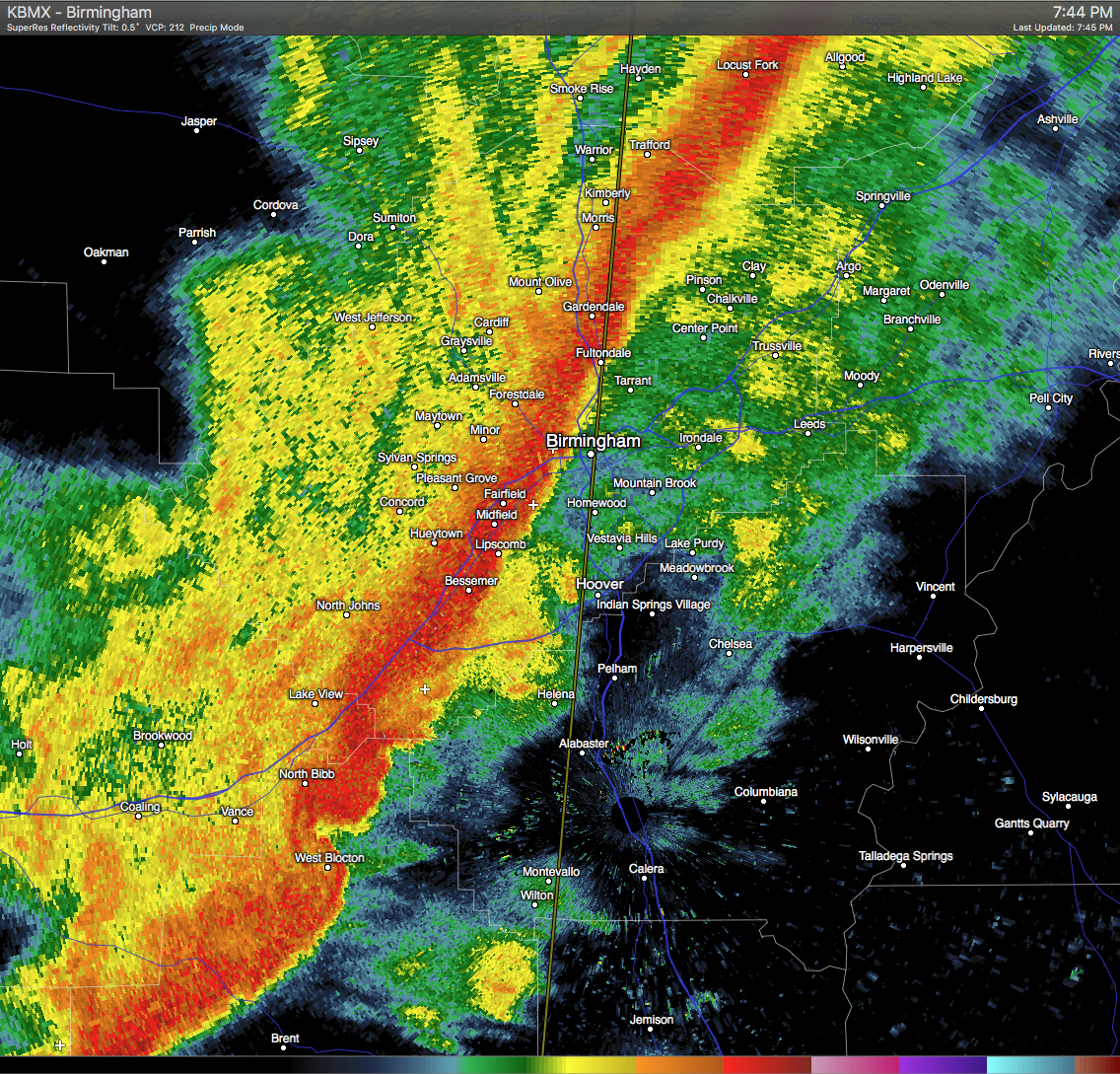
Strong thunderstorms are currently located in a line near County Line to near Eoline. These storms are moving to the east at 45 MPH. Wind gusts of up to 50 MPH can be expected with these storms. Torrential rainfall is also occurring with these storms, and may lead to localized flooding. Areas in the path are listed below:
BIRMINGHAM, HOOVER, VESTAVIA HILLS, ALABASTER, BESSEMER, HOMEWOOD, PELHAM, MOUNTAIN BROOK, TRUSSVILLE, HELENA, GARDENDALE, IRONDALE, LEEDS, MOODY, CALERA, FAIRFIELD, CHELSEA, FULTONDALE, MONTEVALLO AND COLUMBIANA.