Currently across Central Alabama, the squall line has become more horizontal in nature compared to when if first started moving into the state several hours ago, and now stretches west-southwestward from into western Georgia, through Fruithurst and Heflin, back through Sylacauga and Gantts Quarry, through Clanton and Maplesville, and Thomaston and Butler, before entering into Southeastern Mississippi. It is continuing its slow movement off to the east, and should be completely exiting the state before the noon hour on Tuesday. No watches or warnings are in effect, not only for our state, but for the rest of the southeast.
The guys at the SPC are looking at the situation across the southern parts of the state and back into Mississippi and Louisiana, and are determining that another severe thunderstorm watch will not be issued and the likelihood of any storms reaching severe criteria are small throughout the rest of tonight and early into Tuesday.
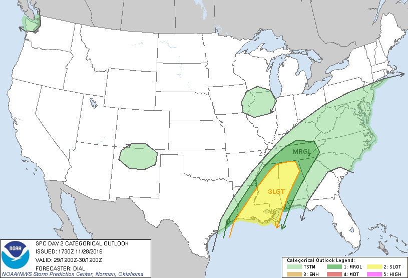
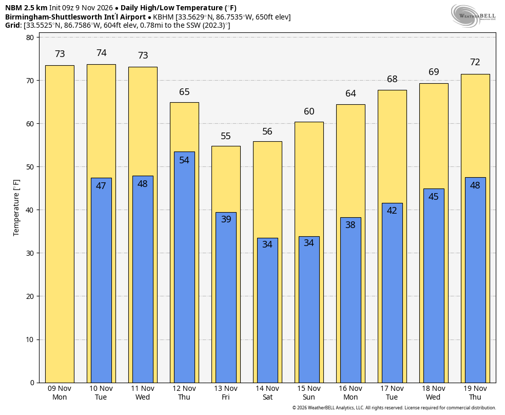
As far as tomorrow, there will be a lull in rain activity mostly, and the sun could even peek out from behind the clouds for a little bit. The boundary that tonight’s squall line was associated with is expected to stall out, as another short wave will start to approach the state. Instability values will start to rise as the boundary will start to move back to the north as a warm front, and convective thunderstorms will start to fire along the front during the evening hours. The temperatures will start to rise along and south of the front as a southerly flow will increase.
Exact timing on when to expect the main severe threat will be in a window from midnight tomorrow night until early Wednesday afternoon. With the convection firing along the warm front, discrete cells could form and possibly go strong to severe before that, possibly as early as 5-6PM. All modes of severe weather look to be possible: damaging straight line winds, large hail, and tornadoes.
We’ll have a better idea as the morning arrives, so be sure to watch the Weather Xtreme Video as James Spann will have the latest update on tomorrow night’s round of strong to severe weather.