


The old weather adage says, “In Like a Lion, Out Like a Lamb.” That is often the case, as weather patterns are usually active as the beginning of March, but calming by the end of the month somewhat.
And we have a very strong upper level system impacting the U.S. today. A powerful upper trough will take on a negative tilt today, its axis swinging to a line from Des Moines to St. Louis by this afternoon. This “negative tilt” or an arrangement from northwest to southeast of the trough axis, makes for a more energetic system. The powerful jetstream of yesterday has weakened some today, but strong upper winds extend from Dallas to Nashville.
The surface low is pretty far to th enorth for a big severe weather outbreak for us. It is located just northwest of Toronto, Canada, east of Michigan. The front extends back to near Texarkana.
A line of thunderstorms extends from southeast of Columbus OH to Lexington KY to Nashville to east of Memphis this morning. Numerous severe thunderstorm warnings are all along the line from southwestern Pennsylvania to the Memphis area. There is a single tornado warning for areas southeast of Nashville including Gordonsville and Watertown.
There is a high wind potential with these storms, that is being driven by the strong winds aloft.
Lots of wind damage reports this morning across Kentucky and Tennessee.
Tornado watches and severe thunderstorm watches are in effect for a large area from Ohio and West Virginia back to eastern Arkansas and the Missouri Bootheel. Almost the entire state of Tennessee is in a watch at this time.
This activity will stay mainly north of Alabama, but could clip the Tennessee Valley through the morning hours.
The air has that stormy springlike feel this morning. Winds are breezy, out of the southwest at 10-20 mph with occasional gusts to 25 mph. Dewpoints are in the lower and middle 60s, giving the air a humid feel. Temperatures are in the upper 60s approaching 70F and will top out in the lower and middle 70s today as sun peeks through occasional breaks in the clouds.
Here is a projection of the progress of the line of storms that will affect North and Central Alabama today using the HRRR model:
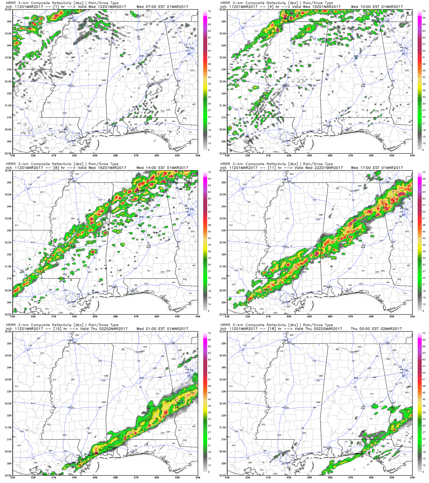
This line will have instability that is on the low end of moderate (750-1250 joules of CAPE) to work with when it arrives, and a decent amount of bulk shear to keep the storms organized. Low level helicity or spin will be on the low side though with the southwestern winds predominantly near the surface.
Here is the Energy Helicity Index (EHI) from the latest run of the GFS.
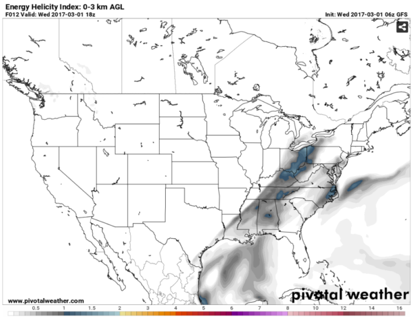
Values of 1 or greater are more likely to produce tornadoes.
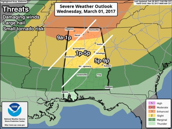
So as you can see, can’t rule out an isolated tornado, especially over Northwest Alabama early in the afternoon or late morning, but the overall tornado threat is low.
Here are the timing windows overlain across the SPC Day One risk outlook. See the risks explained here.
It’s a great time to review your severe weather safety plan, especially for severe thunderstorms with damaging winds. Take severe thunderstorm warnings seriously. There is nearly always a tragic story of a tree falling on a house or a limb falling on a car killing someone, so pay attention to those severe thunderstorm warnings as well as tornado warnings and be in a safe place when strong storms approach your area. Here are our safety tips.
Sunny and cooler tomorrow. Look for a freeze by Saturday morning with lows in the middle and upper 20s.



