


A few showers have formed over North Central Alabama over the past 90 minutes.
They extend from New Hope in Marshall County to near Falkville in Morgan County to Double Springs in Winston County to Vernon in Lamar County.
They are pushing southeast at about 20 mph.
The showers are forming in a narrow tongue of uncapped, slightly unstable air that extends northward over the western half of Alabama.
These showers could develop a few rumbles of thunder as they push east generally near and north of the I-20 corridor.
Additional showers will form through the morning hours, and storms should form ahead of the line by early afternoon.
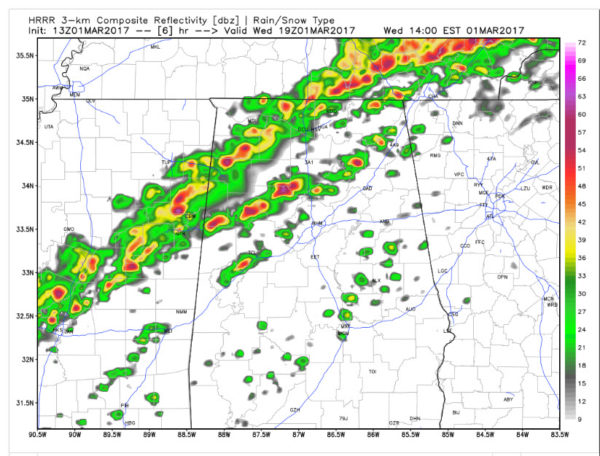
Those storms are a little worrisome for West Central Alabama since they could be supercells.
The main line of storms will reach Northwest Alabama by noon.
Storms should be into Birmingham and Tuscaloosa by 2 p.m.
They should end in the I-59 Corridor by 4:30-5 p.m.
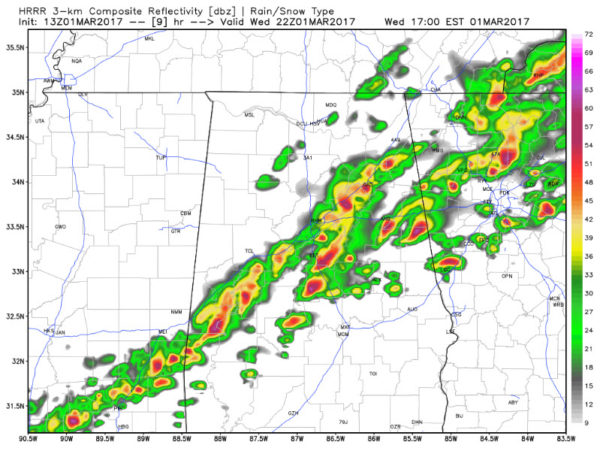
The main threat with the storms later will be damaging winds but there is still a small threat of an isolated tornado.
We will be monitoring the severe weather throughout the event, so stay with AlabamaWX for the every latest.



