


The SPC adjusted its Day One Severe Weather Outlook to include more of North Central Alabama in the Enhanced Risk area.
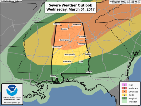
The severe weather threat is increasing over North and Central Alabama. The airmass is becoming more unstable and there is a little more low level spin that we anticipated.
It will be interesting to see what the storms in Mississippi do when they get into this airmass over Alabama.
A tornado watch is in effect for North and Central Alabama until 6 p.m.
Here is an explanation of the risk categories.



