


…A SEVERE THUNDERSTORM WARNING REMAINS IN EFFECT UNTIL 245 PM CST FOR CENTRAL FAYETTE COUNTY… At 235 PM CST, severe thunderstorms were located along a line extending from near Kansas to near Fayette, moving east at 60 mph.
HAZARD…60 mph wind gusts and quarter size hail.
SOURCE…Radar indicated.
IMPACT…Hail damage to vehicles is expected. Expect wind damage to roofs, siding, and trees. Locations impacted include… Fayette, Berry, Belk, Bankston, Bevill State College Fayette, Hubbertville, Fowlers Crossroads and Richard Arthur Field.
Severe Thunderstorm Warning Continues For Parts Of Fayette County Until 2:45PM
Mar 1st @ 2:07 pm
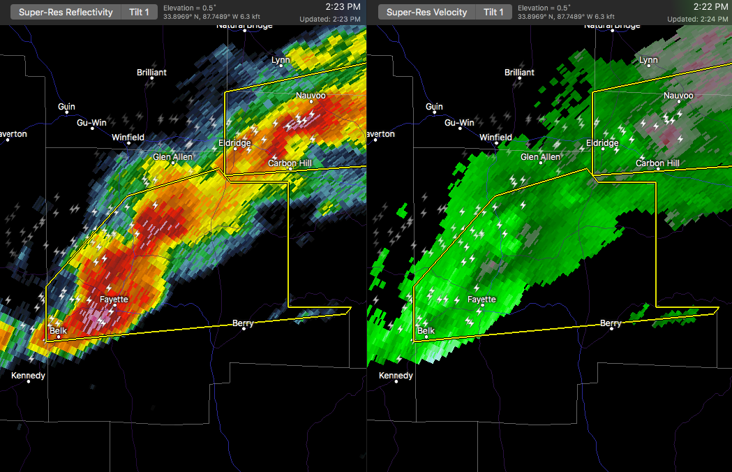

…A SEVERE THUNDERSTORM WARNING REMAINS IN EFFECT UNTIL 245 PM CST FOR CENTRAL FAYETTE COUNTY… At 222 PM CST, severe thunderstorms were located along a line extending from 6 miles south of Glen Allen to near Belk, moving east at 60 mph.
HAZARD…60 mph wind gusts and quarter size hail.
SOURCE…Radar indicated.
IMPACT…Hail damage to vehicles is expected. Expect wind damage to roofs, siding, and trees. Locations impacted include… Fayette, Berry, Belk, Bankston, Bevill State College Fayette, Hubbertville, Fowlers Crossroads and Richard Arthur Field.
Severe Thunderstorm Warning Canceled For Parts Of Lamar County Until 2:45PM
Mar 1st @ 2:07 pm
…THE SEVERE THUNDERSTORM WARNING FOR SOUTHEASTERN LAMAR COUNTY IS
CANCELLED…
The storms which prompted the warning have moved out of the warned
area. Therefore, the warning has been cancelled.
A tornado watch remains in effect until 600 PM CST for west central
Alabama.
Severe Thunderstorm Warning Continues For Parts Of Fayette And Lamar Counties Until 2:45PM
Mar 1st @ 2:07 pm

…A SEVERE THUNDERSTORM WARNING REMAINS IN EFFECT UNTIL 245 PM CST FOR CENTRAL FAYETTE AND SOUTHEASTERN LAMAR COUNTIES… At 217 PM CST, a severe thunderstorm was located near Belk, or near Fayette, moving east at 55 mph.
HAZARD…60 mph wind gusts and quarter size hail.
SOURCE…Radar indicated.
IMPACT…Hail damage to vehicles is expected. Expect wind damage to roofs, siding, and trees. Locations impacted include… Fayette, Vernon, Berry, Belk, Bankston, Blooming Grove, Bluff, Cody, Richard Arthur Field, Bevill State College Fayette, Hubbertville, Fowlers Crossroads and Hightogy.
Severe Thunderstorm Warning Issued For Parts Of Fayette And Lamar Counties Until 2:45PM
Mar 1st @ 2:07 pm
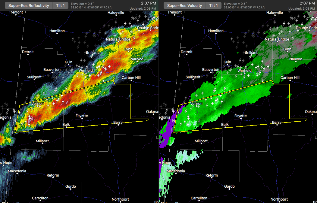

The National Weather Service in Birmingham has issued a
* Severe Thunderstorm Warning for…
Central Fayette County in west central Alabama…
Southern Lamar County in west central Alabama…
* Until 245 PM CST
* At 207 PM CST, a severe thunderstorm was located near Vernon, moving east at 60 mph.
HAZARD…60 mph wind gusts and quarter size hail.
SOURCE…Radar indicated.
IMPACT…Hail damage to vehicles is expected. Expect wind damage to roofs, siding, and trees.
* Locations impacted include…
Fayette, Vernon, Berry, Belk, Bankston, Blooming Grove, Bluff, Cody, Richard Arthur Field, Bevill State College Fayette, Hubbertville, Fowlers Crossroads, Star and Hightogy.



