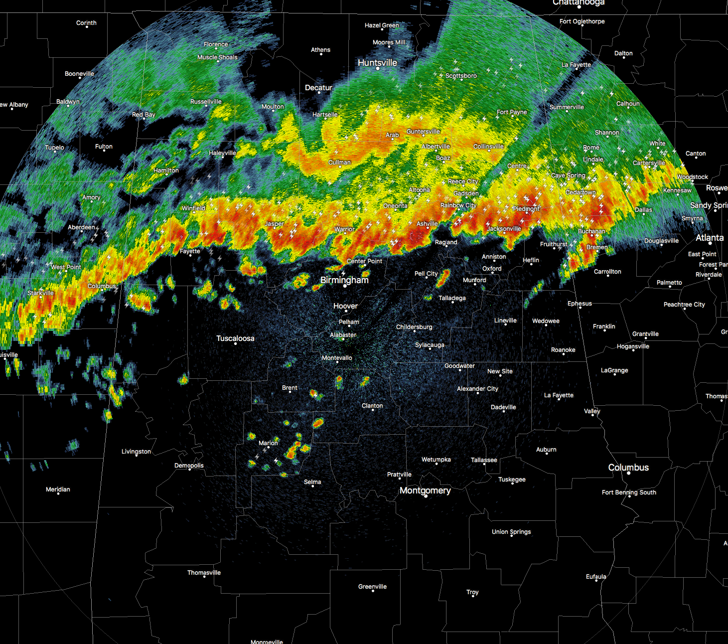
Currently, the line of storms has made it into the northern parts of Central Alabama, stretching from Vernon to Dora and Sumiton to Springville to Fruithurst. At its current speed, the line will be pushing into the Birmingham Metropolitan Area within the next 15 to 20 minutes, Tuscaloosa within the next hour, and reaching Clanton by 4AM.
At this point, there are no current warnings for North and Central Alabama, and we do not believe that a new Severe Thunderstorm Watch will be issued for Central Alabama. Most of the storms are elevated, with the strong winds staying aloft and not reaching the ground. For parts of the line that had hail cores earlier, the hail is no longer in severe criteria (less than 1 inch in diameter). You can still expect heavy rain, gusty winds, dangerous cloud-to-ground lightning, and some small hail when the squall line reaches your location.
THIS JUST IN:
A Significant Weather Alert has been issued for Tuscaloosa and Pickens counties until 3:30AM. At 2:26AM, strong thunderstorms along a line extending from 6 miles northeast of Berry to near Columbus. Movement was south at 50 mph. Pea size hail and wind gusts of 40 to 50 mph will be possible with these storms.
Locations impacted include…
Tuscaloosa, Northport, Aliceville, Gordo, Reform, Carrollton, Pickensville, Holt, Lake View, Brookwood, Coaling, Vance, Coker, Ethelsville, McMullen, Samantha, McFarland Mall, Benevola, Johnston Lake and Lake Lurleen State Park.
Torrential rainfall is also occurring with these storms, and may lead to localized flooding. Do not drive your vehicle through flooded roadways. Frequent cloud to ground lightning is occurring with these storms. Lightning can strike 10 miles away from a thunderstorm. Seek a safe shelter inside a building or vehicle.