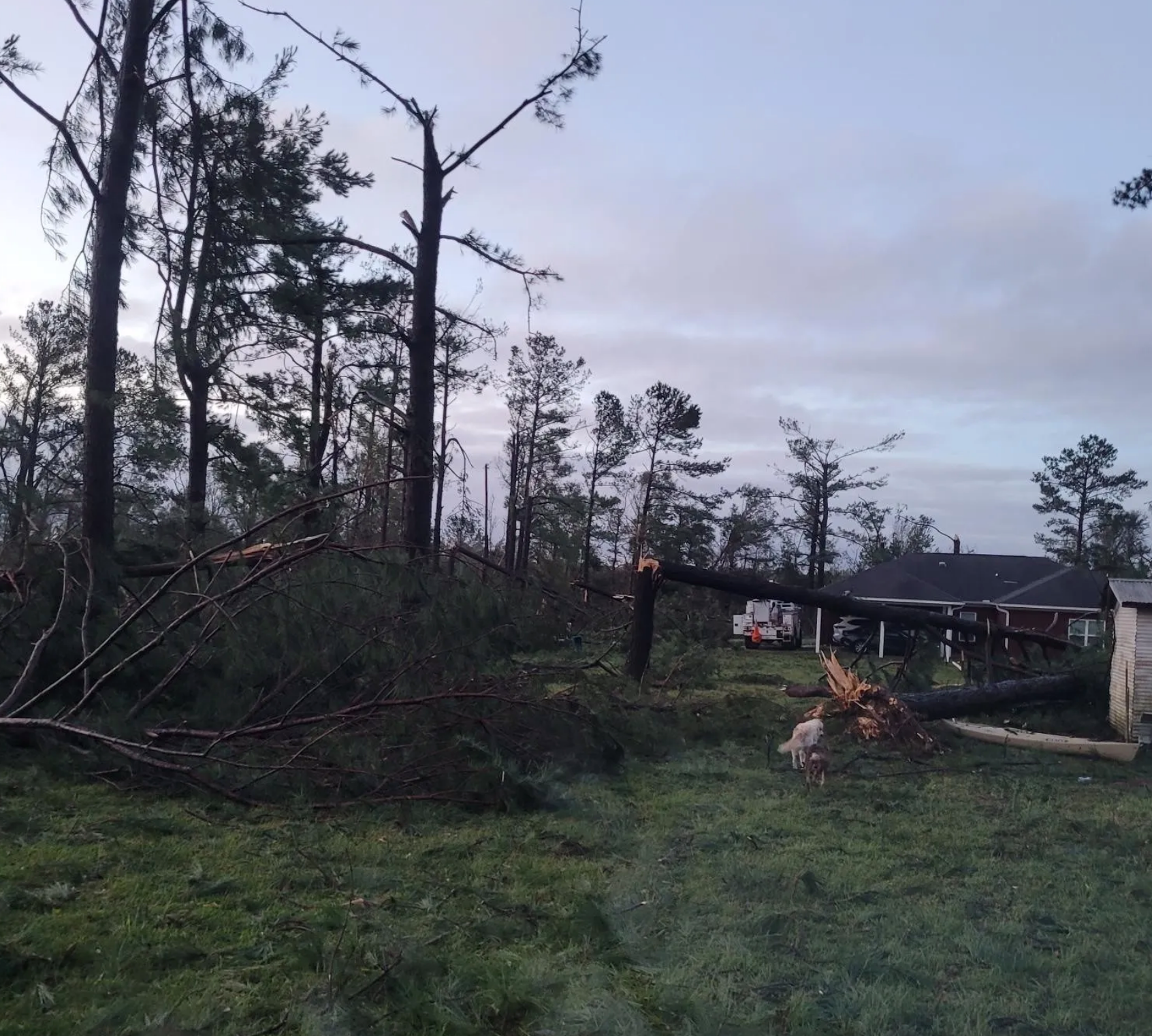
…No Central Alabama counties under tornado watch number 129!
The watch has been canceled for Barbour, Pike and Russell Counties.
Thank goodness that we weather caused relatively few problems in the Southeast today. Thanks for paying attention to the weather and being great ambassadors in your networks. We have the most savvy weather audience in the country and it pays off on severe weather days.
It feels really refreshing outside. There are a few light showers rotating through north Alabama, but they are fairly inconsequential. Enjoy the rest of your evening and watch out for the breezy conditions through tomorrow.
And don’t forget about the chances of frost Saturday morning.
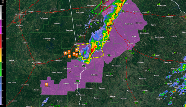
Three counties left in the tornado watch, that is.
If you live in Lee, Macon or Bullock Counties, you can go to sleep. The severe weather threat is over for you.
If you live in Russell, Barbour or Pike Counties, you have a little ways to go as the watch continues for you. And a little secret, the threat is over for you as well Pike. The line of storms is out of your county.
It will be out of Russell in 15 minutes (by 10:45) and out of Barbour by 11 p.m.
Enjoy the refreshing air when it gets there!
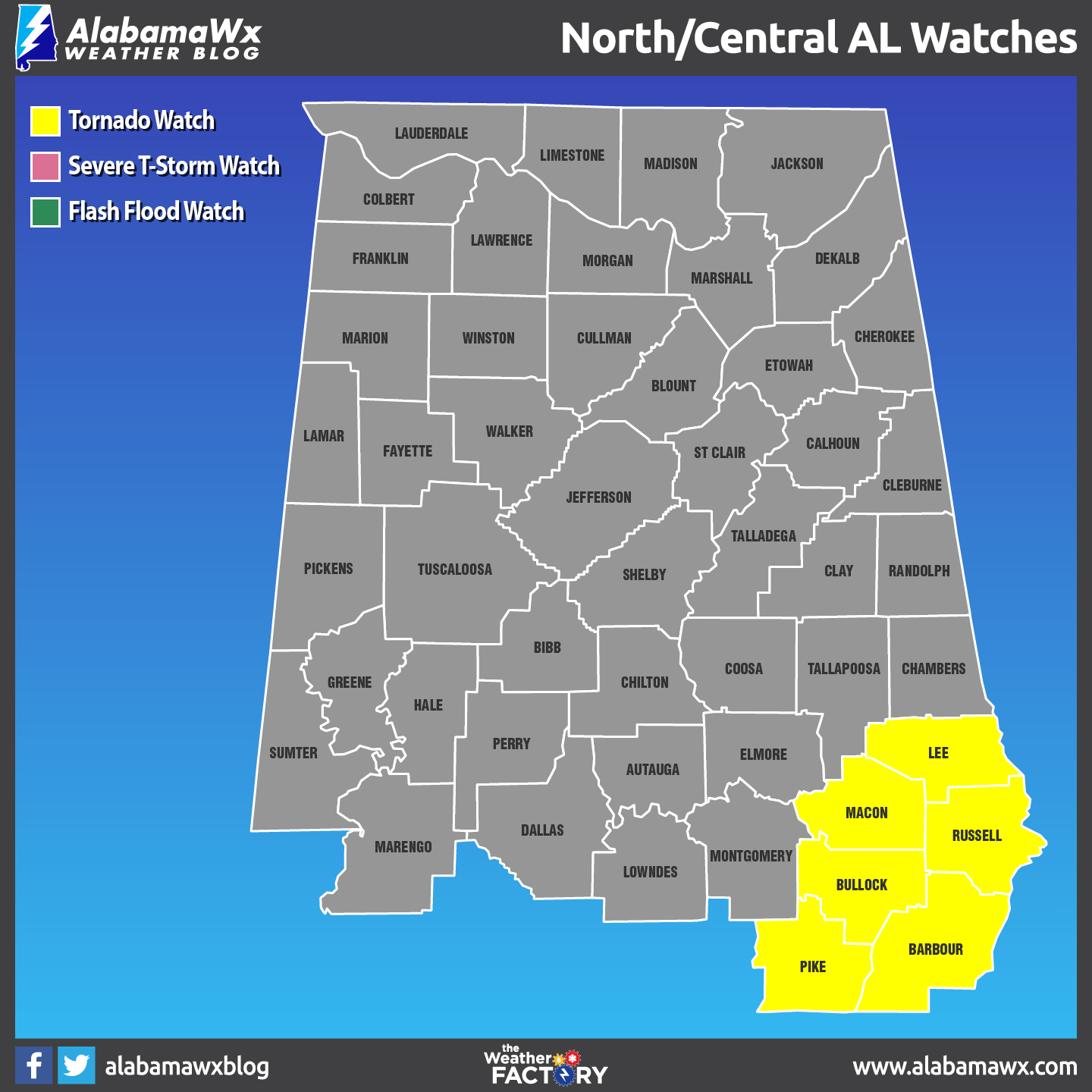
At 946PM, the NWS has cancelled Chambers County from the Tornado Watch.
A Tornado Watch remains in effect for Barbour, Bullock, Lee, Macon, Pike, and Russell counties until 1:00 AM Thursday. A few tornadoes are possible, along with large hail and wind gusts up to 70 MPH.
_____________________________________________________
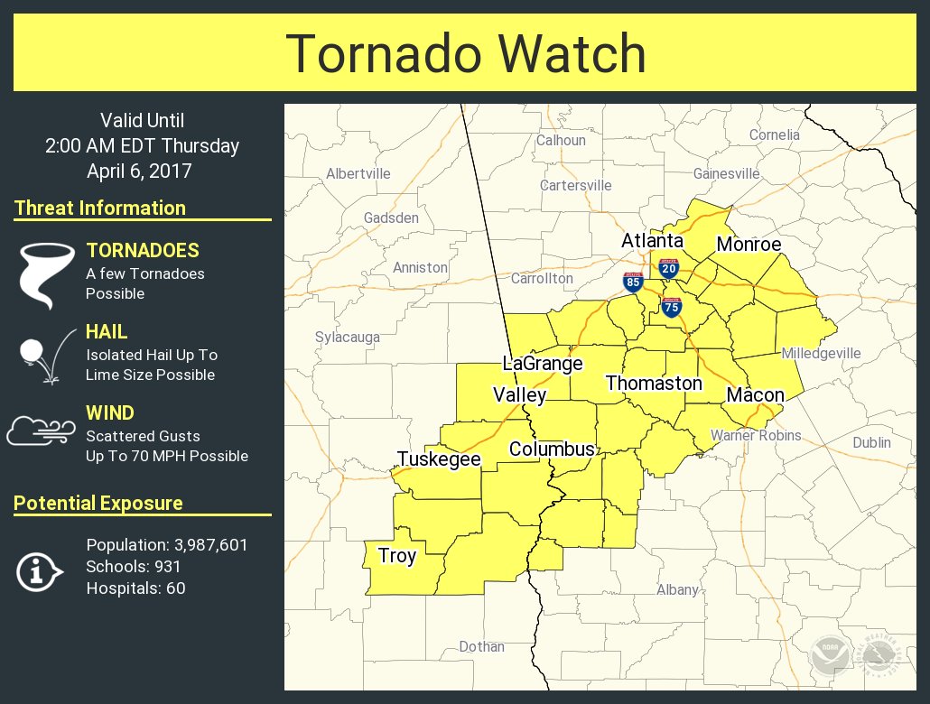
The old Tornado Watch was allowed to expire, but a new Tornado watch has been issued for Barbour, Bullock, Pike, Chambers, Lee, Macon, and Russell counties until 1:00 AM Thursday. A few tornadoes are possible, along with large hail and wind gusts up to 70 MPH.
_____________________________________________________
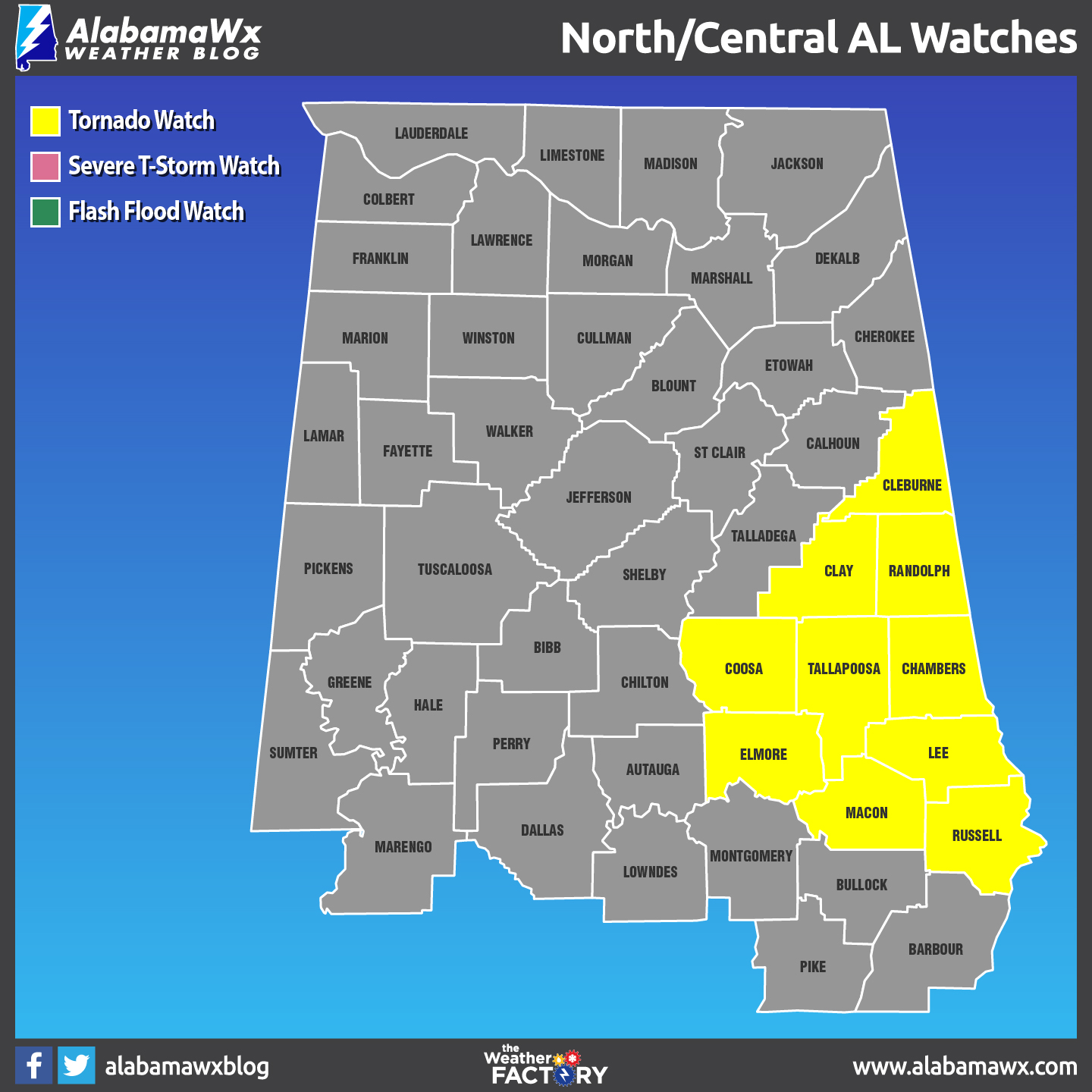
At 8:01PM, the NWS has cancelled these counties from the Tornado Watch: Calhoun, Cherokee, Chilton, DeKalb, Etowah, Jackson, Marshall, Shelby, St. Clair, Talladega.
Counties remaining in the watch: Chambers, Clay, Cleburne, Coosa, Elmore, Lee, Macon, Randolph, Russell, Tallapoosa.
_____________________________________________________
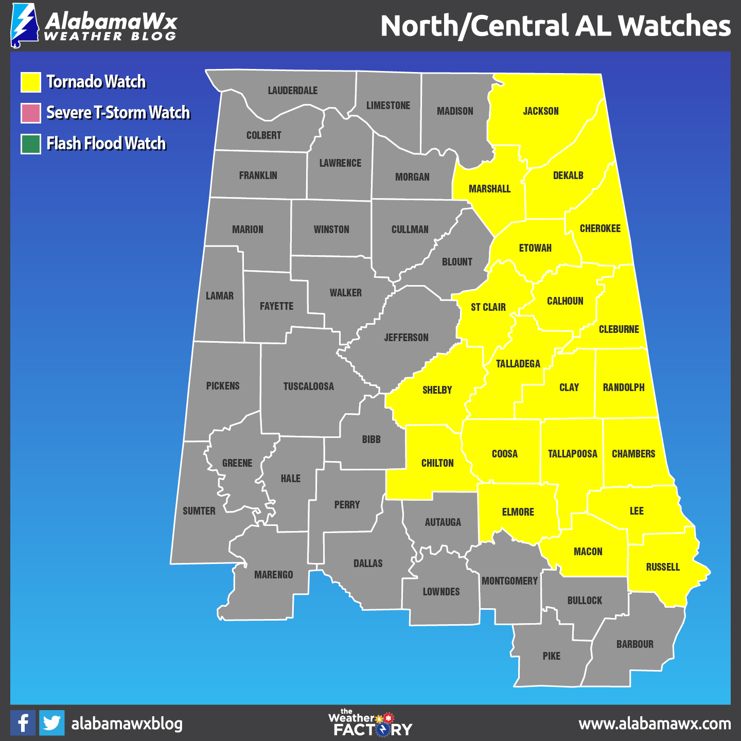
At 6:52PM, the NWS has cancelled these counties from the Tornado Watch: Autauga, Barbour, Bibb, Blount, Bullock, Jefferson, Lowndes, Montgomery, Pike.
Counties remaining in the watch: Calhoun, Chambers, Cherokee, Chilton, Clay, Cleburne, Coosa, Elmore, Etowah, Lee, Macon, Randolph, Russell, Shelby, St. Clair, Talladega, Tallapoosa.
_____________________________________________________

At 6:09PM, the NWS has cancelled these counties from the Tornado Watch: Cullman, Madison, Morgan, Tuscaloosa, Walker.
Counties remaining in the watch: Autauga, Barbour, Bibb, Blount, Bullock, Calhoun, Chambers, Cherokee, Chilton, Clay, Cleburne, Coosa, Elmore, Etowah, Jefferson, Lee, Lowndes, Macon, Montgomery, Pike, Randolph, Russell, Shelby, St. Clair, Talladega, Tallapoosa, DeKalb, Jackson, Marshall until till 9:00 PM CDT.
_____________________________________________________
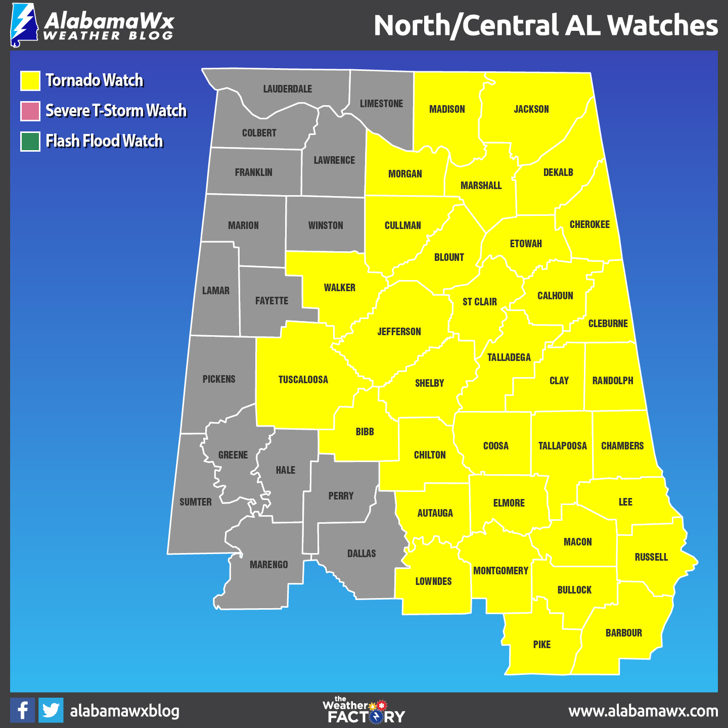
The National Weather Service Has Cancelled Tornado Watch 127 For The Following Areas In Alabama
Limestone, Marion, Winston, Fayette
Tornado Watch 127 Remains Valid Until 9 Pm Cdt This Evening For The Following Areas
Cullman, Madison, Morgan, Dekalb, Jackson, Marshall, Autauga, Bibb, Blount, Chilton, Coosa, Elmore, Jefferson, Lowndes, Montgomery, Shelby, St. Clair, Talladega, Walker, Calhoun, Chambers, Clay, Cleburne, Lee, Macon, Randolph, Russell, Tallapoosa, Cherokee, Etowah, Barbour, Bullock, Pike, Tuscaloosa
_____________________________________________________
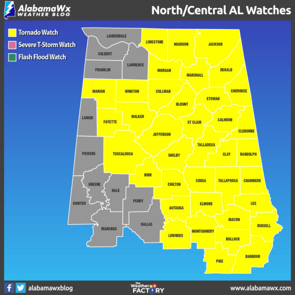
UPDATE 3:24 PM
The NWS Huntsville has canceled the tornado watch for Colbert, Franklin, Lauderdale and Lawrence Counties.
The Tornado Watch continues for Cullman, DeKalb, Jackson, Limestone, Madison, Marshall, Morgan [AL] till 9:00 PM CDT
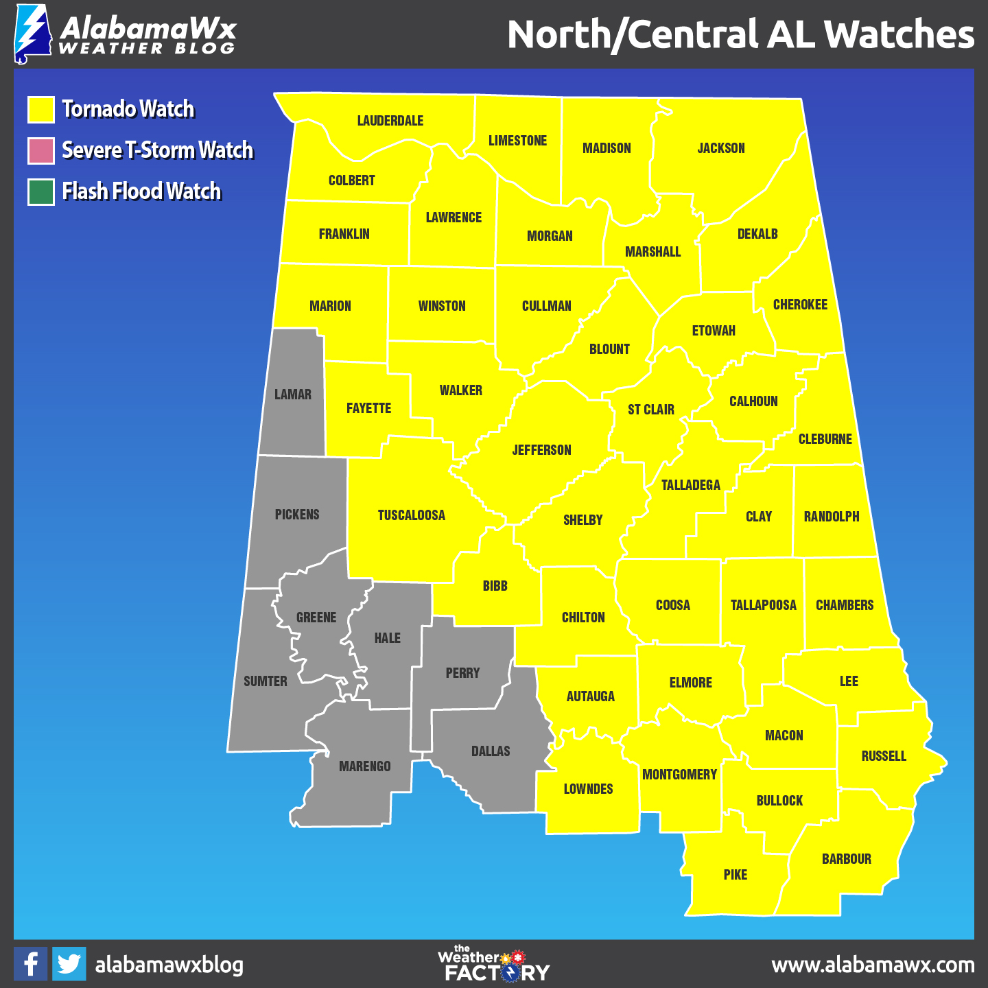
In Central Alabama: The tornado watch continues for Autauga, Barbour, Bibb, Blount, Bullock, Calhoun, Chambers, Cherokee, Chilton, Clay, Cleburne, Coosa, Elmore, Etowah, Fayette, Jefferson, Lee, Lowndes, Macon, Marion, Montgomery, Pike, Randolph, Russell, Shelby, St. Clair, Talladega, Tallapoosa, Tuscaloosa, Walker, and Winston Counties.
URGENT – IMMEDIATE BROADCAST REQUESTED
Tornado Watch Number 127
NWS Storm Prediction Center Norman OK
150 PM CDT Wed Apr 5 2017
The NWS Storm Prediction Center has issued a
* Tornado Watch for portions of
Central Alabama Counties: Autauga, Barbour, Bibb, Blount, Bullock, Calhoun, Chambers, Cherokee, Chilton, Clay, Cleburne, Coosa, Elmore, Etowah, Fayette, Jefferson, Lee, Lowndes, Macon, Marion, Montgomery, Pike, Randolph, Russell, Shelby, St. Clair, Talladega, Tallapoosa, Tuscaloosa, Walker, Winston Counties
North Alabama Counties: Colbert, Cullman, DeKalb, Franklin, Jackson, Lauderdale, Lawrence, Limestone, Madison, Marshall and Morgan Counties.
* Effective this Wednesday afternoon and evening from 150 PM until 900 PM CDT.
* Primary threats include…
A few tornadoes likely with a couple intense tornadoes possible
Widespread large hail likely with isolated very large hail
events to 2.5 inches in diameter possible
Widespread damaging wind gusts to 70 mph likely
SUMMARY…Thunderstorms will form along a cold front moving across
the watch area this afternoon, with some storms becoming supercells.
Tornadoes, large hail, and damaging winds will become a concern
through the afternoon and early evening.
The tornado watch area is approximately along and 75 statute miles
east and west of a line from 40 miles northeast of Louisville KY to
10 miles south southeast of Selma AL. For a complete depiction of
the watch see the associated watch outline update (WOUS64 KWNS
WOU7).
REMEMBER…A Tornado Watch means conditions are favorable for
tornadoes and severe thunderstorms in and close to the watch
area. Persons in these areas should be on the lookout for
threatening weather conditions and listen for later statements
and possible warnings.