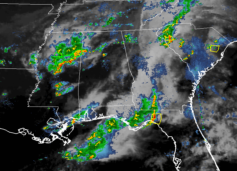
Rainfall at this point of your Friday evening has been scarce south of the I-20 corridor for much of the evening so far in Central Alabama, with most of the shower and storm activity affecting the northern locations of the area. We currently have some big storms that are moving into the western parts of the area, especially into Marion and Lamar counties. No convective warnings are in effect for any locations in Alabama or Mississippi that are associated with these storms, but copious amounts of rainfall have led to a few Flash Flood Warnings being issued in Mississippi.
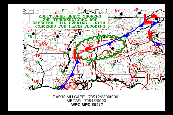
What can we expect as far as rainfall tonight… Slow-moving thunderstorms with heavy rainfall rates up to 2 inches per hour will cause some concerns for flash flooding through the evening hours. Numerous showers and thunderstorms are focusing near an almost stationary front over northern Mississippi and out ahead of the approaching center of low pressure exiting Arkansas and moving into Mississippi. Mid-level instability values, along with mid and upper level dynamical forcing associated with the low is rather well established and will continue to promote additional thunderstorms over the next several hours, as this energy will be interacting with the unstable and moist airmass along the front.
The concern is the slow movement of the cells given the relatively weak steering air current, encouraging heavy rainfall totals through the evening. The latest HRRR model guidance strongly supports convection becoming rather confined along the front east of the surface low. Storms focused over northern Mississippi will gradually shift east into northern Alabama late this evening. Rainfall totals of 2 to 4 inches, and isolated totals near 5 inches, can be expected through 1AM Saturday morning. This will result in concerns for flash flooding, particularly over urban areas. The main risk areas for flash flooding will be for roughly along and north of a line from Tuscaloosa to Calera to Wedowee.
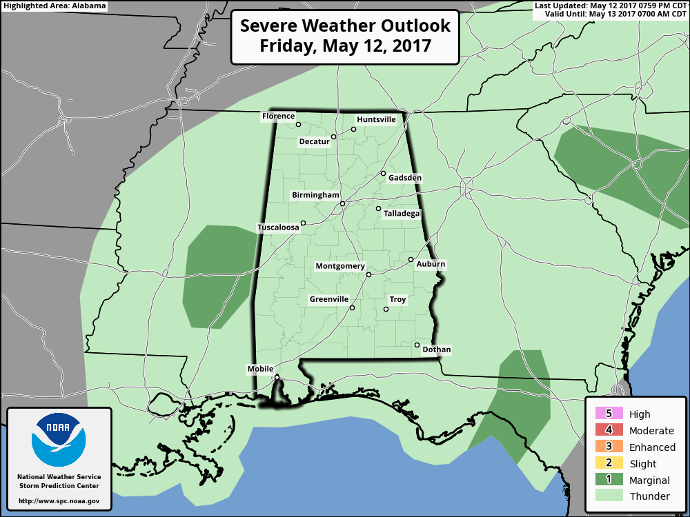
The risk for severe weather for the remainder of tonight has been removed from all of Central Alabama by the Storm Prediction Center. There may be a storm or two that could become strong, but the organized severe weather threat is over.