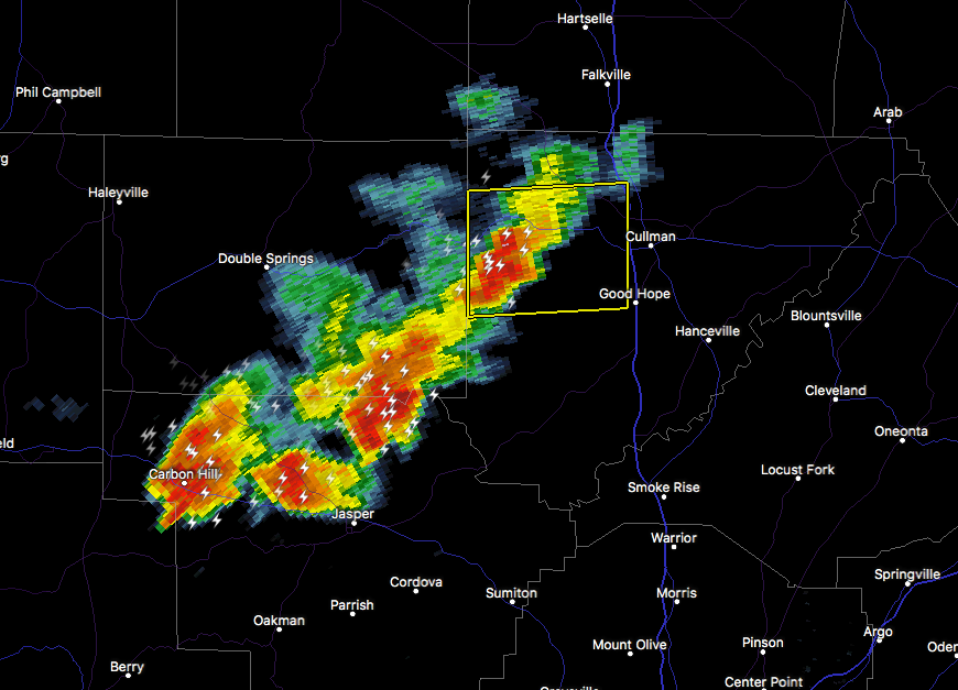
At 7:59 PM CDT, Doppler radar was tracking strong thunderstorms along a line extending from near Helicon to near Smith Dam to near Carbon
Hill. Movement was east at 25 mph. Pea size hail and winds in excess of 40 mph will be possible with these storms.
Locations impacted include…
Jasper, Sumiton, Cordova, Dora, Carbon Hill, Arley, Parrish, Oakman, Addison, Sipsey, Kansas, Nauvoo, Curry, Gorgas Steam Plant, Smith
Dam, Nesmith, Lake Shore, Poplar Springs, Helicon and Gorgas.
To report severe weather, contact your nearest law enforcement agency. They will relay your report to the National Weather Service office in Birmingham.