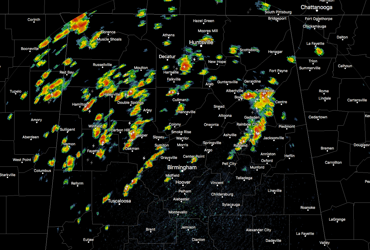
RADAR CHECK AT 11:40AM
Numerous showers and storms have fired up in the moisture-rich air across the northern-half of Central Alabama as we run up to the midday hour. Several of these storms have the potential of wind gusts of 40-50 MPH, along with torrential downpours and dangerous cloud-to-ground lightning. All of these are moving to the northeast somewhere between 10-15 MPH. We expect these to continue for a while across the area.
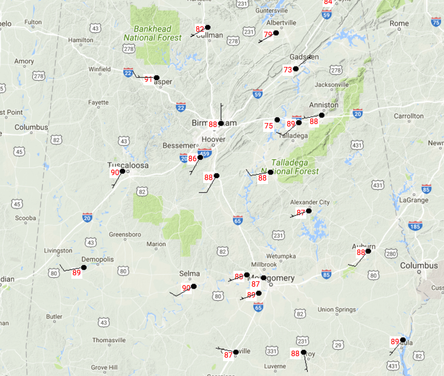
TEMPERATURES ACROSS CENTRAL ALABAMA AT 11:15AM
There is actually a big spread of temperatures at this time across the area, thanks to nearly complete sunshine in some parts, to rain cooled air in others. The warm spot is currently 90 degrees in sunshine, while the cool spot is Gadsden at 73 degrees in rain cooled air.
WEATHER FOR THE REMAINDER OF WEDNESDAY
Skies will be partly cloudy out there across Central Alabama, and it will be hot and muggy once again. There is a segment of slightly drier air to our southeast that will keep most, if not all locations, south of a line from Demopolis to Clanton to Wedowee rain free today. North of that, you can expect scattered to numerous showers and thunderstorms throughout the daylight hours.
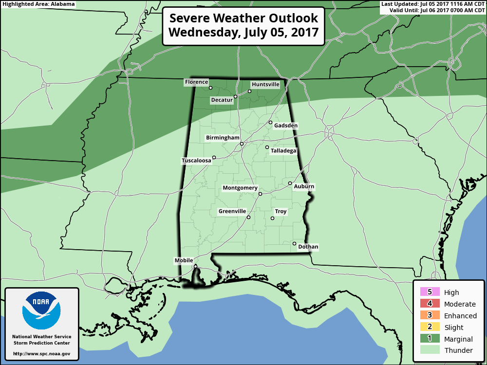
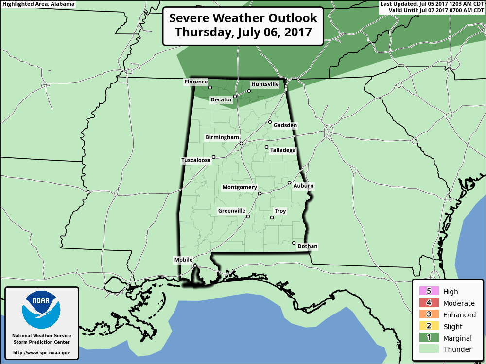
We do not that the SPC has the northern part of the state, including parts of Lamar, Marion, Winston, and Cherokee counties in Central Alabama, in a Marginal Risk for severe storms through the remainder of the day. As usual with summertie storms in Alabama, the main threat will be from damaging wind gusts.
The coverage will diminish somewhat for the evening and overnight hours, but showers and storms will still be possible mainly north of the 1-20/59 corridor west of I-65, and the I-20 corridor east of I-65. With the moisture-rich air over much of the area, the heat index values will be approaching or could cross over the 100 degree barrier. Afternoon highs will be in the lower to middle 90s across Central Alabama, with overnight lows in the lower to middle 70s.
WHAT ABOUT THURSDAY’S WEATHER
The pocket of drier air that is over the southeastern parts of Central Alabama will start to retreat to the east, and scattered shower and storm chances move their way southward. We can expect the shower and storm activity to fire up once again during the late morning hours and continue through the afternoon and early evening hours. SPC also has a Marginal Risk for severe storms for Thursday for the northern parts of the state, but as of now it doesn’t include any locations in Central Alabama. There will be a few showers and storms that will linger into the overnight hours, especially for the northern half of Central Alabama. Highs will be in the upper 80s to the lower 90s, with lows once again in the lower to middle 70s.
HEADING TO THE BEACH
For a detailed look at the weather from Fort Morgan over to Panama City Beach, click here to see the AlabamaWx Beach Forecast Center page. The Beach Forecast is partially underwritten by the support of Brett/Robinson Vacation Rentals in Gulf Shores and Orange Beach. Click here to see Brett/Robinson’s “Own Your Summer” specials now!
BUSINESS IS ABOUT TO PICK UP IN THE TROPICS
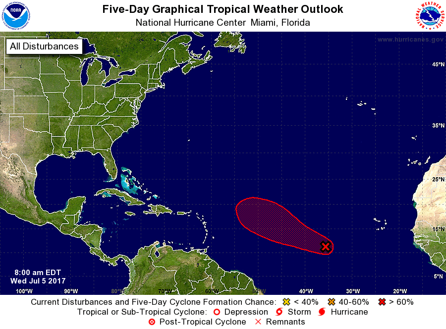
Today may be the day we have a new tropical depression or Tropical Storm Don form out in the eastern Atlantic Ocean. The center of circulation has become better organized, and will start to move to the west-northwest at 10-15 MPH later today. It is located about 800 miles west-southwest of the Cabo Verde Islands, and is forecast to move in the general direction of the US Mainland. We’ll see where it decides to go when it gets closer.
TODAY IN WEATHER HISTORY
July 5, 1916 – A hurricane produced 82 mph winds, an 11.6 foot tide, and a barometric pressure of 28.92 inches at Mobile, AL.
WEATHERBRAINS
Don’t forget you can listen to our weekly 90 minute netcast anytime on the web, or on iTunes. This is the show all about weather featuring many familiar voices, including our meteorologists here at ABC 33/40. you can watch it live here on Monday nights at 8:30PM CDT.