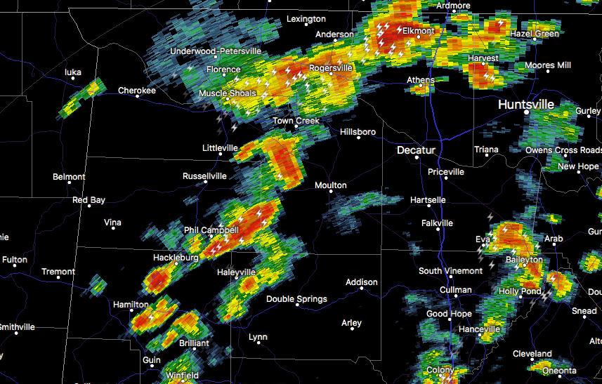
At 1:29 PM CDT, Doppler radar was tracking a strong thunderstorm 7
miles east of Phil Campbell, or 10 miles north of Haleyville, moving
northeast at 25 mph.
Winds in excess of 40 mph will be possible with this storm.
Locations impacted include…
Moulton, Phil Campbell, Mt Hope, Wren, Landersville, Hatton, Newburg,
Bankhead National Forest and Upper Bear Creek Reservoir.
PRECAUTIONARY/PREPAREDNESS ACTIONS…
Frequent cloud to ground lightning is occurring with this storm.
Lightning can strike several miles away from a thunderstorm. Seek a
safe shelter inside a building or vehicle.