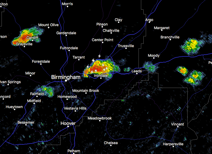
At 2:57 PM CDT, Doppler radar was tracking a strong thunderstorm over
Irondale, moving northeast at 15 mph.
Pea size hail and winds of 40 to 50 mph will be possible with this
storm.
Locations impacted include…
Birmingham, Mountain Brook, Trussville, Irondale, Pinson-Clay-chalkv,
Center Point, Clay, Pinson, Tarrant, Argo, Chalkville, Alton, Grayson
Valley, Birmingham Airport, Palmerdale, Village Springs, Birmingham
Race Course, Ruffner Mountain and Cloverdale.
PRECAUTIONARY/PREPAREDNESS ACTIONS…
Torrential rainfall is also occurring with this storm, and may lead
to localized flooding. Do not drive your vehicle through flooded
roadways.
Frequent cloud to ground lightning is occurring with this storm.
Lightning can strike 10 miles away from a thunderstorm. Seek a safe
shelter inside a building or vehicle.