


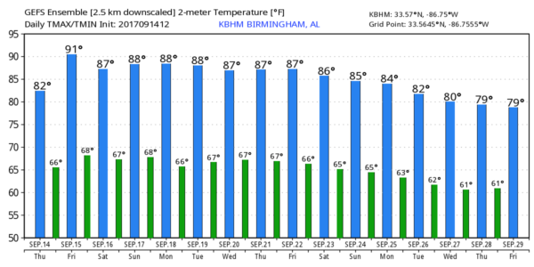
WARMING UP: As an upper ridge begins to build across the eastern half of the nation, afternoon temperatures will continue to trend upward across our state through the weekend. We are seeing mostly low 80s this afternoon; we expect mid 80s tomorrow, followed by highs between 86 and 89 over the weekend.
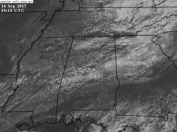
SCATTERED AFTERNOON SHOWERS: The risk of a shower for any one spot tomorrow is quite small, only about one in eight. Then, on Saturday, moisture will be a little deeper, and we will deal with scattered showers and thunderstorms during the afternoon and evening hours, generally between 12:00 noon and 8:00 p.m. The chance of any one place getting wet Saturday afternoon is about one in four. A shower is possible Sunday afternoon, but they should be few and far between.
FOOTBALL WEATHER: Looking good for high school games tomorrow night; a small risk of an evening shower, otherwise mostly fair with temperatures falling from the upper 70s at kickoff into the low 70s by the fourth quarter.
Auburn hosts Mercer Saturday afternoon (3:00p CT kickoff)… we project a mix of sun and clouds with the chance of a brief shower or thunderstorm during the game. Temperatures near 87 at kickoff, falling into the upper 70s by the final whistle.
UAB also has an afternoon game; they host Coastal Carolina (12:00 noon CT kickoff) at Birmingham’s Legion Field. Temperature near 83 at kickoff, rising to near 88 by the fourth quarter. Partly sunny, a brief shower or thunderstorm is possible.
And, Alabama hosts the Colorado State Rams at Bryant Denny Stadium Saturday evening (6:00p CT kickoff)… the chance of a brief shower or storm during the evening, otherwise mostly fair with temperatures falling from the mid 80s at kickoff into the 70s by the second half.
NEXT WEEK: The upper ridge holds, meaning warm days and not much rain; any afternoon showers should be widely spaced. Highs will be mostly in the upper 80s; a few spots could touch 90 degrees on a day or two. See the Weather Xtreme video for maps, graphics, and more details.
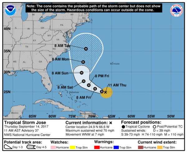
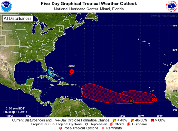
TROPICS: We have Tropical Storm Jose, and two waves in the eastern Atlantic on the board this afternoon. Jose now has sustained winds of 70 mph, and it expected to reach hurricane strength again over the weekend as it moves north between the U.S. East Coast and Bermuda. For now it looks like it will remain east of the U.S., although it might be close enough for wind and some rough surf around Cape Cod by the middle of next week.
Invest 97L in the far eastern Atlantic should gain latitude in coming days and seems to be no threat to land. Invest 96, to the west, seems to have a chance of nearing the Leeward Islands in five days or so, but it is way too early to know since this is just getting organized. Both of these waves have a good chance of becoming a tropical storm within the next three to five days.
BEACH FORECAST: Click here to see the AlabamaWx Beach Forecast Center page. The Beach Forecast is partially underwritten by the support of Brett/Robinson Vacation Rentals in Gulf Shores and Orange Beach. Click here to see Brett/Robinson’s Hot Deals now!
WEATHER BRAINS: Don’t forget you can listen to our weekly 90 minute netcast anytime on the web, or on iTunes. This is the show all about weather featuring many familiar voices, including our meteorologists here at ABC 33/40.
CONNECT: You can find me on all of the major social networks…
Facebook
Twitter
Google Plus
Instagram
Pinterest
Snapchat: spannwx
I enjoyed seeing the kindergarten students this morning at Taylorville Primary School in Tuscaloosa… be looking for them on the Pepsi KIDCAM today at 5:00 on ABC 33/40 News! The next Weather Xtreme video will be posted here by 7:00 a.m. tomorrow…



