


Radar Check At 11:10 AM
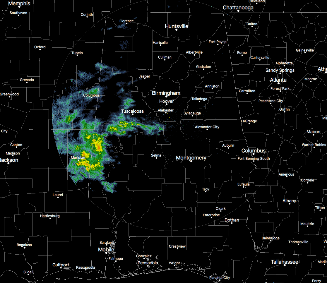
Much of Central Alabama is dry at this point on the first day of November, but over in the west and southwestern parts of the area, there are some decent showers out there. Livingston and Emelle in Sumter County are currently experiencing heavier rainfall than the rest that have rain at the moment. All of this shower activity is pushing to the east-northeast. Tuscaloosa will be seeing some rain by the time this is posted, and we could see some shower activity in the Birmingham Metropolitan Area within an hour.
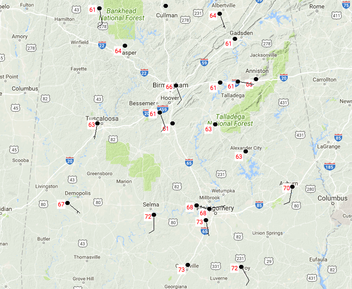
Temperatures are still rather mild across the area at this point. We are seeing lower 60s to the lower 70s at the moment, with Birmingham currently sitting at 66 degrees. With the cloudiness and showers pushing in from the west today, these temperatures probably will only climb a couple of degrees more and that’s it.
Weather For The Rest Of Your Wednesday
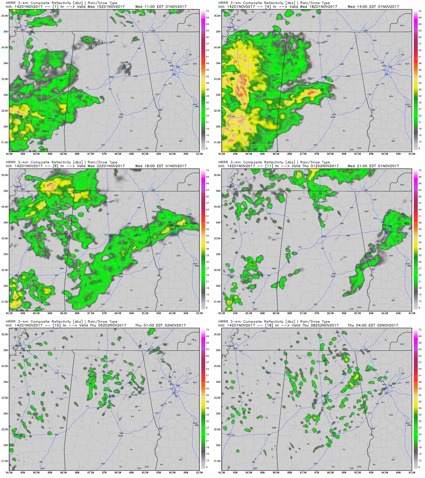
We’ll continue to have showers push in from the west throughout the afternoon and evening hours in Central Alabama, with the best coverage during the 2-5PM hours. Rainfall after that will diminish in coverage, but a few scattered showers will remain possible throughout the remainder of the night and into the overnight hours. Much of the area will see rain at some point today, but there is a great possibility that locations in the southeastern parts of the area remains dry. Afternoon highs will top out in the mid-60s to the mid-70s, and lows will be in the mid-50s to the lower 60s.
Moist Airmass Lingers On, Widely Scattered Showers On Thursday
We will continue to have a fairly moist airmass over Central Alabama for the next few days, but we’ll lack the forcing needed for any major shower development. Much of Central Alabama will have a small risk for scattered showers, but the southeastern corner of the area will probably remain dry once again. Afternoon highs will reach the mid to upper 70s. A few spots in the northwest corner of Central Alabama could have some embedded thunder, but severe weather is not expected at all on Thursday.
Gulf Coast Weather
Be sure to keep up to date with the detailed forecasts from Fort Morgan over to Panama City Beach with the AlabamaWx Weather Blog. Click here to see the AlabamaWx Beach Forecast Center page.
The Beach Forecast is partially underwritten by the support of Brett/Robinson Vacation Rentals in Gulf Shores and Orange Beach. Click here to see Brett/Robinson’s Off Season Deals now!
The Tropics
The disturbance that was out in the Atlantic has fizzled enough for the NHC to drop it from the Tropical Weather Outlook. At this point, all is quiet over the Atlantic Ocean, the Gulf of Mexico, and the Caribbean Sea.
Stay up-to-date with the latest updates on all of the tropical systems out in the Atlantic Ocean, Caribbean Sea, or in the Gulf of Mexico with the latest posts in our Tropical Weather category. Click here to see the latest.
On This Day In Weather History
1966 – Santa Ana winds fanned fires, and brought record November heat to parts of coastal California. November records included 86 degrees at San Francisco, 97 degrees at San Diego, and 101 degrees at the International airport in Los Angeles. Fires claimed the lives of at least sixteen firefighters.
WeatherBrains
Check out the show at www.WeatherBrains.com. You can also subscribe on iTunes. You can watch the show live at live.bigbrainsmedia.com on Monday nights starting at 8:30 PM CDT. You will be able to see the show on the James Spann 24×7 weather channel on cable or directly over the air on the dot 2 feed.



