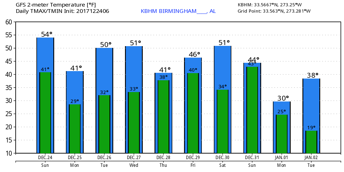
Christmas Eve is going to be cloudy for much of the Southeast US along with fairly chilly temperatures. Most of North and Central Alabama was in the lower and middle 40s this morning. Clouds will limited the heating today, but you can expect to see highs in the lower and middle 50s. With the clouds in place, you might see a spit or two of rain but the weather will be dry for most of us.
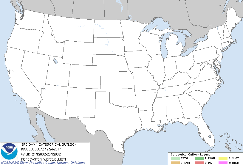
With cold air covering so much of the country for this Christmas, the SPC outlooks for Days 1 through 3 are completely devoid of any thunderstorm areas.
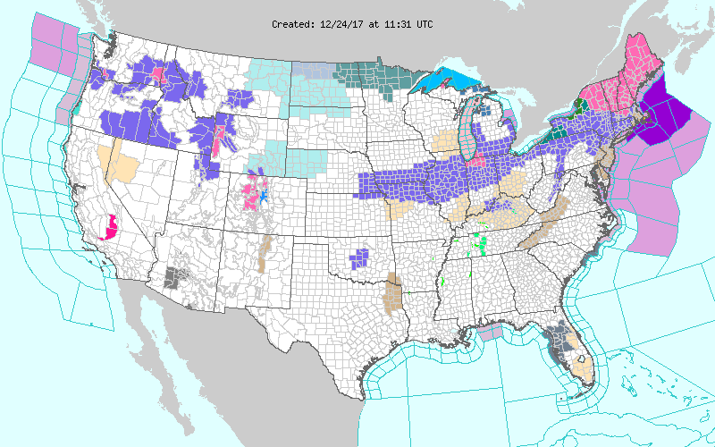
At 500 millibars, another short wave is visible in the broad trough which will bring a reinforcing shot of cold air to the eastern US. Moisture is very limited with this system, but snow is likely across the Ohio River Valley perhaps making it as far south as northern Middle Tennessee. Winter weather advisories were in effect from Southeast Nebraska all the way to New England where much of northern New England was in a winter storm warning.
That short wave will move quickly to New England on Christmas Day, leaving behind some chilly weather. This will be one of the coldest Christmases we’ve seen since about 2010. Morning lows will be in the 25 to 30 degree range while the afternoon highs will only be in the lower half of the 40s. Unfortunately Christmas Day will also be dry with some sunshine, but the cold may keep folks inside with any new presents.
Tuesday and Wednesday the overall broad trough across the eastern two-thirds of the country will remain in place. Lows will remain pretty chilly as highs climb back into the 50s, pretty close to the values expected for this time of year. But a trough over the Baja California area will bring moisture northward and eastward out of the Pacific potentially setting up an overrunning situation for the Southeast US. For the moment it looks like the colder air will remain north of Alabama, so we should not see any winter weather issues. There is some uncertainty with the overrunning as the ECMWF is much slower with the development of this feature and a little further south. Both bring rain into the picture on Thursday. Wednesday and Thursday highs should be in the lower 50s.
A short wave over Nebraska on Thursday should flush the rain and moisture out of much of the Southeast US on Friday as it moves quickly to the Southeast US coast. But it will also usher in some more cold air by Saturday and Sunday with lows in the lower and middle 30s and highs around 50. On Sunday the GFS is pretty bullish on the closed low over Baja California suggesting the development of another overrunning situation for Sunday. The ECMWF, on the other hand, doesn’t latch onto that feature and seems to keep it further south of the Gulf of Mexico. Since we’re verging on voodoo country, we’ll hold off on any serious rain forecast with confidence running pretty low.
Just as we saw in the extended model graphics yesterday, the GFS is very bullish on keeping the pattern very active. January 1st sees a strong short wave move across the East Coast with another weaker short wave over Texas as the closed low over Baja California ejects eastward. Just two days later, January 3rd, there is another strong short wave moving across Oklahoma and Texas. This looks like a wet pattern, however, the moisture seems to be lacking for any significant precipitation. Another trough digs into the Southeast US on January 5th followed by another nice short wave coming into the Lower Mississippi River Valley around the 7th. The screaming message coming from the extended graphics is the continuation of the broad trough over the eastern two-thirds of the country, so there does not appear to be any end to the relatively cold pattern.
Beach Forecast: Click here to see the AlabamaWx Beach Forecast Center page. The Beach Forecast is partially underwritten by the support of Brett/Robinson Vacation Rentals in Gulf Shores and Orange Beach. Click here to see Brett/Robinson’s Hot Deals now!
WeatherBrains: Don’t forget you can listen to our weekly 90 minute netcast anytime on the web, or on iTunes. This is the show all about weather featuring many familiar voices, including our meteorologists here at ABC 33/40.
Thanks for tuning into the Weather Xtreme Video. You can catch the latest forecast this evening at 5 and 10 pm on ABC 3340 as I will be filling in for Charles Daniel. I’m going to take a little liberty with the Christmas Day edition. I’m going to allow myself to sleep in, so the next Weather Xtreme Video should be posted here by 9 or 10 am. Merry Christmas Eve, stay warm, and Godspeed.
-Brian-