


Special Weather Statement
National Weather Service Birmingham AL
421 PM CST WED FEB 28 2018
ALZ015-017-282245-
Walker AL-Blount AL-
421 PM CST WED FEB 28 2018
…SIGNIFICANT WEATHER ADVISORY FOR NORTHEASTERN WALKER AND
SOUTHWESTERN BLOUNT COUNTIES UNTIL 445 PM CST…
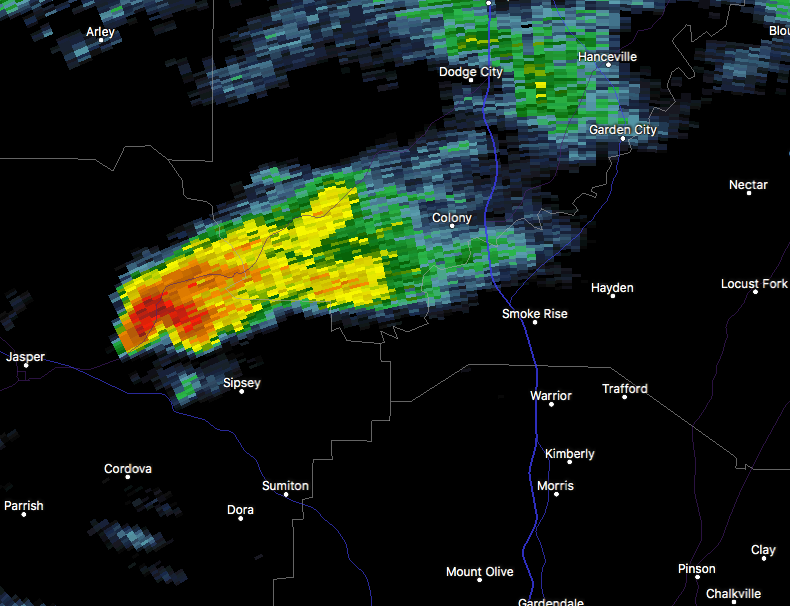
At 421 PM CST, Doppler radar was tracking a strong thunderstorm near
Sipsey, or 8 miles northeast of Cordova, moving east at 35 mph.
Winds in excess of 40 mph will be possible with this storm.
Locations impacted include…
Hayden, Sipsey, Bangor, Arkadelphia, Smith Dam, Lynns Park, Blount
Springs, Smith Lake, Powellville, Smoke Rise, Rickwood Caverns and
Boldo.
PRECAUTIONARY/PREPAREDNESS ACTIONS…
To report severe weather, contact your nearest law enforcement
agency. They will relay your report to the National Weather Service
office in Birmingham.



