


Conditions At 12:55 PM On Good Friday
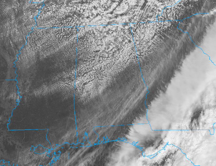
Conditions are continuing to slowly improve across Central Alabama as we reached the early afternoon hours. Skies are mostly cloudy at this point, but clouds will continue to decrease and we will have clear skies by tonight. Temperatures are currently in the mid-50s in the north to the mid-60s throughout the area, with the only spot in the 70s is Eufaula at 71 degrees. Birmingham is at 57 degrees.
Weather For The Rest Of Good Friday
Skies will continue to slowly clear somewhat throughout the remainder of the afternoon and early evening hours, becoming partly cloudy by sunset. Afternoon highs will be cooler, topping out in the lower 60s to the lower 70s from north to south. Skies will clear out and we will be able to enjoy a beautiful night time sky. Overnight lows will bottom out in the upper 30s to the mid 40s.
Storm Survey Team Heading Out To Autauga County Today
From NWS Birmingham: A line of showers and thunderstorms moved across Central Alabama on Thursday, March 29th. The more intense line of thunderstorms impacted the southern half of the area, producing wind gusts of 30 to 40 mph. The only damage reported to the NWS office at this time occurred in Autauga County, where a few trees were reported downed. A storm survey is being planned for Northeast Autauga County near the city of Marbury. Additional Public Information Statements will be issued periodically through the day, as survey teams report back their findings.
Weather For The Easter Weekend
A zonal flow along with high pressure will take over the weather pattern for Central Alabama throughout the weekend, leading to really nice days with cooler nights. Saturday will feature mostly sunny skies with mild temperatures. Highs will top out in the lower to mid-70s. Skies will be mostly clear for the late night and overnight hours, with lows dipping down into the mid to upper 40s. Easter Sunday will be even warmer with partly to mostly clear skies. There is a very small risk of a shower in the extreme northern parts of the area throughout the day, only equalling to a 10% rain chance. Afternoon highs will be in the lower 70s to the lower 80s from north to south.
Potential For Strong To Severe Storms Increasing For Late Tuesday
The next frontal system that will move through looks to have a small possibility of strong to severe storms. As of now, surface instability values are expected to increase into the lower 1000s J/kg just ahead of the front. The main threat at this point appears to be isolated damaging wind gusts, but with any system that moves through during spring severe weather season, we’ll have to watch this system carefully.
Beach Forecast Center
Don’t you wish you were there, already? Soaking up the rays and wiggling your toes in the sand? Get the latest weather and rip current forecasts for the beaches from Fort Morgan to Panama City on our Beach Forecast Center page. There, you can select the forecast of the region that you are interested in.
WeatherBrains
Don’t forget you can listen to our weekly 90 minute netcast anytime on the web at WeatherBrains.com or on iTunes. This is the show all about weather featuring many familiar voices, including the meteorologists at ABC 33/40.
E-Forecast
Get the AlabamaWx Weather Blog’s Seven-Day Forecast delivered directly to your inbox by email twice daily. It is the most detailed weather forecast available in Central Alabama. Subscribe here… It’s free!
Advertise With Us
Don’t miss out! We have enjoyed more than 6.1 MILLION page views on AlabamaWx.com since the start of 2018. We can customize a creative, flexible and affordable package that will suit your organization’s needs. Contact Bill Murray at (205) 687-0782.
On This Day In Weather History
1989 – Thunderstorms developing along and ahead of a slow moving cold front produced large hail and damaging winds at more than fifty locations across the southeast quarter of the nation, and spawned a tornado which injured eleven persons at Northhampton NC.



