


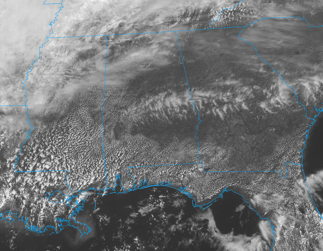
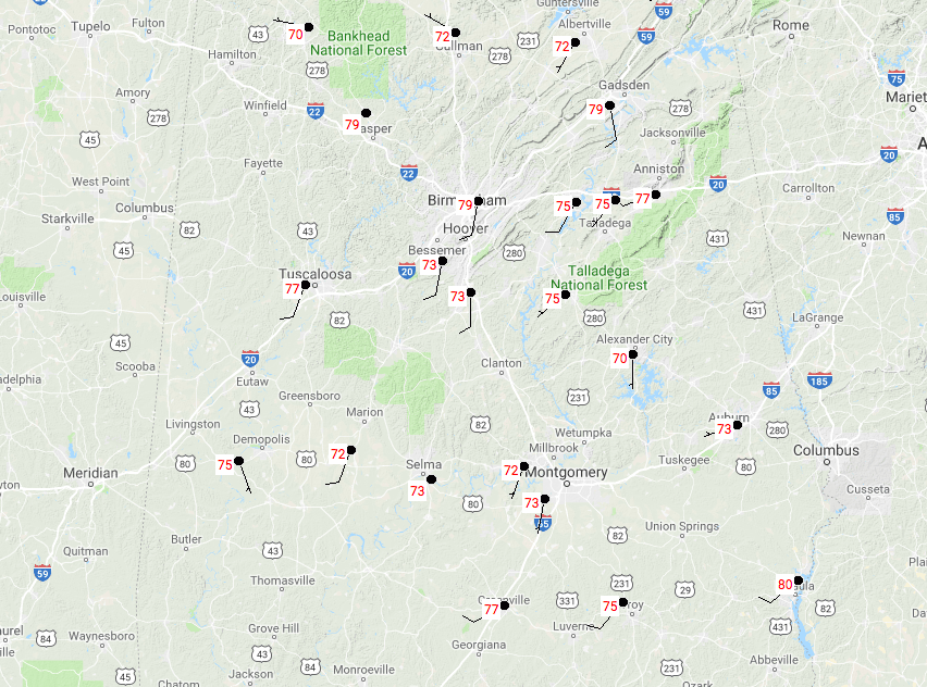
At 1:10 PM on this fine and dandy first Monday of April, we have mostly clear to partly cloudy skies throughout Central Alabama, and temperatures ranging from 70 degrees in Haleyville, to 80 degrees in Eufaula. Birmingham was sitting at 79 degrees. We will continue to have mostly clear to partly cloudy skies throughout the remainder of the daylight hours, and highs topping out in the upper 70s to the mid-80s throughout the area.
For tonight and throughout the overnight hours, we’ll have increasing clouds due to the approach of our next system that could potentially bring us a chance of strong to severe storms on Tuesday evening and into Wednesday morning. Lows will bottom out in the mid-50s to the lower 60s in Central Alabama. The NAM is trying to paint some scattered shower activity for the overnight hours and so does the HRRR, so we’ll go with a very slight risk of a scattered shower or two prior to sunrise on Tuesday.
During the day on Tuesday, most of us will remain dry throughout the morning and afternoon hours before the main action moves in during the late evening and progresses across the area through Wednesday morning. We may have a few isolated showers and storms to develop out ahead of the cold front, but it looks like this system will move through as a linear event. Afternoon highs will be in the mid-70s to the lower 80s.
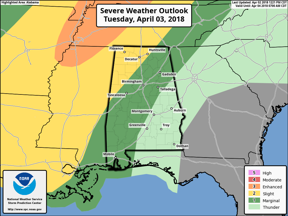
A Slight Risk for severe storms has been defined for Tuesday evening through Wednesday morning for much of the northwestern corner of Central Alabama, with much of the area east of a line from Cedar Bluff (Cleburne Co.) to Deatsville (Elmore Co.) to Hayneville (Lowndes Co.) in a Marginal Risk for severe storms.
Warm air and moisture will be advected into Central Alabama out ahead of a cold front that will be moving through the area during the late evening hours on Tuesday and through the pre-dawn hours on Wednesday, and this will lead to a threat of strong to severe storms during the 7:00 PM Tuesday through the 4:00 AM Wednesday time frame. Latest NAM3k model data shows a good bit of instability developing throughout the afternoon, up into the 1600-2100 J/kg range across much of the area, but winds in the mid-levels will be relatively weak, so updraft development may be restricted somewhat. Significant Tornado Parameter values are rather low with this system as well, 1.2 and below for much of the area. Helicity values in the lower levels will be just enough to support a small threat for tornadoes, but the main threat will come from damaging straight line thunderstorm wind gusts up to 60 MPH.
The main window for strong to severe storms occurring in the western-third of the area from 7:00 PM to 12:00 AM, the central parts from 9:00 PM to 2:00 AM, and the eastern-third of the area from 1:00 AM to 4:00 AM. Be sure to have your source of receiving severe weather alerts close-by, since this will mainly be a late night and pre-dawn event. Make sure you have fresh batteries in your NOAA Weather Radio and flashlights, and have your phones charged. We will keep you updated throughout the day on the blog tomorrow with the latest on the upcoming storm event.
BEACH FORECAST: Don’t you wish you were there, already? Soaking up the rays and wiggling your toes in the sand? Get the latest weather and rip current forecasts for the beaches from Fort Morgan to Panama City on our Beach Forecast Center page. There, you can select the forecast of the region that you are interested in.
WEATHERBRAINS: Don’t forget you can listen to our weekly 90 minute netcast anytime on the web at WeatherBrains.com or on iTunes. This is the show all about weather featuring many familiar voices, including the meteorologists at ABC 33/40.
E-FORECAST: Get the AlabamaWx Weather Blog’s Seven-Day Forecast delivered directly to your inbox by email twice daily. It is the most detailed weather forecast available in Central Alabama. Subscribe here… It’s free!
ADVERTISE WITH ALABAMAWX: Don’t miss out! We have enjoyed more than 6.1 MILLION page views on AlabamaWx.com since the start of 2018. We can customize a creative, flexible and affordable package that will suit your organization’s needs. Contact Bill Murray at (205) 687-0782.



