


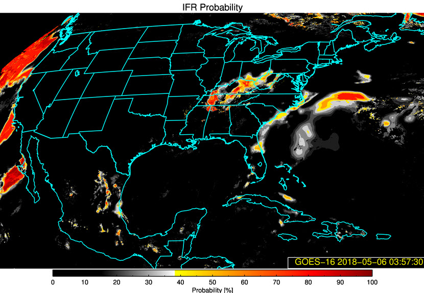
Source: GEOCAT (GEOStationary Cloud Algorithm Testbed)
One of the beautiful things about the new GOES-16 satellite is that algorithms can interpret the data to predict where low clouds and fog could reduce visibilities significantly and graphically display it.
With clearing skies in the wake of our cold front, excellent radiational cooling is allowing the temperature to lower to dewpoint of this still relatively moist air, producing fog and low stratus clouds.
The NWS in Memphis already has a dense fog advisory for parts of northern Mississippi and western Tennessee.
The NWS in Huntsville issued a special weather statement alerting North Alabama counties, as well as their counties in southern Tennessee, that fog could form overnight.
The GOES satellite is showing a high likelihood that IFR conditions (are already occurring from Northwest Alabama into northeastern Mississippi, western Tennessee and southwestern Kentucky. That is shown in the graphic on top of this post.
That is borne out at Muscle Shoals, where the visibility is down to 0.25 miles with an indefinite ceiling and vertical visibility of 200 feet. The sky is obscured by fog.
That means Muscle Shoals is in the Low Instrument Flight Rules category now, which is ceilings below 500 feet AGL and/or visibility less than one mile.
Fog and low clouds will also develop later tonight over parts of Central Alabama as well.



