


It is a warm one out there across Alabama on this May Sunday.
Events like the Regions Tradition are enjoying fine weather with partly cloudy skies at this time. The only showers in the state have formed over the higher ridges of Northeast Alabama. Those showers have grown into a thunderstorm east of Fort Payne. The activity is pushing to the southwest.
More showers and storms are over Southwest Georgia, closer to a trough and upper level low over the southeastern Gulf.
central Alabama will be on the outer periphery of the Gulf systems today, as well as a trough to the west, and it all may provide a higher concentration of scattered showers and storms in areas between I-59 and I-85 over East Central Alabama.
Scattered showers and storms are expected to form across the state this afternoon lasting until about an hour past sunset tonight. They have already started forming across South Central Alabama from Tallapoosa County down through Montgomery County into Crenshaw County.
The heavier storms could have gusty winds, heavy rain, and intense lightning.
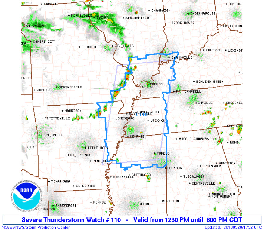
To the west and northwest, there is a threat of severe weather over parts of western Tennessee, northern Mississippi, northeast Arkansas, western Kentucky and southern Missouri and Illinois back into the Ohio Valley.
A severe thunderstorm watch has just been issued for this area until 8 p.m. tonight. The watch comes right up to the counties along the Alabama/Mississippi border.



