


As you can tell by the visible satellite image, the broad low located over the Yucatan Peninsula is starting to get its act together. The latest model runs are now coming into a little better agreement with the general location, but timing is still a little off.
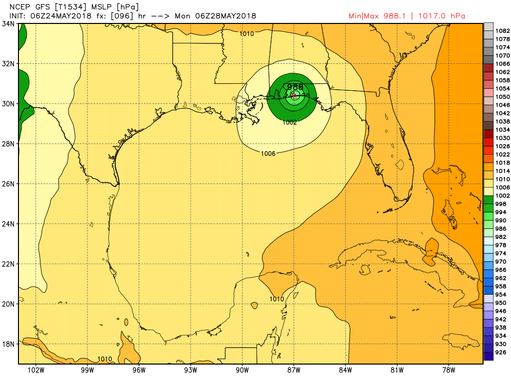
The GFS has the center of the potential depression moving onshore on the Gulf Coast somewhere between Pensacola and Destin Florida late on Sunday night, then moving up into South Alabama on Monday, then stalling out and eventually dissipating by midweek.
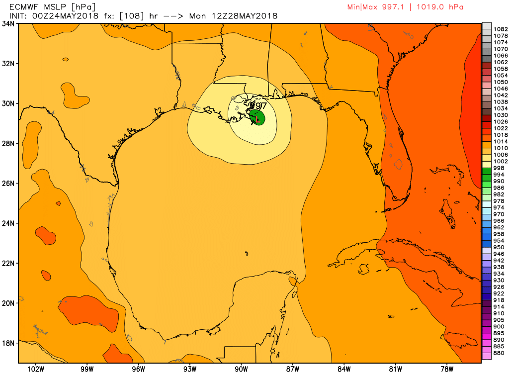
The European model has the center of the potential depression moving into the northern Gulf of Mexico a little slower and not making landfall until late Monday morning somewhere between Gulfport and Grand Isle. After that, it will slowly move northward into Southwestern Mississippi late on Tuesday and eventually dissipating by midday Thursday over North Alabama.
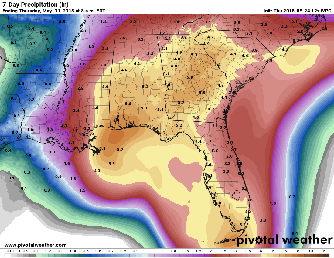
No matter which of those solutions turn out to be the correct solution, rain chances will be greatly enhanced starting late into the holiday weekend and persisting through the beginning of next week. Rainfall totals through Thursday morning (May 31st) ranging from 2.50″ to 6.50″ with localized higher totals possible.
If you will be at the Gulf Coast for the holiday weekend, the good news is that the low should not become a hurricane or a strong tropical storm. There is a small possibility that this could ramp up to a weak tropical storm, but the main issue from this system will be from rain and not wind. Dangerous rip currents will be likely… so if the flags on the beach are red, stay out of the water.
It will not be a complete washout at the beach, as Saturday will be the “drier” day as a few hours of sun is likely, but scattered storms are possible. Those risks for tropical showers and storms will increase for Sunday and Monday, but there will be breaks in the rain and the sun could break through at times.
Depending on the exact location of landfall and the strength of the system, there could be a very low end tornado threat for those locations that will be in the northeastern quadrant… but the main threat with this system will be from heavy rains and possible flooding.
For those who are staying at home in Central Alabama for the holiday weekend, Saturday will be pretty similar to what we have seen throughout the week so far… really warm and humid with scattered showers and thunderstorms mainly during the afternoon and evening hours. Sunday and Monday will not be complete washouts either but the coverage in showers and storms will increase. The sun could break through the clouds at times, but skies will generally be cloudy. When it does rain, it could become heavy at times especially on Monday.
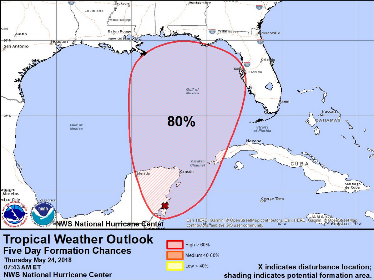
Here is the latest Tropical Weather Outlook from the National Hurricane Center…
Special Tropical Weather Outlook
NWS National Hurricane Center Miami FL
740 AM EDT Thu May 24 2018
For the North Atlantic…Caribbean Sea and the Gulf of Mexico:
A broad, stationary surface low pressure system centered over the southeastern Yucatan Peninsula is gradually becoming better defined. Although showers and thunderstorms, along with strong gusty winds, are confined primarily to the adjacent waters of the northwestern Caribbean Sea, gradual development of this system is expected during the next couple of days as it drifts northward near the Yucatan Peninsula. Environmental conditions are forecast to become more conducive for development through early next week, and a subtropical or tropical depression is likely to form by late Saturday over the southeastern Gulf of Mexico. Regardless of development, locally heavy rainfall is forecast across western Cuba and over much of Florida and the northern Gulf Coast into early next week. In addition, the threat of rip currents will steadily increase along the Gulf coast from Florida westward to Louisiana over Memorial Day weekend.
* Formation chance through 48 hours…medium…40 percent.
* Formation chance through 5 days…high…80 percent.



