


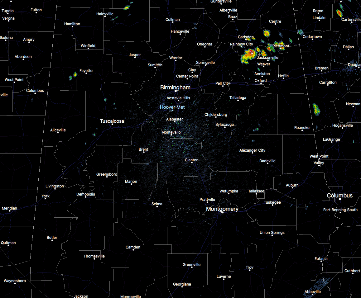
At 1:45 PM, the radar for Central Alabama is actually pretty quiet, with the only thunderstorm activity showing up in the northeastern parts of the area in portions of Etowah, Cherokee, St. Clair, and Calhoun counties. Nearly all of the rest of Central Alabama is dry at this point, with only a few isolated showers dotting the radar in the northwestern parts.
Temperatures are currently ranging from the lower to the mid-80s area wide, with the warm spot currently showing as Tuscaloosa and Selma, both at 86 degrees. Birmingham was at 84 degrees.
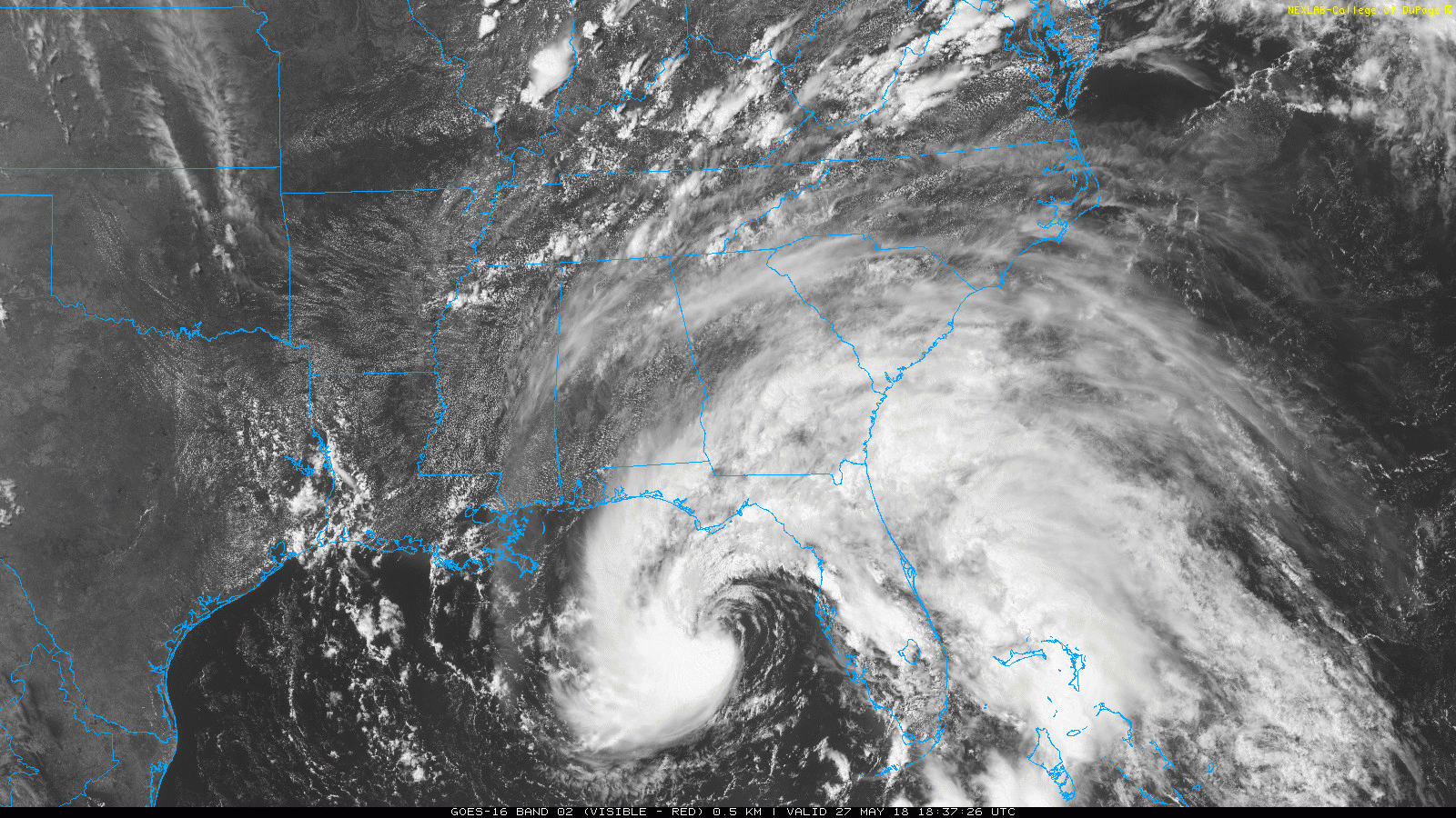
Much of the state has partly to mostly cloudy skies as clouds are starting to move in from Alberto. As you can see with the latest visible satellite view, there is now a clearly defined center of circulation and convection is now wrapping around more like a traditional tropical storm. Here is the latest info on Subtropical Storm Alberto as of 1:00 PM CDT…
SUMMARY OF 200 PM EDT…1800 UTC…INFORMATION
———————————————-
LOCATION…27.7N 84.7W
ABOUT 135 MI…220 KM W OF TAMPA FLORIDA
ABOUT 140 MI…225 KM S OF APALACHICOLA FLORIDA
MAXIMUM SUSTAINED WINDS…50 MPH…85 KM/H
PRESENT MOVEMENT…N OR 360 DEGREES AT 13 MPH…20 KM/H
MINIMUM CENTRAL PRESSURE…994 MB…29.36 INCHES
Some additional strengthening is forecast before the system reaches the northern Gulf Coast. Steady weakening is expected after landfall, and Alberto is forecast to become a tropical depression by Monday night or Tuesday.
A Tropical Storm Warning is in effect for Baldwin, Coffee, Covington, Crenshaw, Dale, Escambia, Geneva, Henry, Houston, and Mobile counties.
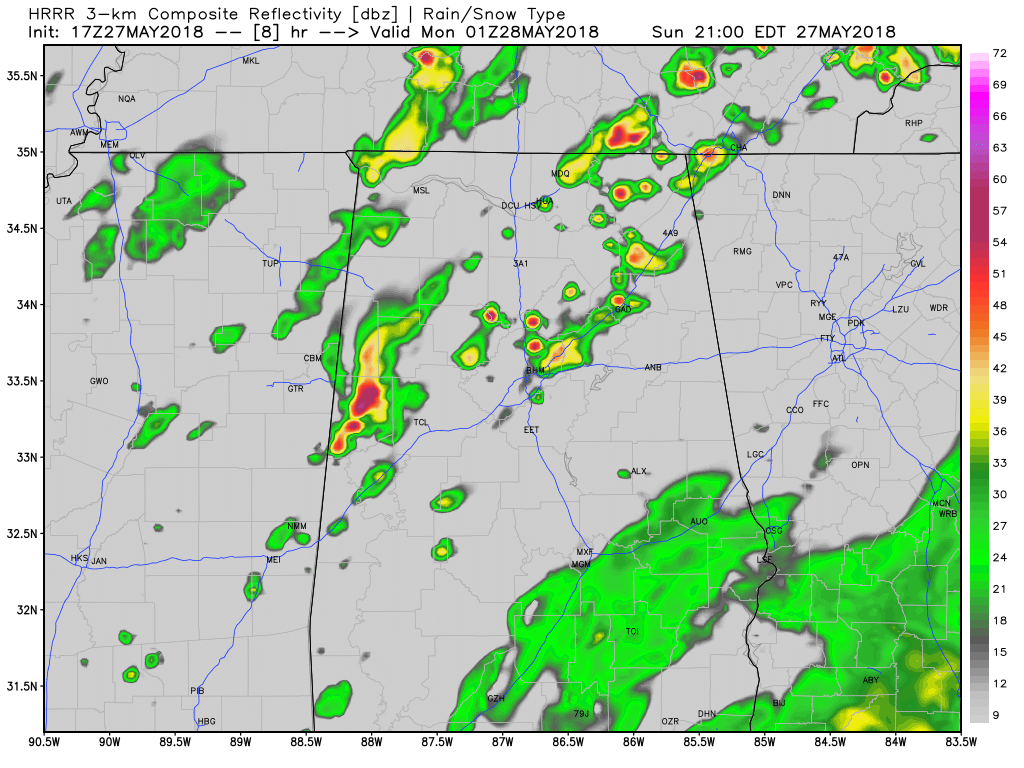
HRRR Simulated Radar at 8PM tonight
The first bands from Alberto will start to move up into the southeastern parts of the area later this evening and move north-northwestward throughout the night and overnight. Winds will start to pick up a little in these bands but will drop back off after the bands pass through. The storms to the north is what the model is showing for the scattered storms that may pop up during the afternoon and early evening hours that are not related to Alberto. Afternoon highs will top out in the mid to upper 80s.



