


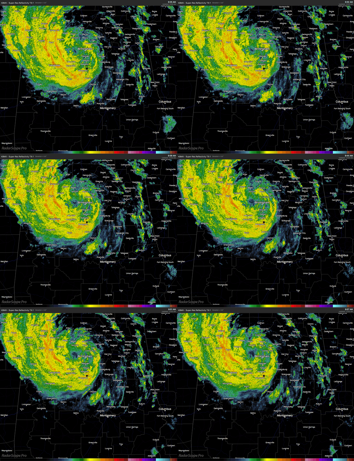
Nearly all of the heavy tropical rain associated with Subtropical Depression Alberto is now west of I-65 with the heaviest falling in a band stretching from Haleyville to Carbon Hill to Fayette to Tuscaloosa to Montevallo. Radar estimates over the last hour shows the heaviest totals just west of Northport and Tuscaloosa at 1.50″, with plenty of 0.50″ to 1.00″ 1-hour totals in that heavy band.
The center of circulation is just west of Birmingham just south of West Jefferson. Movement continues to be just a little west of due north at 12 MPH. Maximum sustained winds are estimated at 30 MPH.

If the current trend continues from what we’ve seen on radar the past few hours, the main flooding threat will be over the west and northwestern locations of Central Alabama until the bottom side of the rain shield passes by. The latest HRRR model run picks up on that idea keeping the heavier rainfall on the western side of the state as Alberto makes his exit. A few scattered showers and thunderstorms will be possible after the main rain shield moves into Tennessee due to the left over tropical moisture, but these will be like your typical summertime storms.
Tornado threat looks to be very minimal at this point as well due to the lack of activity on the eastern side of Alberto. The very small threat for any brief spin-ups will be for locations in the extreme eastern parts of the area that are east and northeast of the center of circulation.
With the excessive rainfall from Alberto, the ground has become saturated and it hasn’t taken much wind to down a few trees throughout the area. We had reports in from Pelham, Columbiana, Mountain Brook, Center Point, and Vandiver of trees that have fallen onto roadways. Only had one report of power outage in Pelham as fallen trees knocked down some power lines. Only one report of damage to a house in Wilsonville from a fallen tree.
A Flash Flood Watch continues until 7:00 PM this evening for Autauga, Barbour, Bibb, Blount, Bullock, Calhoun, Chambers, Cherokee, Chilton, Clay, Cleburne, Coosa, Dallas, Elmore, Etowah, Fayette, Jefferson, Lee, Lowndes, Macon, Marion, Montgomery, Perry, Pike, Randolph, Russell, Shelby, St. Clair, Talladega, Tallapoosa, Tuscaloosa, Walker, and Winston counties.
A Wind Advisory continues until 2:00 PM this afternoon for Autauga, Barbour, Blount, Bullock, Calhoun, Chambers, Cherokee, Chilton, Clay, Cleburne, Coosa, Dallas, Elmore, Etowah, Jefferson, Lee, Lowndes, Macon, Montgomery, Pike, Randolph, Russell, Shelby, St. Clair, Talladega, and Tallapoosa counties.
We’ll continue to have updates throughout the day.



