


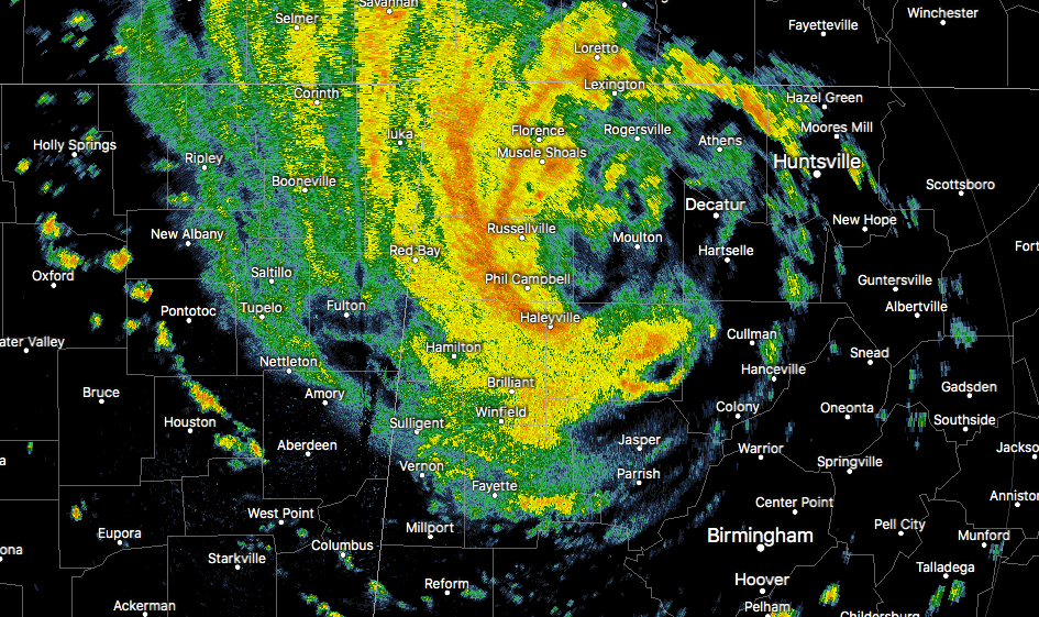
Radar check at 2:30 shows the center of Subtropical Depression Alberto located just to the south of Town Creek in Lawrence County in the northwest corner of the state, with the heaviest rain band set up over Muscle Shoals to Hackleburg to Lynn to Arley. There is still a flash flood threat as these heavy tropical downpours continue over the same general locations for a good bit of time, as estimated radar rates at this time are approaching 1.50″ per hour.
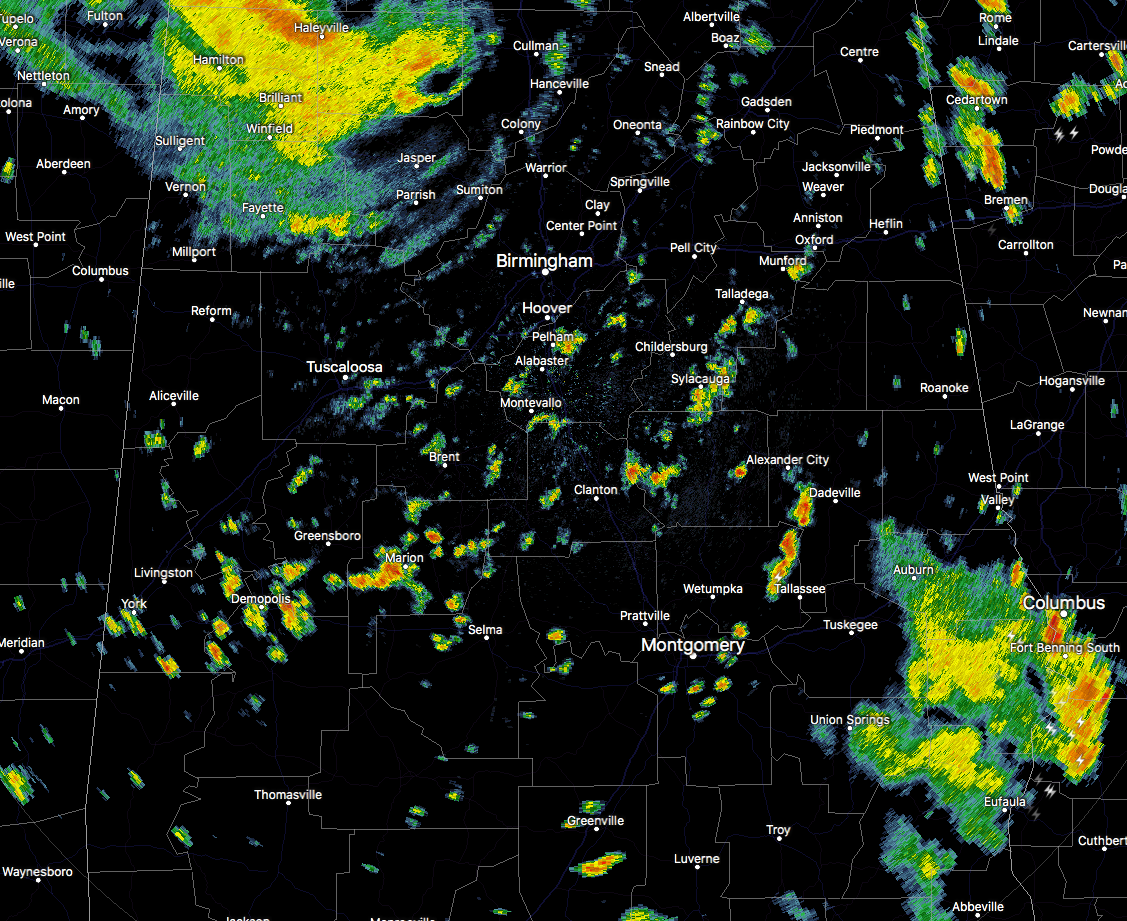
Back to the south and east of the main center of Alberto, scattered showers and thunderstorms have developed over the much of the rest of Central Alabama with the daytime heating and available tropical moisture, and have started to rotate around in the cyclonic flow. More of these should continue to develop throughout the afternoon as the atmosphere is allowed to warm even more as the rain-cooled air is being replaced with an unstable and warmer air.
There is still a very, very small potential for a brief, isolated spin-up tornado in the northeastern parts of the state, but as the center continues to push off to the north, that threat will continue to lessen for locations southeast of the center of Alberto. There was a Mesoscale Discussion that came out earlier from the SPC, but they were only giving a 5% chance of a Tornado Watch being issued for parts of northwest Georgia and Tennessee.
A Flash Flood Watch continues until 7:00 PM for Autauga, Barbour, Bibb, Blount, Bullock, Calhoun, Chambers, Cherokee, Chilton, Clay, Cleburne, Coosa, Dallas, Elmore, Etowah, Fayette, Jefferson, Lee, Lowndes, Macon, Marion, Montgomery, Perry, Pike, Randolph, Russell, Shelby, St. Clair, Talladega, Tallapoosa, Tuscaloosa, Walker, and Winston counties.
As of just one hour ago, Alabama Power was reporting nearly 30,000 customers without power as many trees and power lines have been downed by the gusty gradient winds and saturated ground. We are still getting reports in of trees falling in the northwest corner of the state, just too many to list at this point.
The good news is that we should be seeing the center of Alberto pushing out of the state and into Tennessee within the next 2-3 hours. The bad news is that there is still plenty of moisture left behind that scattered to numerous showers and thunderstorms are possible back to the south and southeast of the center.
We’ll continue to keep you posted throughout the afternoon.



