


Showers and thunderstorms continue to move cyclonicly through portions of Central Alabama this evening as they are caught up in the backside of the pattern of Subtropical Depression Alberto. Some of these continue to put down copious amounts of rain along with some gusty winds and dangerous cloud-to-ground lightning. A few of these could become strong throughout the evening and a Significant Weather Advisory may need to be issued for the threat of strong winds up to 40 MPH.
The southern portion of the main rain band associated with Alberto is continuing to exit the state to the north, but another round of tropical downpours is about to rotate into such places as Red Bay, Russellville, Tuscumbia, and Phil Campbell. An Areal Flood Warning is in effect for parts Of Colbert, Franklin, Lauderdale, and Lawrence counties until 10:30 PM for current rain and for what us about to wrap-around into the area.
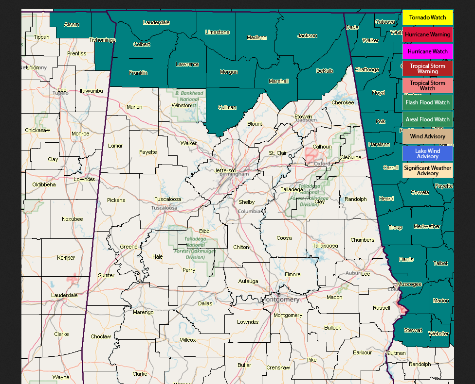
NWS Birmingham has allowed the Flash Flood Watch to expire at 7:00 PM for Central Alabama.
NWS Huntsville continues the Flash Flood Watch for all of North Alabama until 7:00 AM Wednesday (Colbert, Cullman, DeKalb, Franklin, Jackson, Lauderdale, Lawrence, Limestone, Madison, Marshall, and Morgan counties).



