


The center of Subtropical Depression Alberto continues to move northward through western Kentucky early this morning, but its effects are still being felt in Alabama.
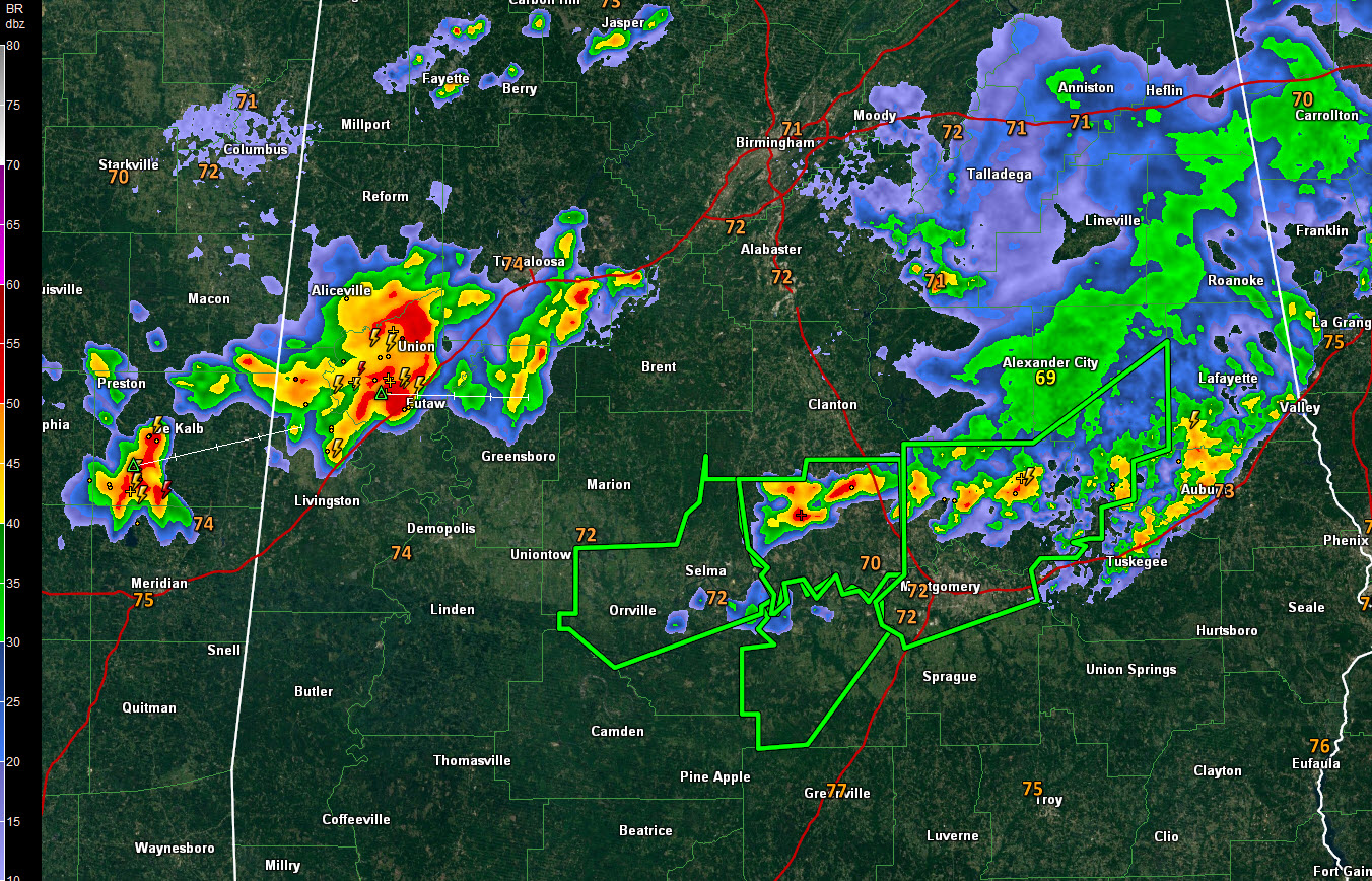
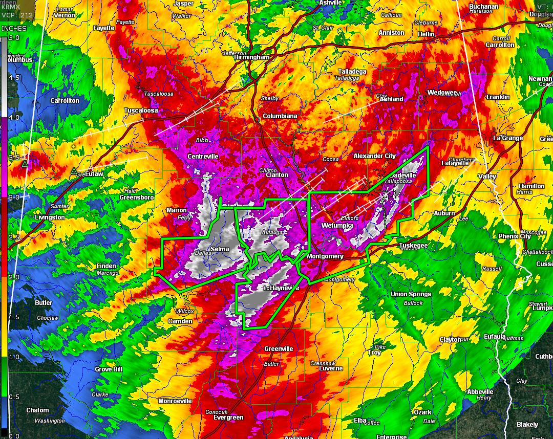
An overnight round of very heavy thunderstorms has left a string a flash flood warnings from Dallas County to Tallapoosa County including the Montgomery and Selma areas. Up to three inches of rain has fallen overnight across South Central Alabama.
Storm total rainfall across Dallas, Autauga, Lowndes, Elmore and Tallapoosa Counties is over 4.5 inches.
Now additional storms have formed near the Alabama/Mississippi border early this morning. They are moving across parts of Pickens and Sumter and cover most of Greene County. These storms will be impacting the I-59 Corridor, moving across Tuscaloosa County between now and 5 a.m. They will then affect much of Jefferson County between 5 and 7 a.m.
Other storms have formed across Kemper and Lauderdale Counties in Mississippi. These will also move across the same areas as the current storms in West Alabama, potentially producing training effects and really adding up the rainfall totals, much like the earlier storms and causing flooding. Areal flood advisories are already posted for parts of Pickens, Greene, and Sumter Counties.
The rainfall will be intense will rainfall rates approaching 2 inches per hour in spots.
They have lots and lots of lightning, so be alert to that. And winds will gust to 40-50 mph as well.
Be inside as these storms approach.



