


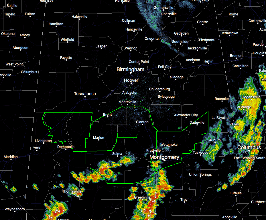
Conditions Just Before 12:30 PM In Central Alabama
The good news is that the heavy thunderstorms that dumped copious amounts of rain over the southern counties of Central Alabama are diminishing somewhat in size and are moving south and southeastward out of those locations. Flash Flood Warnings continue in effect for multiple locations across the southern portions of the area. There are plenty of reports of water covering the roadways in parts of Dallas, Chilton, Hale, Perry, Tuscaloosa, Elmore, Bibb, and Greene counties. For the rest of the area, other than some light rain over the extreme northern parts of the area, everyone else is dry with partly to mostly cloudy skies.
A Flash Flood Watch is in effect until 7:00 PM this evening for Autauga, Bibb, Blount, Calhoun, Chambers, Cherokee, Chilton, Clay, Cleburne, Coosa, Elmore, Etowah, Greene, Hale, Jefferson, Lee, Perry, Randolph, Shelby, St. Clair, Talladega, Tallapoosa, and Tuscaloosa counties.
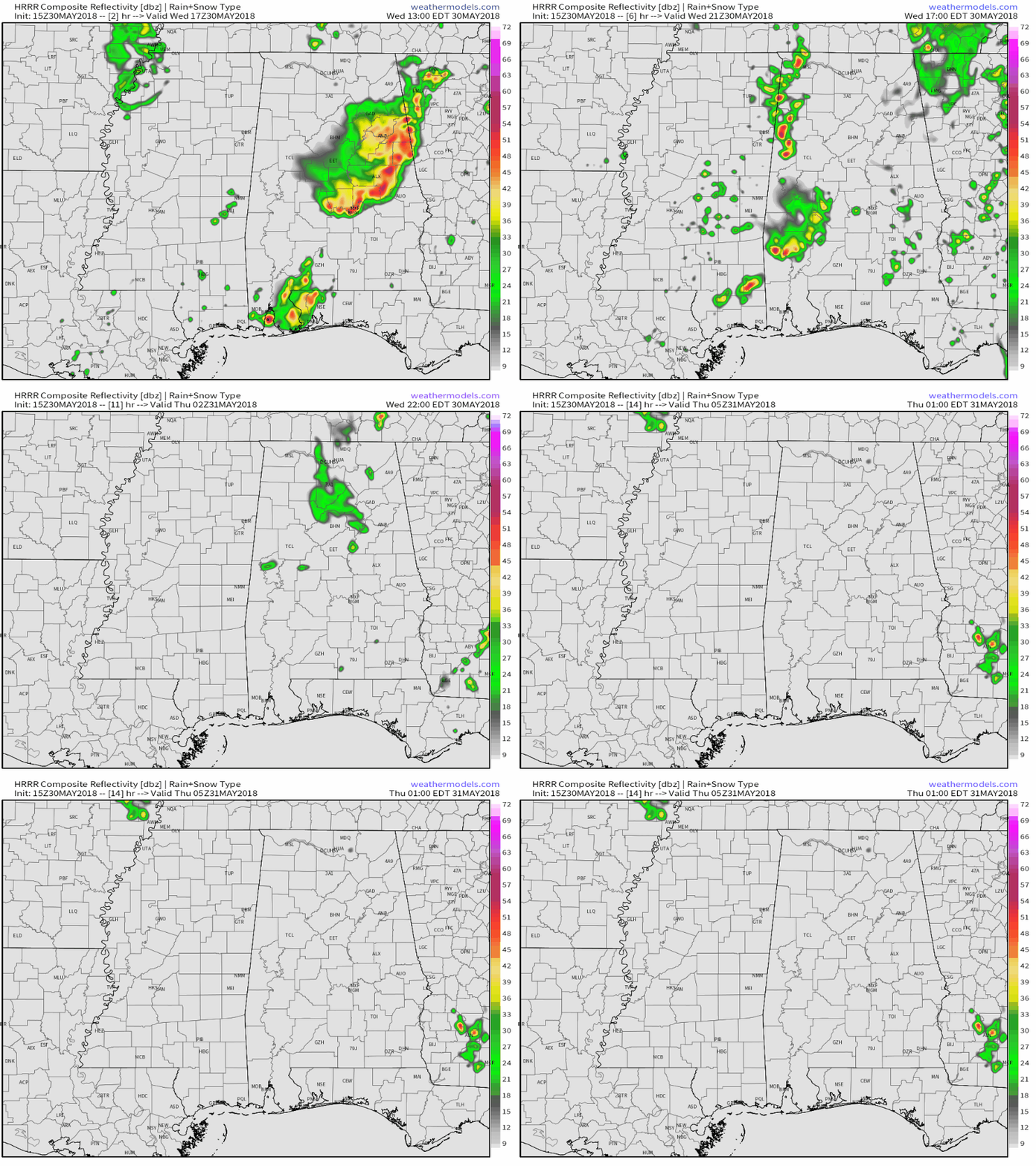
Weather For The Rest Of Your Wednesday
Showers and storms in the area currently will continue to push out of the area throughout the next several hours while the rest of the area will get a decent chance to dry out for a bit. The latest HRRR is showing another group of showers and thunderstorms moving through the western parts of the area starting around 2-4 PM but eventually dying out as they make it to the I-65 corridor before midnight. At this point, these showers and storms have not developed but the day is not over. Afternoon highs will top out into the mid-to-upper 80s, but locations that received heavy rainfall throughout the morning may not make up that high. A few scattered showers may be left over into the late night into the overnight hours, with lows dropping into the upper 60s to the lower 70s.
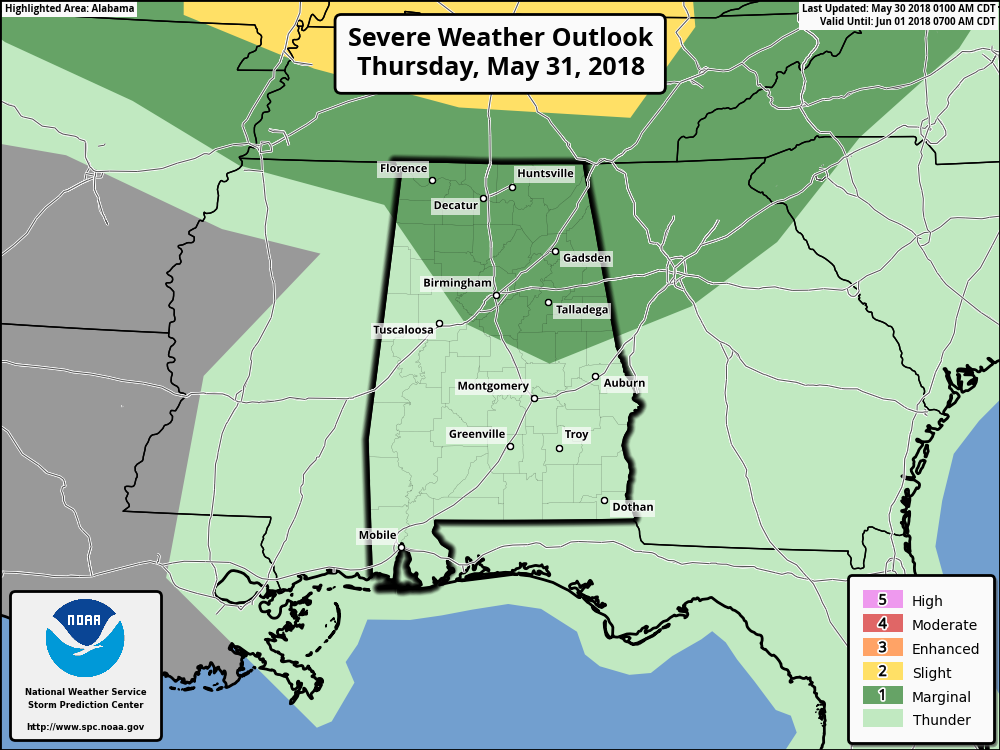
Some Strong To Possible Severe Storms On Thursday
Much of Central Alabama should be dry throughout the day tomorrow, but we may have a MCS that will move through the northeastern quarter of the state during the late afternoon through the evening hours. There is a Marginal Risk for severe storms for much of the northern half of the state, including Birmingham, Gadsden, and Anniston. The main threat will be from strong thunderstorm wind gusts. We’ll go with a slight chance of isolated to scattered pulse-type thunderstorms during the afternoon, with strong thunderstorms possible late in the afternoon through the evening hours. Afternoon highs will be in the mid-80s to the lower 90s. The best chances for storms will be in the northeastern quarter of Central Alabama, but all of the area will have a chance. Overnight lows will be in the lower 70s.
On This Day In Weather History
1879 – A major outbreak of severe weather occurred in Kansas and western Missouri. In Kansas, tornadoes killed eighteen persons at Delphos, and thirty persons at Irving. Two tornadoes struck the town of Irving within a few minutes time virtually wiping the small Kansas community off the map. The second tornado was perhaps two miles wide, and exhibited multiple vortices.
Beach Forecast Center
Don’t you wish you were there, already? Soaking up the rays and wiggling your toes in the sand? Get the latest weather and rip current forecasts for the beaches from Fort Morgan to Panama City on our Beach Forecast Center page. There, you can select the forecast of the region that you are interested in.
WeatherBrains
Don’t forget you can listen to our weekly 90 minute netcast anytime on the web at WeatherBrains.com or on iTunes. This is the show all about weather featuring many familiar voices, including the meteorologists at ABC 33/40.
E-Forecast
Get the AlabamaWx Weather Blog’s Seven-Day Forecast delivered directly to your inbox by email twice daily. It is the most detailed weather forecast available in Central Alabama. Subscribe here… It’s free!
Advertise With Us
Don’t miss out! We have enjoyed over 10.1 MILLION page views on AlabamaWx.com since the start of 2018. We can customize a creative, flexible and affordable package that will suit your organization’s needs. Contact Bill Murray at (205) 687-0782.



