


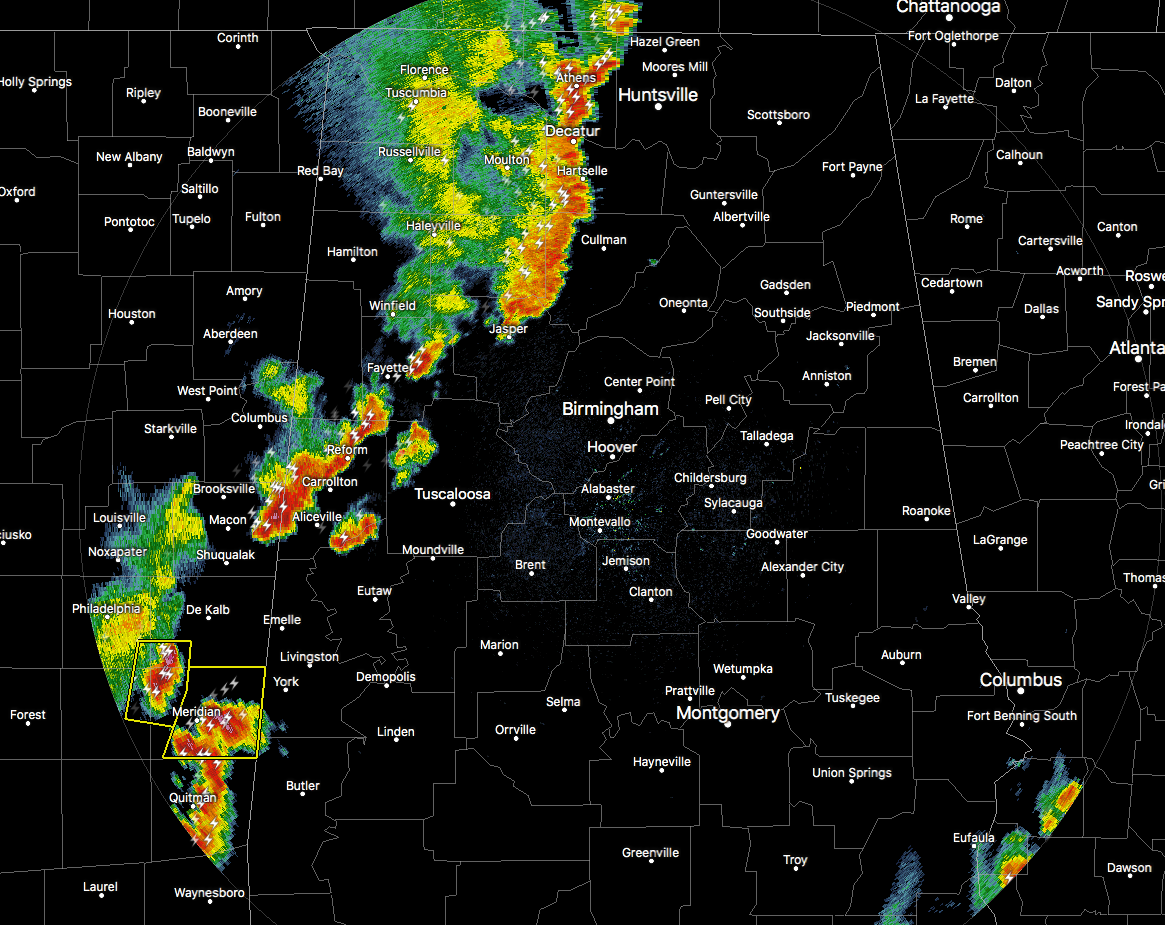
RADAR CHECK AT 6:25 PM: Storms have weakened some over the past couple of hours but are still putting down plenty of rain, gusty winds, some small hail, and very dangerous cloud-to-ground lightning. The broken line of thunderstorms stretch from the AL/TN state line at Ardmore (Limestone Co.) down to Falkville (Morgan Co.) to Jasper (Walker Co.), then the line breaks up a bit into scattered storms stretching from Fayette (Fayette Co.) to Memphis (Pickens Co.).
There are still a couple of storms back in Mississippi that currently have severe thunderstorm warnings on them, that will be moving into the western parts of Sumter county within the hour. We’ll have to watch to see if these maintain their strength as they cross the border.
We’ll continue to keep you posted throughout the evening until the strong to severe storm threat passes.

This is such a cool animation from GOES-16 showing the birth of these storms and watching the bubbling tops as they progress eastward into the state. I can watch stuff like this all day.



