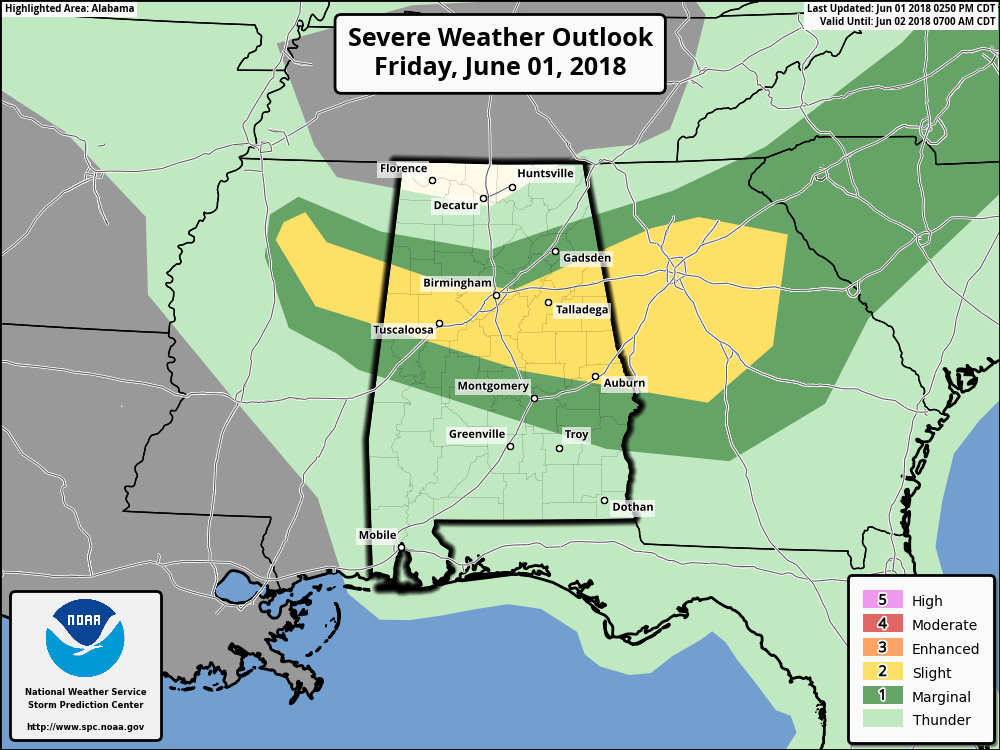
The Storm Prediction Center has removed the Enhanced Risk for severe storms for the remainder of today and tonight, and reduced the Slight Risk area as well.
The Slight Risk area now encompasses locations south of a line from just south of Sulligent (Lamar Co.) to just north of Berry (Fayette Co.) to just north of Leeds (Jefferson Co.) to Piedmont (Etowah Co.). That area goes to a line that stretches from Memphis (Pickens Co.) to Maplesville (Chilton Co.) to Ladonia (Russell Co.). A Marginal Risk surrounds the slight risk area.
The main threat will be from damaging thunderstorm wind gusts up to 60 MPH, with a smaller threat of hail up to 1″ in diameter (quarter size). Timing for strong to severe storms will be from now until 9:00 PM tonight.
A Severe Thunderstorm Watch continues in effect until 9:00 PM for Autauga, Bibb, Calhoun, Chambers, Chilton, Clay, Cleburne, Coosa, Elmore, Fayette, Greene, Hale, Jefferson, Lamar, Lee, Macon, Marion, Perry, Pickens, Randolph, Shelby, St. Clair, Talladega, Tallapoosa, Tuscaloosa, and Walker counties.
We’ll continue to have updates throughout the night.