


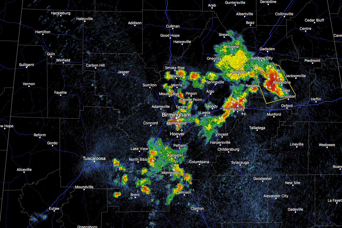
While most of the stronger storms have started calming down a little, an outflow boundary is the culprit for storms firing and intensifying over the eastern parts of Central Alabama. Storm tops on some of these storms are reaching over 50,000 feet, with the vertically integrated liquid levels reaching 70 dbz.
A Severe Thunderstorm Warning is in effect for parts of Calhoun and St. Clair counties until 9:45 PM for the possibility of 60 MPH wind gusts and some small hail. Location in the path of this storm are Anniston, Fort McClellan, Saks, West End-Cobb Town, Glencoe, Weaver, Ragland, Ohatchee, Blue Mountain, Alexandria, Neely Henry Lake, Southside, Neely Henry Dam, Sulphur Springs and Wellington. It’s moving to the southeast at 15 MPH.
Strong storms are approaching Pell City and Lincoln at the moment, which briefly shown some small hail.
More storms are firing from boundaries left over from previous storms, especially over the Birmingham metropolitan area.
We’ll keep our eyes on these storms as they are continuing to hang on while losing the heating of the day.



