


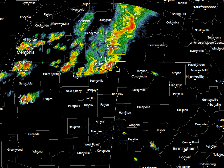
A batch of strong to severe thunderstorms are starting to enter the northwest corner of Lauderdale County in northwest Alabama, with the lead storm having a severe thunderstorm warning issued on it until 7:30 PM for damaging wind gusts up to 70 MPH. This lead storm is moving east at 55 MPH. We’ll have to see if NWS Huntsville continues with a severe thunderstorm warning or decides to go with a significant weather advisory. Either way, this storm is capable of producing strong wind gusts, heavy rainfall, and dangerous cloud-to-ground lightning.
As I type this, they went with a Severe Thunderstorm Warning for parts of Colbert and Lauderdale counties until 7:45 PM.
The good news is that these storms should begin a weakening trend as they continue to move farther into the state due to the cooling of the boundary layer. I wouldn’t be surprised if strong storms continue on until around 9:00 PM before losing enough daytime heating and instability to weaken.
We’ll keep you posted.



