


…A SEVERE THUNDERSTORM WARNING REMAINS IN EFFECT UNTIL 215 PM CDT FOR BLOUNT AND ETOWAH COUNTIES… At 151 PM CDT, severe thunderstorms were located along a line extending from Nectar to Steele to near Hokes Bluff, moving south at 35 mph.
HAZARD…70 mph wind gusts and penny size hail.
SOURCE…Emergency management.
IMPACT…Expect considerable tree damage. Damage is likely to mobile homes, roofs, and outbuildings. Locations impacted include… Gadsden, Rainbow City, Oneonta, Attalla, Hokes Bluff, Blountsville, Cleveland, Dallas, Glencoe, Sardis City, Locust Fork, Altoona, Snead, Susan Moore, Walnut Grove, Reece City, Allgood, Fairview, Nectar and Rosa.
Severe Thunderstorm Warning Issued For Parts Of Blount And Etowah Counties Until 2:15PM
Jun 28th @ 1:06 pm
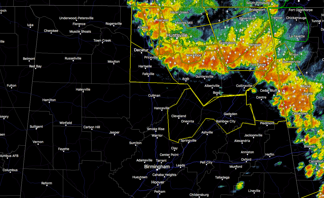

The National Weather Service in Birmingham has issued a
* Severe Thunderstorm Warning for…
Blount County in central Alabama…
Etowah County in northeastern Alabama…
* Until 215 PM CDT.
* At 104 PM CDT, severe thunderstorms were located along a line extending from near Arab to near Guntersville to near Fyffe, moving south at 35 mph.
HAZARD…70 mph wind gusts.
SOURCE…Radar indicated.
IMPACT…Expect considerable tree damage. Damage is likely to mobile homes, roofs, and outbuildings.
* Locations impacted include…
Gadsden, Rainbow City, Oneonta, Attalla, Hokes Bluff, Blountsville, Cleveland, Dallas, Glencoe, Sardis City, Locust Fork, Altoona, Snead, Susan Moore, Walnut Grove, Reece City, Allgood, Fairview, Nectar and Rosa.



