


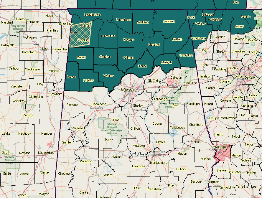
The National Weather Service in Birmingham has issued a FLASH FLOOD WATCH for Blount, Cherokee, Etowah, Fayette, Lamar, Marion, Walker, Winston till 7:00 AM CDT Thursday.
Heavy rainfall will be possible along and ahead of slow moving cold front. This rain will be very efficient and could produce 1 to 2 inches in a very short time, with locally higher totals. Stay tuned for updates to locations as well as possible warnings through the period.
NWS Birmingham will re-evaluate later this morning to see if the watch needs to be expanded farther to the south.
A flash flood watch means that conditions may develop that lead to flash flooding. Flash flooding is a very dangerous situation.



