


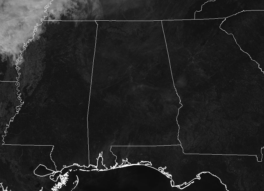
A REFRESHING DAY FINALLY ACROSS CENTRAL ALABAMA
Just absolutely perfect today across Central Alabama as skies will be sunny and afternoon highs will only top out in the lower to mid-70s. Currently, temperatures are in the mid-60s to the lower 70s, with Birmingham sitting at 72 degrees. The cool spot is Haleyville at 66 degrees. It also feels really comfortable as dry air is over the area and dewpoints are in the 40s to near 50. For tonight, skies will be mainly clear and lows will be in the upper 40s to the mid-50s.
TONIGHT’S HIGH SCHOOL FOOTBALL GAMES
The weather will be clear and cool with temperatures falling from the lower 60s to near 70 degrees at kickoff into the lower 50s to near 60 degrees by the final whistle.
A NICE WEEKEND AHEAD
We start on a small and short-lived warming trend for the weekend as Saturday will be mainly sunny with highs in the lower to the upper 70s. Sunday will be warmer with highs in the mid-70s to the mid-80s, with a very small chance of an isolated shower or two mainly in the extreme northwestern parts of Central Alabama.
SATURDAY’S COLLEGE FOOTBALL GAMES
Auburn hosts Tennessee at Jordan-Hare Stadium (11:00 am CDT kickoff). Skies will be mainly sunny, with temperatures rising from near 70 at kickoff, into the mid-70s by the fourth quarter.
Alabama will host Missouri (6:00 pm CDT kickoff) at Bryant-Denny Stadium. Expect clear skies with temperatures falling from the mid-70s at kickoff into the upper 60s by the end of the game.
UAB will travel to Houston to play Rice Saturday (12:00 pm CDT kickoff). Skies will be partly sunny with temperatures in the lower 80s at kickoff, and mid-80s by the second half.
RACE WEEKEND
A great weekend for NASCAR fans coming into Talladega; lots of sunshine each day through Sunday with pleasant temperatures. Look for a high in the low 70s today, mid-70s tomorrow, and upper 70s Sunday. Mornings will be cool with lows in the 40s and 50s.
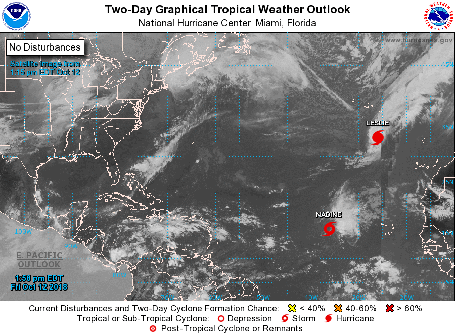
THE TROPICS REMAIN VERY ACTIVE
Tropical Storm Nadine and Hurricane Leslie remain out in the far eastern Atlantic and are no threat to land. The National Hurricane Center has dropped the chances of the disturbance in the Caribbean Sea developing at all.
BEACH FORECAST CENTER
Get the latest weather and rip current forecasts for the beaches from Fort Morgan to Panama City on our Beach Forecast Center page. There, you can select the forecast of the region that you are interested in.
CONNECT ON SOCIAL MEDIA
You can find the AlabamaWx Weather Blog on the major social media networks:
Facebook
Twitter
WE’RE HAVING A RECORD-BREAKING YEAR… ADVERTISE WITH US TODAY!
Don’t miss out! We have enjoyed over 16.3 million page views on AlabamaWx.com since the start of 2018. We can customize a creative, flexible and affordable package that will suit your organization’s needs. Contact Bill Murray at (205) 687-0782.
E-FORECAST
Get the Alabama Wx Weather Blog’s Seven-Day Forecast delivered directly to your inbox by email twice daily. It is the most detailed weather forecast available in Central Alabama. Subscribe here… It’s free!
WEATHERBRAINS:
Don’t forget you can listen to our weekly 90 minute netcast anytime on the web at WeatherBrains.com or on iTunes, Stitcher, or Spotify. This is the show all about weather featuring many familiar voices, including the meteorologists at ABC 33/40.
ON THIS DAY IN WEATHER HISTORY
1962 – The “Columbus Day Big Blow” occurred in the Pacific Northwest. It was probably the most damaging windstorm of record west of the Cascade Mountains. Winds reached hurricane force, with gusts above 100 mph. More than 3.5 billion board feet of timber were blown down, and communications were severely disrupted due to downed power lines. The storm claimed 48 lives, and caused 210 million dollars damage.



