


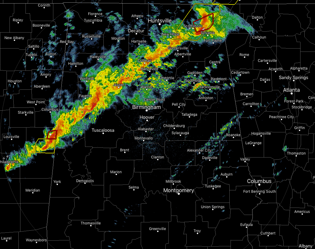
Observations show that the instability is holding true out ahead of the line of storms, in the 1000-1800 J/kg range. Helicity values are still running high as well, up into the 250-500 m2s-2 range. Winds at the surface are currently out of the south-southwest but are veering out of the west-southwest at the 500mb level, or 18,000 feet. Dewpoints are in the upper 60s to the lower 70s from the AL/TN state line down to as far south as Troy and Eufaula. Conditions still show that the environment is favorable for severe thunderstorms with the possibility of rotating updrafts.
The good news is that it appears that the dynamics of the system is starting to lift farther to the north which is making the line a little weaker and draping more in a flattened orientation instead of the 45-degree angle you would like to see with a strong QLCS. The bad news is that we are continuing to see a few rotational couplets in the line that has been enough for tornado warnings to be issued.
We may be dealing with more of a damaging wind threat as the line continues to push off to the east, but we will still have to watch for brief spin-ups within the line of storms. These cells will continue to pulse up and down in strength as they continue eastward. Once the cells make it to the east side of I-59, we believe the severe risk will drop off greatly. We’ll continue to keep you updated throughout the pre-dawn hours.
Once the line passes your location, dewpoints are quickly decreasing into the lower 60s and into the upper 50s. We are already seeing that happen in the extreme north and northwestern parts of the state.



