


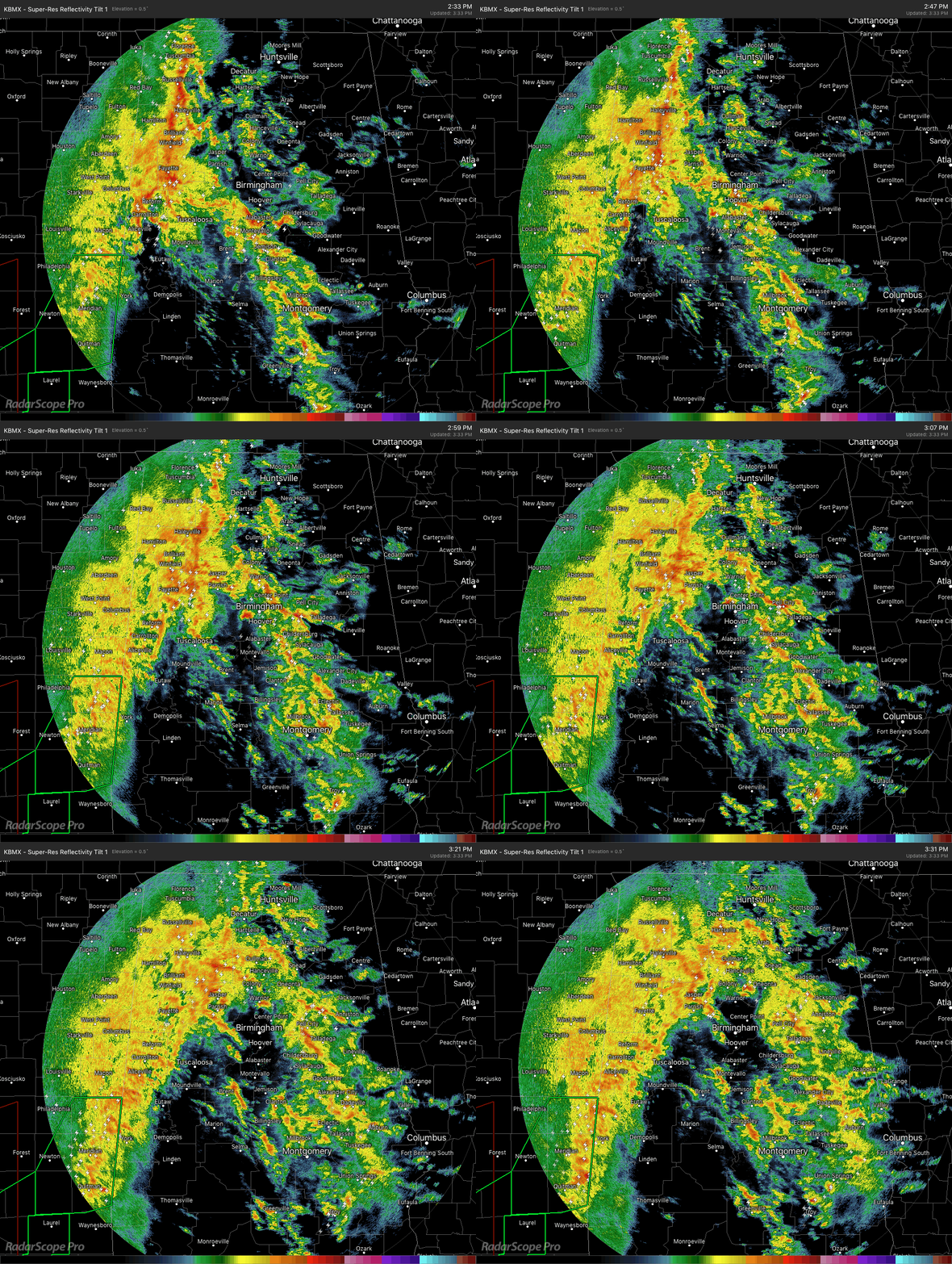
As of 3:35 pm on this Thursday afternoon, the main line of storms continue to move through the western half of the state and now making its way into the central parts of the area. The storms in the eastern half of the area developed out ahead of the line in the southern parts of the area and moved mostly north-northeastward as the system continues to move slowly through the area.
We continue to see no severe weather across the area, with only a few Significant Weather Advisories issued throughout the afternoon for gusty winds up to 50 MPH and some hail.
All of this activity is moving very slowly to the east as the cells within the system are racing off to the northeast. Unfortunately, we could see training of cells over the same locations which could lead to heavier rainfall totals and localized flash flooding. So far, we have received no reports of flooding across the area, so let’s cross our fingers that it stays that way.
As expected, the instability so far has been elevated, which has kept any storms from becoming severe. Later tonight, there is a possibility that surface-based instability will move across portions of Central Alabama, and mix that with some shear, and we could see some storms begin to slowly rotate. With that happening, there will be a threat of isolated damaging wind gusts and a very, very small risk of a brief isolated tornado or two.
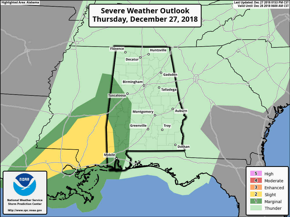
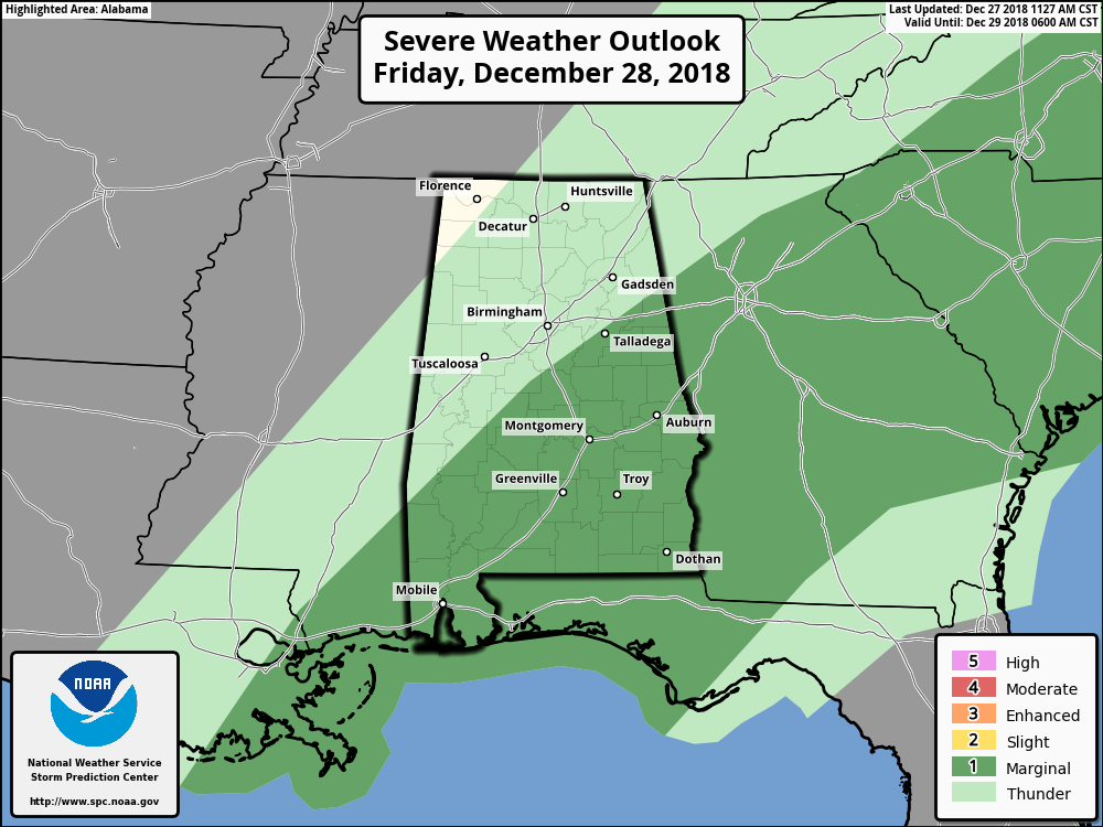
We do have a Marginal Risk for severe storms over the extreme west and southwestern parts of Central Alabama through the rest of tonight and into the overnight hours. That Marginal Threat transitions over the east and southeastern parts of the area throughout the day and into the evening on Friday. We’ll continue to watch to see if the SPC decides to issue a watch for any part of the area.
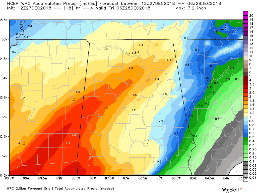
Rainfall will be heavy at times as the activity moves through the area during the rest of tonight and through the day on Friday. The above image shows projected rainfall totals through 12:00 am Friday.
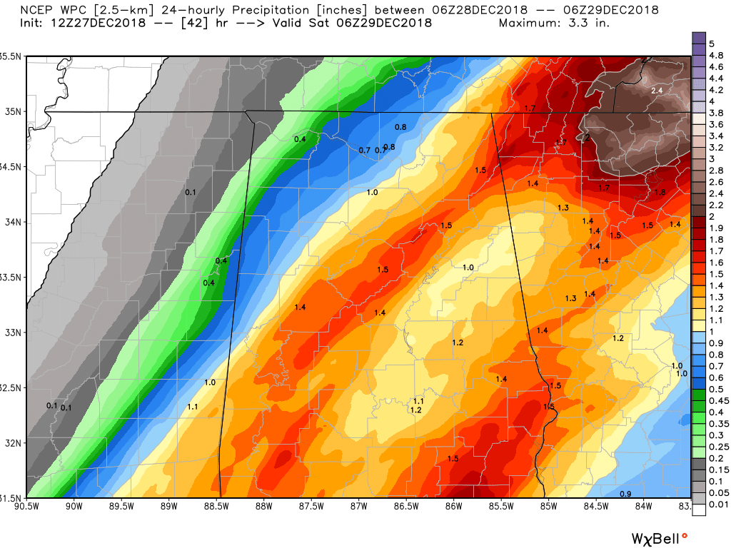
And this image shows the rainfall totals projected throughout the day on Friday. If you were to add the two maps together, we could see totals from as lows as 2.00 inches to as high as 3.5 inches, with even higher amounts in some locations if heavier rainfall lingers over an area longer than expected.
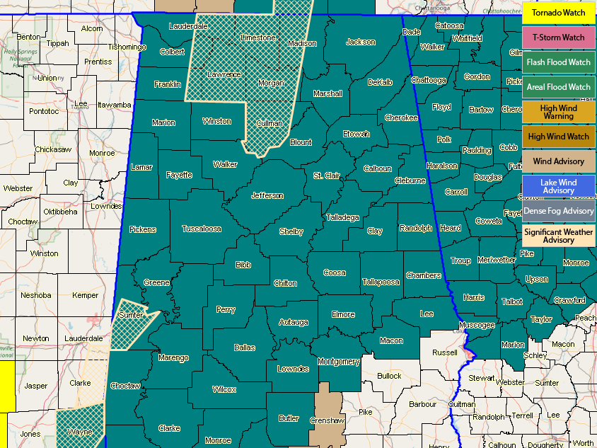
A Flash Flood Watch continues for all of North Alabama until 9:00 am Friday, while a Flash Flood Watch continues for nearly all of Central Alabama (excluding Barbour, Bullock, Pike, and Russell counties) until 6:00 pm Friday.
A Wind Advisory continues for nearly all of Central Alabama until 12:00 am Friday. The Wind Advisory for Colbert, Cullman, Franklin, Lauderdale, Lawrence, Limestone, Marshall, and Morgan counties was extended until 6:00 pm Friday, while DeKalb, Jackson, and Madison counties will expire from the advisory at 12:00 am Friday.
We’ll keep you posted throughout the rest of today and through tomorrow.



