


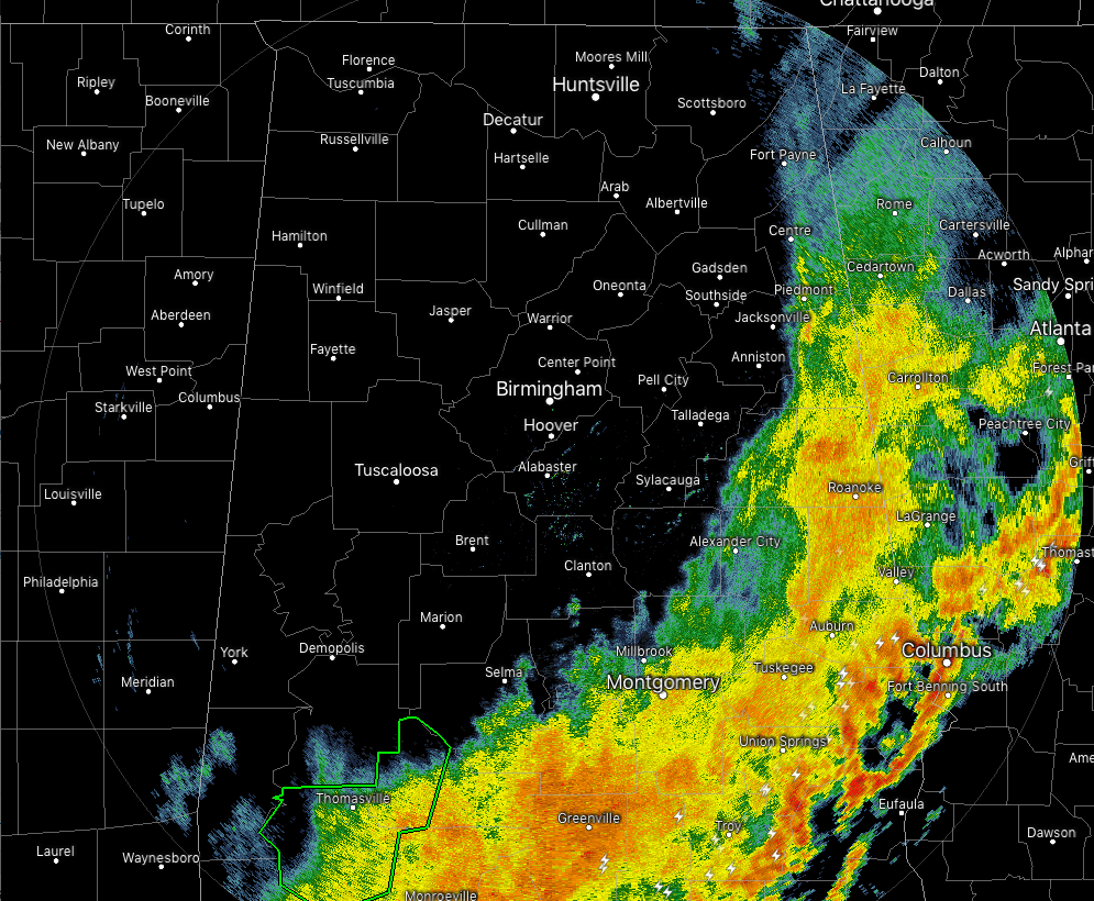
As of 9:15 am this morning, all of the rain activity has moved well into the extreme eastern and southeastern parts of Central Alabama. Rainfall is especially heavy in the southeastern parts of the area where thunderstorms are occurring. With the exception of the locations closest to the Alabama/Georgia state line, everyone north of I-20 is free from any rainfall… and boy, do we need a chance to dry out.

As of 4:00 am this morning, rainfall estimates have a wide range from right around 0.25 inches in the southeastern corner of Central Alabama to as high as 6.00 inches in the northwestern parts of the area. North Alabama saw rainfall totals in the 1.00-4.00 inch range. Up here at my place in North Jefferson County, I received 4.67 inches of rainfall from 12:00 am Thursday to 8:30 am today. Nearly half of that fell during the overnight hours from 12:00 am today to roughly around 7:00 am. I’m sure an updated graphic will come out later today.
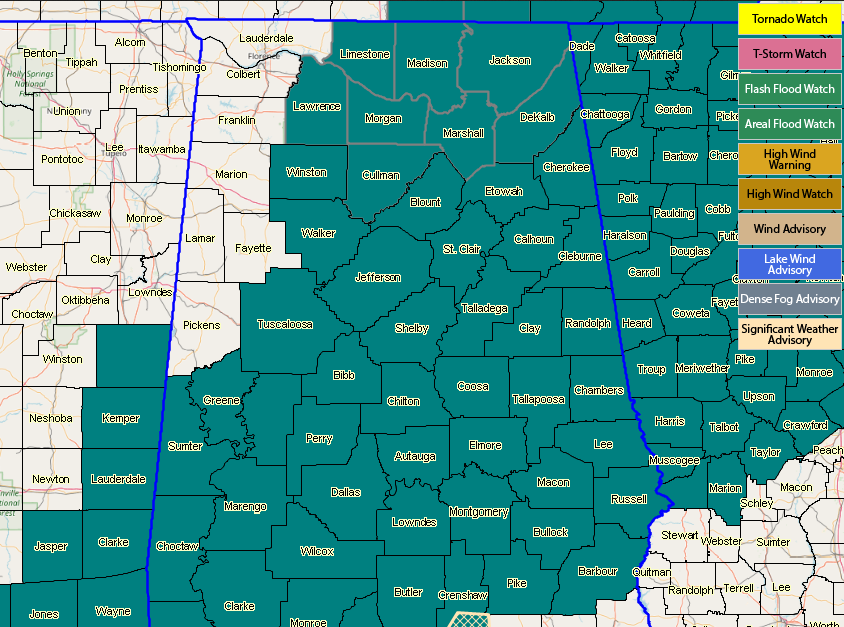
NWS Birmingham continues a Flash Flood Watch for Autauga, Barbour, Bibb, Blount, Bullock, Calhoun, Chambers, Cherokee, Chilton, Clay, Cleburne, Coosa, Dallas, Elmore, Etowah, Greene, Hale, Jefferson, Lee, Lowndes, Macon, Marengo, Montgomery, Perry, Pike, Randolph, Russell, Shelby, St. Clair, Sumter, Talladega, Tallapoosa, Tuscaloosa, Walker, and Winston counties until 6:00 pm tonight. Fayette, Lamar, Marion, and Pickens counties were removed from the watch as the threat of accumulating rainfall is over.
NWS Huntsville is allowing the Flash Flood Watch to expire for all of their counties at 9:00 am this morning.
So for the rest of today, we’ll get a decent chance to dry out for a little bit and clouds will actually start to diminish in coverage from the west throughout the day. Much of the rainfall should be out of the area by 5:00 pm, but a few stray showers may linger over the southeastern parts of the area for a couple of hours more. By the midday hour, we should see some sunshine making to the surface over the northwestern half of the area. We should have mostly clear skies by the evening rush hour for much of the area with some clouds hanging on in the extreme southern parts. Afternoon highs will top out in the lower 60s to just at or near 70 degrees across the area from northwest to southeast. For tonight, colder air will start to move in from the northwest with lows dropping into the mid-30s to the upper 50s from northwest to southeast. Any shower activity should stay south of the area through the late night and overnight hours.



