


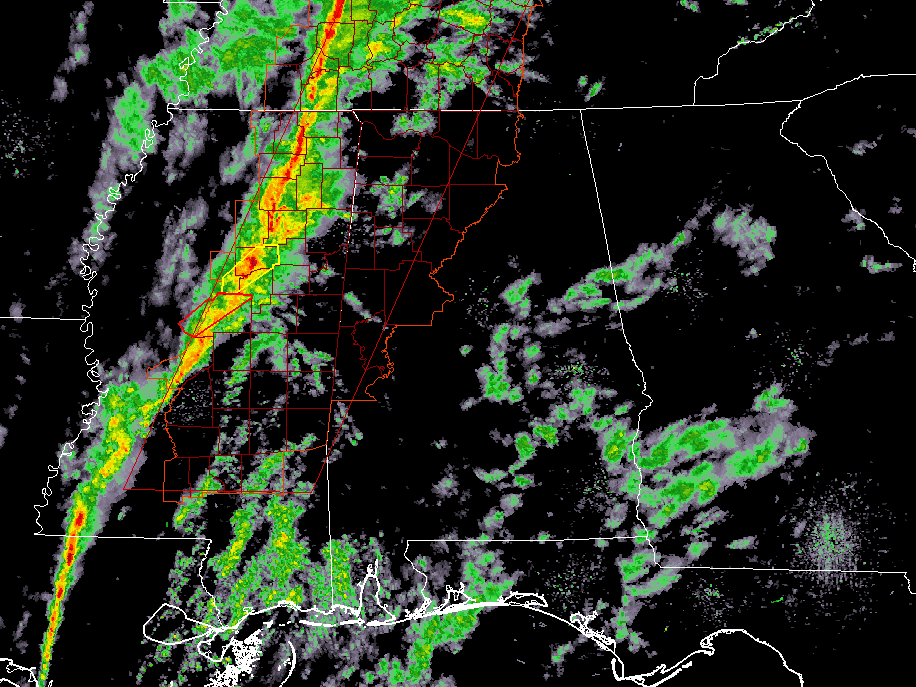
The line of thunderstorms is about 30-60 minutes away from entering the northwestern corner of the state. Once that happens, there will be the potential for damaging wind gusts up to 70 MPH and a couple brief-spin-up tornadoes along the line. We also have the potential for a few supercell thunderstorms to develop out ahead of the main line that could bring damaging wind gusts and a small possibility of a tornado.
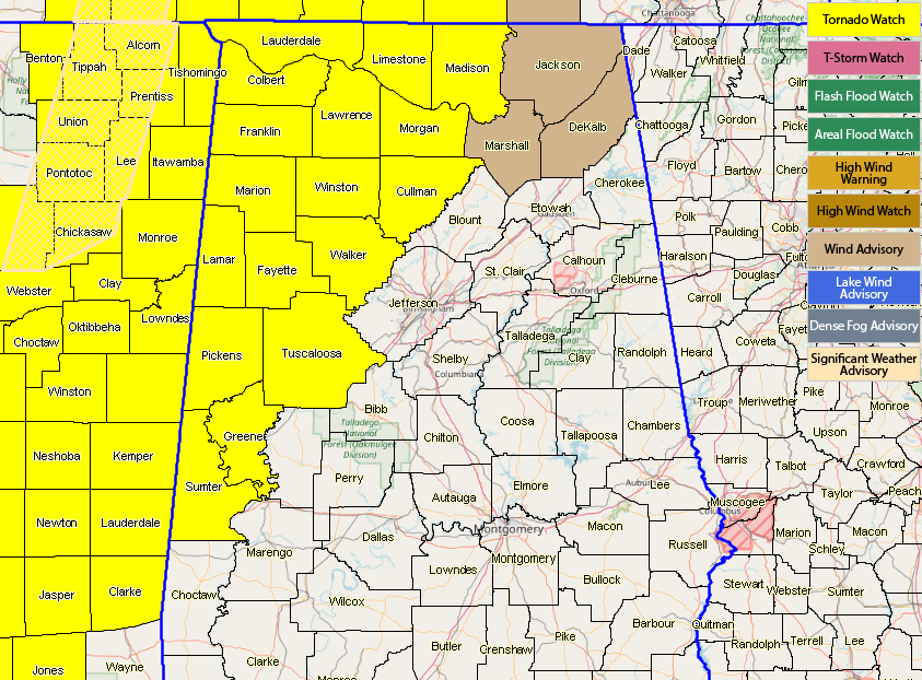
A Tornado Watch continues for the northwest and western parts of the state until 7:00 pm tonight.
Also, gusty non-thunderstorm winds could bring down a few trees as the ground is already saturated from the rains of the past week. We are currently seeing winds in the 15-25 MPH range with gusts up to 40 MPH due to the tightening of the pressure gradient.
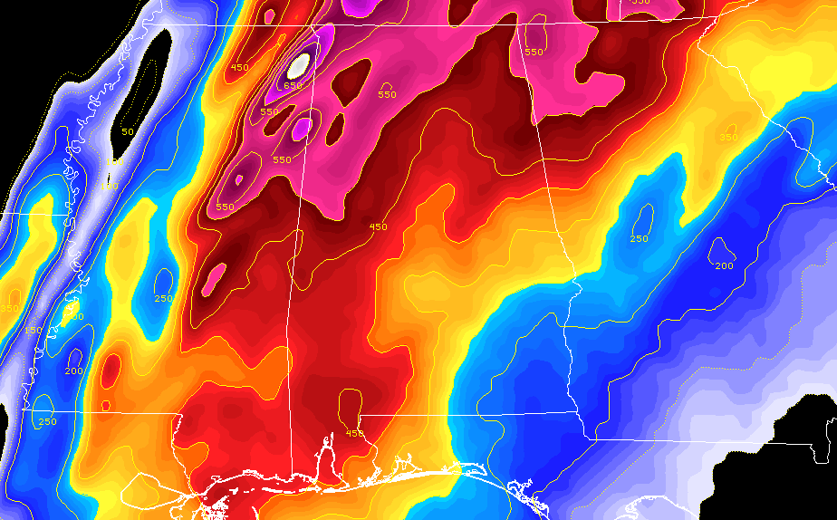
We now have plenty of wind shear in place over most of North/Central Alabama, and instability at the surface is really starting to increase for the western half of the area, as values are now over 600 J/kg near the state line. The potential is there for a few storms to have the ability to start to rotate. Dewpoints have soared into the mid to upper 60s, and with temperatures in the upper 60s to the mid=70, the ingredients are coming together for the potential of strong to severe thunderstorms.
We’ll continue to keep you posted throughout the remainder of the day. Be ready to act if your location comes under a warning.



