


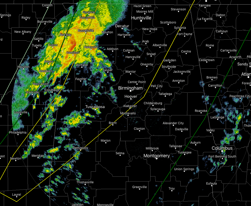
A line of stronger storms continues to push into the northwestern parts of North and Central Alabam, with more scattered activity entering into the state in the west and southwestern parts. While I was just about to type that the line is not all that impressive at this point with hardly any lightning at all, a Severe Thunderstorm Warning was just issued for parts of Franklin County until 2:30 pm.
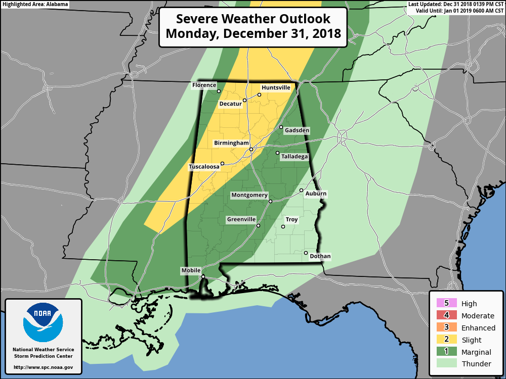
A Slight Risk for severe storms continues west of a line from Demopolis to Alabaster to Rainsville, but we do notice that the risks have been removed from the northwestern corner of the state where the main line of storms has already passed by. The Marginal Risk continues for most of the rest of North and Central Alabama.
While there have been some embedded stronger wind gusts in the line, we really haven’t seen any rotation occurring in Alabama, and really, not much lightning either.
I believe that the main timing of the potential of stronger to severe storms remains the same, but the good news is that the better dynamic support is already well removed from the better instability. This should keep our main threat of severe storms lower, but this still remains a gusty wind and heavy rain event.
We still have plenty of shear in place, but our surface instability has now plateaued around 400-600 J-kg nearest the line of storms. We have learned in the past that it does not take that much instability with high shear rates to get damaging winds and smaller tornadoes, so we’ll keep an eye on the situation throughout the day.
Both Huntsville and Birmingham offices of the NWS should start dropping counties from the Tornado Watch as the line passes more into the central parts of the state.



